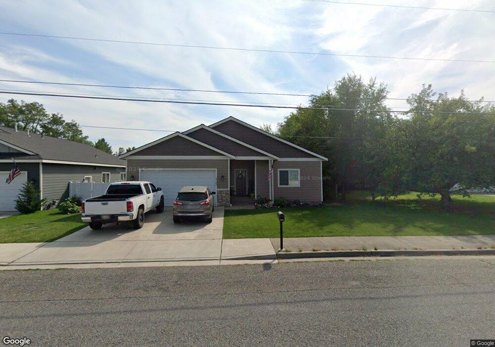
2782 E 12th Ave Post Falls, ID 83854
Estimated Value: $471,000 - $521,000
3
Beds
2
Baths
1,600
Sq Ft
$316/Sq Ft
Est. Value
About This Home
This home is located at 2782 E 12th Ave, Post Falls, ID 83854 and is currently estimated at $505,461, approximately $315 per square foot. 2782 E 12th Ave is a home located in Kootenai County with nearby schools including Prairie View Elementary School, Post Falls Middle School, and Post Falls High School.
Ownership History
Date
Name
Owned For
Owner Type
Purchase Details
Closed on
Aug 19, 2019
Sold by
Basler Brian and Basler Cassie
Bought by
Frank Zac and Frank Chelsea
Current Estimated Value
Home Financials for this Owner
Home Financials are based on the most recent Mortgage that was taken out on this home.
Original Mortgage
$254,915
Interest Rate
3.7%
Mortgage Type
New Conventional
Purchase Details
Closed on
May 13, 2005
Sold by
Thomas Susan J
Bought by
Thomas Susan J
Create a Home Valuation Report for This Property
The Home Valuation Report is an in-depth analysis detailing your home's value as well as a comparison with similar homes in the area
Purchase History
| Date | Buyer | Sale Price | Title Company |
|---|---|---|---|
| Frank Zac | -- | Kootenai County Title Co | |
| Thomas Susan J | -- | -- | |
| Thomas Susan J | -- | -- | |
| Thomas Susan J | -- | -- |
Source: Public Records
Mortgage History
| Date | Status | Borrower | Loan Amount |
|---|---|---|---|
| Previous Owner | Frank Zac | $254,915 |
Source: Public Records
Tax History
| Year | Tax Paid | Tax Assessment Tax Assessment Total Assessment is a certain percentage of the fair market value that is determined by local assessors to be the total taxable value of land and additions on the property. | Land | Improvement |
|---|---|---|---|---|
| 2025 | $2,003 | $497,707 | $178,537 | $319,170 |
| 2024 | $1,910 | $467,700 | $155,250 | $312,450 |
| 2023 | $1,910 | $503,697 | $172,500 | $331,197 |
| 2022 | $2,551 | $538,066 | $172,500 | $365,566 |
| 2021 | $2,259 | $346,810 | $115,000 | $231,810 |
| 2020 | $2,128 | $284,600 | $90,000 | $194,600 |
| 2019 | $2,082 | $262,900 | $80,000 | $182,900 |
| 2018 | $918 | $234,810 | $68,000 | $166,810 |
| 2017 | $708 | $48,000 | $48,000 | $0 |
| 2016 | $624 | $40,000 | $40,000 | $0 |
| 2015 | $508 | $32,000 | $32,000 | $0 |
| 2013 | $531 | $31,000 | $31,000 | $0 |
Source: Public Records
Map
Nearby Homes
- 931 N Goldenrod Ct
- 3755 E 16th Ave
- L1B1 N Post Falls Dr
- 3270 E Quad Park Ct
- 3414 E 12th Ave
- 1048 E 4th Ave Unit 104
- NNA E Mullan Ave
- 3683 E Mullan Ave
- 1358 N Ewell Ct
- 304 N Greensferry Rd Unit 207
- 1163 E Polston Ave
- 0 N Spencer St
- XXX E 3rd Ave
- 1627 E Zoey Ln
- 1356 N Highway 41 Unit 51
- 634 N Calgary Ct
- 1255 E Stetson Ave
- 1016 E Healy Ave
- 936 E Healy
- 982 E Healy Ave
- 2802 E 12th Ave
- 2710 E 12th Ave
- 1150 N Bainbridge St
- 2844 E 12th Ave
- 1220 N Celestine St
- 1221 N Celestine St
- 1142 N Bainbridge St
- 2870 E 12th Ave
- 2743 E Redondo Cir
- 1155 N Bainbridge St
- 1238 N Celestine St
- 1125 N Sugar Maple Trail
- 1239 N Celestine St
- 1223 N Moonstone St
- 2701 E 12th Ave
- 2745 E Redondo Cir
- 1149 N Bainbridge St
- 2727 E Redondo Cir
- 1085 N Sugar Maple Trail
- 1141 N Bainbridge St
Your Personal Tour Guide
Ask me questions while you tour the home.