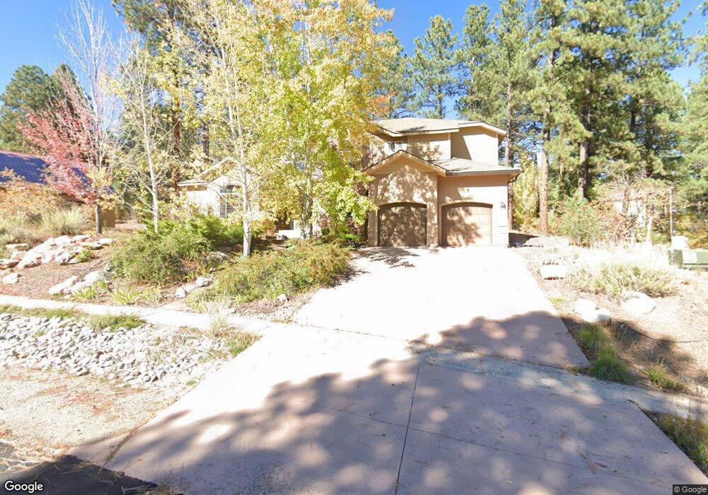
279 El Diente Dr Durango, CO 81301
Edgemont NeighborhoodEstimated Value: $973,147 - $1,095,000
3
Beds
3
Baths
2,567
Sq Ft
$411/Sq Ft
Est. Value
About This Home
This home is located at 279 El Diente Dr, Durango, CO 81301 and is currently estimated at $1,054,287, approximately $410 per square foot. 279 El Diente Dr is a home located in La Plata County with nearby schools including Riverview Elementary School, Miller Middle School, and Durango High School.
Ownership History
Date
Name
Owned For
Owner Type
Purchase Details
Closed on
Jun 22, 2015
Sold by
Holtgrieve Matthew P and Holtgrieve Emily
Bought by
Willis Carolyn
Current Estimated Value
Home Financials for this Owner
Home Financials are based on the most recent Mortgage that was taken out on this home.
Original Mortgage
$160,000
Outstanding Balance
$125,280
Interest Rate
4.06%
Mortgage Type
New Conventional
Estimated Equity
$929,007
Purchase Details
Closed on
Aug 16, 2012
Sold by
Caskey Charles Bradford and Caskey Melisa Anne
Bought by
Holtgrieve Matthew P and Holtgrieve Emily
Home Financials for this Owner
Home Financials are based on the most recent Mortgage that was taken out on this home.
Original Mortgage
$372,000
Interest Rate
3.63%
Mortgage Type
New Conventional
Purchase Details
Closed on
Apr 19, 2005
Sold by
Ri Ted Jonathan Rifkin and Ri Cheryl Dugan
Bought by
Caskey Charles Bradford and Caskey Melisa Anne
Home Financials for this Owner
Home Financials are based on the most recent Mortgage that was taken out on this home.
Original Mortgage
$340,000
Interest Rate
6.06%
Mortgage Type
Future Advance Clause Open End Mortgage
Purchase Details
Closed on
Feb 14, 2002
Bought by
Willis Carolyn
Create a Home Valuation Report for This Property
The Home Valuation Report is an in-depth analysis detailing your home's value as well as a comparison with similar homes in the area
Home Values in the Area
Average Home Value in this Area
Purchase History
| Date | Buyer | Sale Price | Title Company |
|---|---|---|---|
| Willis Carolyn | $535,000 | Heritage Title | |
| Holtgrieve Matthew P | $465,000 | Colorado Land Title Co Llc | |
| Caskey Charles Bradford | $129,900 | Land Title | |
| Willis Carolyn | $59,500 | -- |
Source: Public Records
Mortgage History
| Date | Status | Borrower | Loan Amount |
|---|---|---|---|
| Open | Willis Carolyn | $160,000 | |
| Previous Owner | Holtgrieve Matthew P | $372,000 | |
| Previous Owner | Caskey Charles Bradford | $340,000 |
Source: Public Records
Tax History
| Year | Tax Paid | Tax Assessment Tax Assessment Total Assessment is a certain percentage of the fair market value that is determined by local assessors to be the total taxable value of land and additions on the property. | Land | Improvement |
|---|---|---|---|---|
| 2025 | $2,750 | $59,350 | $8,680 | $50,670 |
| 2024 | $2,441 | $47,990 | $8,250 | $39,740 |
| 2023 | $2,441 | $51,160 | $8,790 | $42,370 |
| 2022 | $2,194 | $53,600 | $9,210 | $44,390 |
| 2021 | $2,221 | $42,960 | $6,190 | $36,770 |
| 2020 | $2,187 | $43,220 | $7,640 | $35,580 |
| 2019 | $2,116 | $43,220 | $7,640 | $35,580 |
| 2018 | $1,960 | $39,760 | $7,540 | $32,220 |
| 2017 | $1,939 | $39,760 | $7,540 | $32,220 |
| 2016 | $1,910 | $41,590 | $8,850 | $32,740 |
| 2015 | $1,796 | $40,860 | $8,850 | $32,010 |
| 2014 | $1,552 | $33,810 | $7,660 | $26,150 |
| 2013 | -- | $33,810 | $7,660 | $26,150 |
Source: Public Records
Map
Nearby Homes
- 143 El Diente Dr
- 163 El Diente Dr
- 77 Culebra Cir
- 448 Iron King
- 398 Iron King
- 55 Edgemont Way
- 15 Edgemont Way
- 220 Edgemont Meadows Rd
- 188 Farm Pond Ln
- 498 Woodbridge Way
- 841 Woodbridge Ln
- 383 Eagle Pass
- 470 Edgemont Meadows Rd
- 671 Edgemont Meadows Rd
- 41 Edgemont Meadows Rd
- 25 Window Lake Trail
- 115 Big Bend Ct
- 47 Kenosha Trail
- 65 Mill Creek Ct
- 71 Deep Creek Ct
- 299 El Diente Dr
- 261 El Diente Dr
- 775 Golden Dipper
- 246 El Diente Dr
- 270 El Diente Dr
- 243 El Diente Dr
- 98 El Diente Dr
- 249 El Diente Dr
- 0 the Golden Dipper Rd Unit 760062
- 0 the Golden Dipper Rd Unit 750792
- 0 the Golden Dipper Rd Unit 741423
- 0 the Golden Dipper Rd Unit 736063
- 0 the Golden Dipper Rd Unit 617040
- 0 the Golden Dipper Rd Unit 642986
- 0 the Golden Dipper Rd Unit 653477
- 0 the Golden Dipper Rd Unit 659703
- 0 the Golden Dipper Rd Unit 660157
- 0 the Golden Dipper Rd Unit 666670
- 0 the Golden Dipper Rd Unit 682399
- 0 the Golden Dipper Rd Unit 683314
Your Personal Tour Guide
Ask me questions while you tour the home.