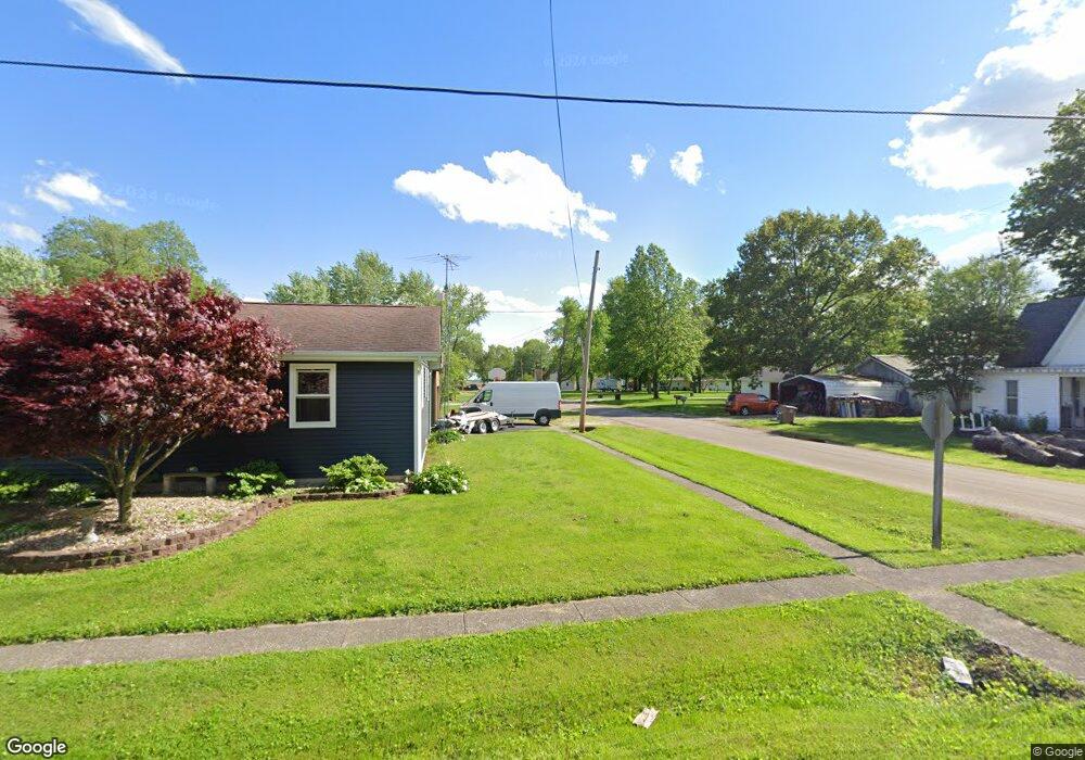
280 E Myrtle St Palmyra, IL 62674
Estimated Value: $53,562 - $211,000
Studio
--
Bath
--
Sq Ft
8,364
Sq Ft Lot
About This Home
This home is located at 280 E Myrtle St, Palmyra, IL 62674 and is currently estimated at $114,391. 280 E Myrtle St is a home with nearby schools including Northwestern Elementary School, Northwestern Junior High School, and Northwestern High School.
Ownership History
Date
Name
Owned For
Owner Type
Purchase Details
Closed on
Nov 22, 2016
Sold by
Dunn Stanley E and Dunn Rosalie
Bought by
Abbott Kenneth
Current Estimated Value
Home Financials for this Owner
Home Financials are based on the most recent Mortgage that was taken out on this home.
Original Mortgage
$11,900
Outstanding Balance
$9,554
Interest Rate
3.42%
Mortgage Type
Commercial
Estimated Equity
$104,837
Create a Home Valuation Report for This Property
The Home Valuation Report is an in-depth analysis detailing your home's value as well as a comparison with similar homes in the area
Purchase History
| Date | Buyer | Sale Price | Title Company |
|---|---|---|---|
| Abbott Kenneth | $17,000 | Lange Title |
Source: Public Records
Mortgage History
| Date | Status | Borrower | Loan Amount |
|---|---|---|---|
| Open | Abbott Kenneth | $11,900 |
Source: Public Records
Tax History
| Year | Tax Paid | Tax Assessment Tax Assessment Total Assessment is a certain percentage of the fair market value that is determined by local assessors to be the total taxable value of land and additions on the property. | Land | Improvement |
|---|---|---|---|---|
| 2024 | $549 | $9,435 | $2,645 | $6,790 |
| 2023 | $534 | $8,736 | $2,449 | $6,287 |
| 2022 | $534 | $8,165 | $2,289 | $5,876 |
| 2021 | $513 | $7,631 | $2,139 | $5,492 |
| 2020 | $511 | $7,132 | $1,999 | $5,133 |
| 2019 | $498 | $6,793 | $1,904 | $4,889 |
| 2018 | $499 | $6,640 | $1,861 | $4,779 |
| 2017 | $1,263 | $17,222 | $1,802 | $15,420 |
| 2016 | $1,246 | $16,753 | $1,753 | $15,000 |
| 2015 | $1,276 | $16,753 | $1,753 | $15,000 |
| 2014 | $1,280 | $16,753 | $1,753 | $15,000 |
| 2013 | $1,251 | $16,753 | $1,753 | $15,000 |
Source: Public Records
Map
Nearby Homes
- 307 S Main St
- 207 W Grand Ave
- 203 Walnut St
- Lots 2-4 Barton St
- 12140 County Loop Rd
- 0 County Loop Rd
- 28360 Quarton Rd
- 367 E Oak St
- 14201 Williamson Rd
- 15296 Magnolia Dr
- 30287 Cedar Ln
- 15959 N Lake Rd
- 279 Athensville Rd
- 0 Enos Rd
- 0 Hagaman Rd
- 2750 Nortonville Rd
- Tbd Hagaman Rd
- L 6 7 8 Ryder St
- 207 Brenda Ln
- 150 E Tanner St
- 208 E Myrtle St
- 440 S Pearl St
- 437 S Union St
- 385 S Pearl St
- 423 S Pearl St
- 403 S Pearl St
- 387 S Union St
- 366 S Pearl St
- 466 S Pearl St
- 357 S Union St
- 449 S Pearl St
- 192 E Myrtle St
- 233 E Steidley St
- 357 S Pearl St
- 191 E Myrtle St
- 281 E Steidley St
- 404 S Union St
- 300 E Oak St
- 341 E Steidley St
- 280 E Oak St
Your Personal Tour Guide
Ask me questions while you tour the home.