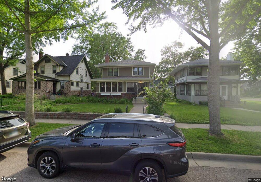
281 Macalester St Saint Paul, MN 55105
Macalester-Groveland NeighborhoodEstimated Value: $586,000 - $621,613
3
Beds
2
Baths
1,783
Sq Ft
$338/Sq Ft
Est. Value
About This Home
This home is located at 281 Macalester St, Saint Paul, MN 55105 and is currently estimated at $603,403, approximately $338 per square foot. 281 Macalester St is a home located in Ramsey County with nearby schools including Groveland Park Elementary School, Hidden River Middle School, and Central Senior High School.
Ownership History
Date
Name
Owned For
Owner Type
Purchase Details
Closed on
May 9, 2023
Sold by
Trojan Michael and Stumpf Joan
Bought by
Zingrone Tobia and Zingrone Laura
Current Estimated Value
Home Financials for this Owner
Home Financials are based on the most recent Mortgage that was taken out on this home.
Original Mortgage
$483,162
Outstanding Balance
$469,800
Interest Rate
6.42%
Mortgage Type
New Conventional
Estimated Equity
$133,603
Create a Home Valuation Report for This Property
The Home Valuation Report is an in-depth analysis detailing your home's value as well as a comparison with similar homes in the area
Home Values in the Area
Average Home Value in this Area
Purchase History
| Date | Buyer | Sale Price | Title Company |
|---|---|---|---|
| Zingrone Tobia | $560,000 | -- |
Source: Public Records
Mortgage History
| Date | Status | Borrower | Loan Amount |
|---|---|---|---|
| Open | Zingrone Tobia | $483,162 |
Source: Public Records
Tax History Compared to Growth
Tax History
| Year | Tax Paid | Tax Assessment Tax Assessment Total Assessment is a certain percentage of the fair market value that is determined by local assessors to be the total taxable value of land and additions on the property. | Land | Improvement |
|---|---|---|---|---|
| 2025 | $7,336 | $593,700 | $139,200 | $454,500 |
| 2024 | $7,336 | $547,200 | $139,200 | $408,000 |
| 2023 | $7,336 | $476,200 | $139,200 | $337,000 |
| 2022 | $7,178 | $467,100 | $139,200 | $327,900 |
| 2021 | $6,950 | $432,700 | $139,200 | $293,500 |
| 2020 | $7,414 | $430,200 | $139,200 | $291,000 |
| 2019 | $7,688 | $430,200 | $139,200 | $291,000 |
| 2018 | $6,772 | $440,800 | $139,200 | $301,600 |
| 2017 | $5,996 | $398,500 | $139,200 | $259,300 |
| 2016 | $6,418 | $0 | $0 | $0 |
| 2015 | $6,242 | $363,900 | $125,300 | $238,600 |
| 2014 | $5,784 | $0 | $0 | $0 |
Source: Public Records
Map
Nearby Homes
- 1615 Stanford Ave
- 191 Vernon St
- 388 Snelling Ave S
- 1688 James Ave
- 1818 Juliet Ave
- 1676 Randolph Ave
- 1797 James Ave
- 1447 Juliet Ave
- 1848 James Ave
- 1396 Palace Ave
- 555 Saratoga St S
- 580 Snelling Ave S Unit 4
- 560 Saratoga St S
- 590 Fairview Ave S
- 750 Summit Ave
- 1670 Ashland Ave
- 1540 Ashland Ave Unit 12
- 1354 Grand Ave
- 1625 Scheffer Ave
- 633 Saratoga St S
- 281 S Macalester St
- 285 Macalester St
- 277 Macalester St
- 291 Macalester St
- 1654 Berkeley Ave
- 1655 Stanford Ave
- 295 Macalester St
- 1662 Berkeley Ave
- 1643 Berkeley Ave
- 284 Macalester St
- 288 Macalester St
- 276 Macalester St
- 292 Macalester St
- 1661 Stanford Ave
- 257 Macalester St
- 1655 Berkeley Ave
- 296 Macalester St
- 1668 Berkeley Ave
- 264 Macalester St
- 1659 Berkeley Ave