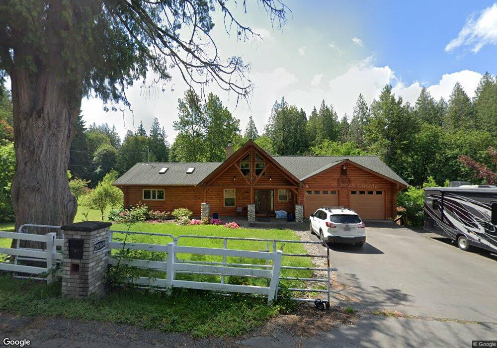
28349 SE Kw Anderson Rd Gresham, OR 97080
Sandy River NeighborhoodEstimated Value: $877,000 - $1,039,025
4
Beds
4
Baths
4,200
Sq Ft
$224/Sq Ft
Est. Value
About This Home
This home is located at 28349 SE Kw Anderson Rd, Gresham, OR 97080 and is currently estimated at $939,506, approximately $223 per square foot. 28349 SE Kw Anderson Rd is a home located in Multnomah County with nearby schools including Powell Valley Elementary School, Gordon Russell Middle School, and Sam Barlow High School.
Ownership History
Date
Name
Owned For
Owner Type
Purchase Details
Closed on
Apr 1, 2020
Sold by
Rosca Steve and Rosca Elizabeth
Bought by
David Joshua C and Dalton Grace Annalise
Current Estimated Value
Home Financials for this Owner
Home Financials are based on the most recent Mortgage that was taken out on this home.
Original Mortgage
$510,400
Outstanding Balance
$451,170
Interest Rate
3.4%
Mortgage Type
New Conventional
Estimated Equity
$488,336
Purchase Details
Closed on
Feb 8, 2005
Sold by
Sellers Barbara
Bought by
Rosca Steve and Rosca Elizabeth
Create a Home Valuation Report for This Property
The Home Valuation Report is an in-depth analysis detailing your home's value as well as a comparison with similar homes in the area
Home Values in the Area
Average Home Value in this Area
Purchase History
| Date | Buyer | Sale Price | Title Company |
|---|---|---|---|
| David Joshua C | $699,000 | Ticor Title Company Of Or | |
| David Joshua C | $699,000 | Ticor Title Company Of Or | |
| Rosca Steve | $155,000 | Transnation Title Agency Or | |
| Rosca Steve | $155,000 | Transnation Title Agency Or |
Source: Public Records
Mortgage History
| Date | Status | Borrower | Loan Amount |
|---|---|---|---|
| Open | David Joshua C | $510,400 |
Source: Public Records
Tax History Compared to Growth
Tax History
| Year | Tax Paid | Tax Assessment Tax Assessment Total Assessment is a certain percentage of the fair market value that is determined by local assessors to be the total taxable value of land and additions on the property. | Land | Improvement |
|---|---|---|---|---|
| 2025 | $8,915 | $469,040 | -- | -- |
| 2024 | $8,522 | $455,380 | -- | -- |
| 2023 | $8,335 | $442,120 | $0 | $0 |
| 2022 | $8,123 | $429,250 | $0 | $0 |
| 2021 | $7,904 | $416,750 | $0 | $0 |
| 2020 | $7,438 | $404,620 | $0 | $0 |
| 2019 | $7,250 | $392,840 | $0 | $0 |
| 2018 | $6,912 | $381,400 | $0 | $0 |
| 2017 | $6,641 | $370,300 | $0 | $0 |
| 2016 | $5,858 | $359,520 | $0 | $0 |
| 2015 | $5,729 | $349,050 | $0 | $0 |
| 2014 | $5,603 | $338,890 | $0 | $0 |
Source: Public Records
Map
Nearby Homes
- 28467 SE Kw Anderson Rd
- 1439 SE Pheasant Ave
- 1478 SE Pheasant Ave
- 5856 SE Woodland Dr
- 1490 SE Pheasant Ave
- 1494 SE Pheasant Ave
- Pepperwood Plan at The Vineyards at Blue Pearl
- Glacier Plan at The Vineyards at Blue Pearl
- 1221 SE Ironwood Ln
- 5960 SE 15th Loop
- 6115 SE 16th St
- 1649 SE Night Heron Way
- 5709 SE 18th Ct
- 2093 SE Osprey Ave
- 4732 SE Powell Valley Rd
- 6421 SE 22nd St
- 6443 SE 22nd St
- 4724 SE Powell Valley Rd
- 295 SE Baker Ave
- 4753 SE 14th St
- 28349 SE Wk Anderson Rd
- 28349 SE K W Anderson Rd
- 28450 SE K W Anderson Rd
- 28415 SE K W Anderson Rd
- 28415 SE Wk Anderson Rd
- 28467 SE Wk Anderson Rd
- 28512 SE Wk Anderson Rd
- 4410 SE 282nd Ave
- 0 SE 282nd Ave
- 4510 SE 282nd Ave
- 4503 SE 282nd Ave
- 0 SE Kw Anderson Rd
- 4500 SE 282nd Ave
- 4524 SE 282nd Ave
- 4560 SE 282nd Ave
- 4230 SE Troutdale Rd
- 1040 SE 282nd Ave
- 1025 SE 282nd Ave
- 28660 SE Wk Anderson Rd
- 4200 SE Troutdale Rd