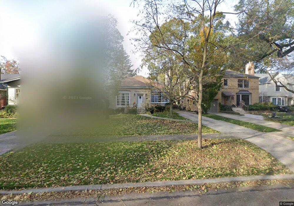
284 Bartram Rd Riverside, IL 60546
Estimated Value: $523,300 - $643,000
3
Beds
3
Baths
1,580
Sq Ft
$368/Sq Ft
Est. Value
About This Home
This home is located at 284 Bartram Rd, Riverside, IL 60546 and is currently estimated at $581,825, approximately $368 per square foot. 284 Bartram Rd is a home located in Cook County with nearby schools including A F Ames Elementary School, L J Hauser Jr High School, and Riverside Brookfield High School.
Ownership History
Date
Name
Owned For
Owner Type
Purchase Details
Closed on
Jan 8, 2019
Sold by
Navarro Reynaldo and Navarro Guadalupe
Bought by
Navarro Raynaldo and Navarro Guadalupe
Current Estimated Value
Purchase Details
Closed on
Jun 2, 2004
Sold by
Ionescu Bogdan and Ionescu Cristina
Bought by
Navarro Raynaldo and Navarro Guadalupe
Purchase Details
Closed on
Dec 20, 1994
Sold by
American National Bk & Tr Co Of Chicago
Bought by
Ionescu Bogdan and Ionescu Cristina
Home Financials for this Owner
Home Financials are based on the most recent Mortgage that was taken out on this home.
Original Mortgage
$161,600
Interest Rate
9.24%
Create a Home Valuation Report for This Property
The Home Valuation Report is an in-depth analysis detailing your home's value as well as a comparison with similar homes in the area
Home Values in the Area
Average Home Value in this Area
Purchase History
| Date | Buyer | Sale Price | Title Company |
|---|---|---|---|
| Navarro Raynaldo | -- | None Available | |
| Navarro Raynaldo | $476,000 | Prairie Title | |
| Ionescu Bogdan | $2,000 | -- |
Source: Public Records
Mortgage History
| Date | Status | Borrower | Loan Amount |
|---|---|---|---|
| Previous Owner | Ionescu Bogdan | $161,600 |
Source: Public Records
Tax History
| Year | Tax Paid | Tax Assessment Tax Assessment Total Assessment is a certain percentage of the fair market value that is determined by local assessors to be the total taxable value of land and additions on the property. | Land | Improvement |
|---|---|---|---|---|
| 2025 | $12,167 | $44,000 | $9,850 | $34,150 |
| 2024 | $12,167 | $44,000 | $9,850 | $34,150 |
| 2023 | $11,207 | $44,000 | $9,850 | $34,150 |
| 2022 | $11,207 | $35,416 | $8,619 | $26,797 |
| 2021 | $10,828 | $35,415 | $8,618 | $26,797 |
| 2020 | $10,620 | $35,415 | $8,618 | $26,797 |
| 2019 | $9,853 | $34,166 | $7,880 | $26,286 |
| 2018 | $6,776 | $34,166 | $7,880 | $26,286 |
| 2017 | $6,442 | $34,166 | $7,880 | $26,286 |
| 2016 | $8,008 | $28,383 | $6,895 | $21,488 |
| 2015 | $8,219 | $28,383 | $6,895 | $21,488 |
| 2014 | $8,110 | $28,383 | $6,895 | $21,488 |
| 2013 | $8,465 | $32,759 | $6,895 | $25,864 |
Source: Public Records
Map
Nearby Homes
- 305 Desplaines Ave
- 315 Bartram Rd
- 231 Bartram Rd
- 367 Bartram Rd
- 101 Southcote Rd
- 8117 W 30th St
- 410 Repton Rd
- 236 Maplewood Rd
- 220 Maplewood Rd
- 2527 Keystone Ave
- 269 Shenstone Rd
- 2433 Keystone Ave
- 10 E Burlington St Unit 2C
- 10 E Burlington St Unit 2B
- 78 Pine Ave
- 2311 Park Ave
- 369 Addison Rd
- 478 Kent Rd
- 2245 Des Plaines Ave Unit A
- 2230 Keystone Ave
- 280 Bartram Rd
- 288 Bartram Rd
- 276 Bartram Rd
- 292 Bartram Rd
- 272 Bartram Rd
- 296 Bartram Rd
- 268 Bartram Rd
- 302 Bartram Rd
- 289 Northwood Rd
- 285 Northwood Rd
- 264 Bartram Rd
- 297 Northwood Rd
- 281 Northwood Rd
- 301 Northwood Rd
- 306 Bartram Rd
- 277 Northwood Rd
- 260 Bartram Rd
- 303 Northwood Rd
- 283 Bartram Rd
- 287 Bartram Rd
Your Personal Tour Guide
Ask me questions while you tour the home.