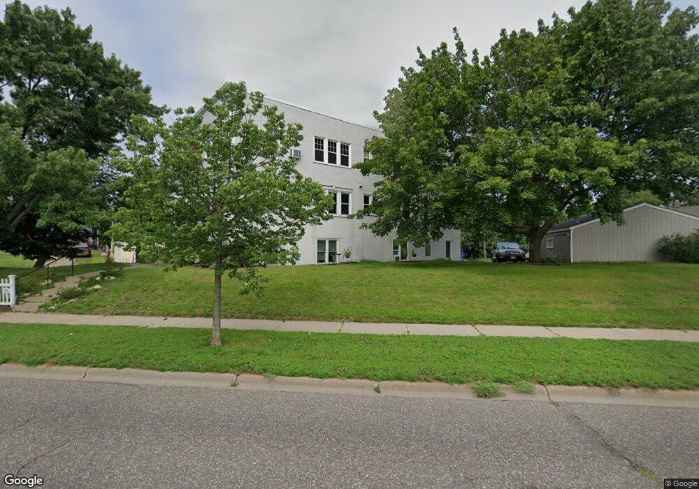
285 Cliff St Unit 1 Saint Paul, MN 55102
West Seventh NeighborhoodEstimated Value: $164,000 - $224,000
2
Beds
1
Bath
834
Sq Ft
$224/Sq Ft
Est. Value
About This Home
This home is located at 285 Cliff St Unit 1, Saint Paul, MN 55102 and is currently estimated at $187,119, approximately $224 per square foot. 285 Cliff St Unit 1 is a home located in Ramsey County with nearby schools including Randolph Heights Elementary School, Hidden River Middle School, and Central Senior High School.
Ownership History
Date
Name
Owned For
Owner Type
Purchase Details
Closed on
Nov 20, 2017
Sold by
Biever Liam Matthew and Biever Maggie Mae Miler
Bought by
Woessner Justin and Woessner Ramona
Current Estimated Value
Home Financials for this Owner
Home Financials are based on the most recent Mortgage that was taken out on this home.
Original Mortgage
$108,640
Outstanding Balance
$91,107
Interest Rate
3.88%
Estimated Equity
$96,012
Purchase Details
Closed on
Jul 1, 2003
Sold by
Adams Peter J and Lenin Adams Christina
Bought by
Miller Maggie M
Purchase Details
Closed on
Jan 25, 2002
Sold by
Webb John C and Webb Carol Bowman
Bought by
Adams Peter J and Lemm Adams Christina
Create a Home Valuation Report for This Property
The Home Valuation Report is an in-depth analysis detailing your home's value as well as a comparison with similar homes in the area
Home Values in the Area
Average Home Value in this Area
Purchase History
| Date | Buyer | Sale Price | Title Company |
|---|---|---|---|
| Woessner Justin | $115,394 | Ancona Title & Escrow | |
| Miller Maggie M | $134,900 | -- | |
| Adams Peter J | $140,000 | -- |
Source: Public Records
Mortgage History
| Date | Status | Borrower | Loan Amount |
|---|---|---|---|
| Open | Woessner Justin | $108,640 |
Source: Public Records
Tax History Compared to Growth
Tax History
| Year | Tax Paid | Tax Assessment Tax Assessment Total Assessment is a certain percentage of the fair market value that is determined by local assessors to be the total taxable value of land and additions on the property. | Land | Improvement |
|---|---|---|---|---|
| 2025 | $2,178 | $162,100 | $1,000 | $161,100 |
| 2023 | $2,178 | $156,500 | $1,000 | $155,500 |
| 2022 | $1,850 | $145,400 | $1,000 | $144,400 |
| 2021 | $1,774 | $134,300 | $1,000 | $133,300 |
| 2020 | $1,666 | $133,700 | $1,000 | $132,700 |
| 2019 | $1,364 | $120,500 | $1,000 | $119,500 |
| 2018 | $802 | $102,200 | $1,000 | $101,200 |
| 2017 | $1,116 | $69,500 | $1,000 | $68,500 |
| 2016 | $1,214 | $0 | $0 | $0 |
| 2015 | $926 | $70,500 | $7,100 | $63,400 |
| 2014 | $1,814 | $0 | $0 | $0 |
Source: Public Records
Map
Nearby Homes
- 275 Cliff St
- 398 Banfil St
- 89 Douglas St
- 212 McBoal St
- 383 Grand Ave Unit 1
- 383 Grand Ave Unit 9
- 391 Grand Ave Unit 304
- 380 Ramsey St Unit 1B
- 270 7th St W
- 185 Elm St
- 310 Ryan Ave
- 11 Summit Ct Unit 11
- 442 Summit Ave Unit 4
- 442 Summit Ave Unit 6
- 415 Summit Ave Unit 2
- 421 Summit Ave Unit 3
- 421 Summit Ave Unit 2
- 506 Grand Hill
- 190 Elm St
- 312 Spring St Unit 309
- 285 Cliff St Unit 6
- 285 Cliff St Unit 3
- 285 Cliff St Unit 2
- 285 Cliff St Unit 5
- 285 Cliff St
- 285 285 Cliff-Street-
- 285 285 Cliff St
- 302 Superior St
- 293 Superior St
- 308 Superior St
- 291 Superior St
- 307 Michigan St
- 285 Superior St
- 312 Superior St
- 283 Superior St
- 189 Dousman St
- 277 Cliff St
- 316 Superior St
- 313 Superior St
- 317 Michigan St