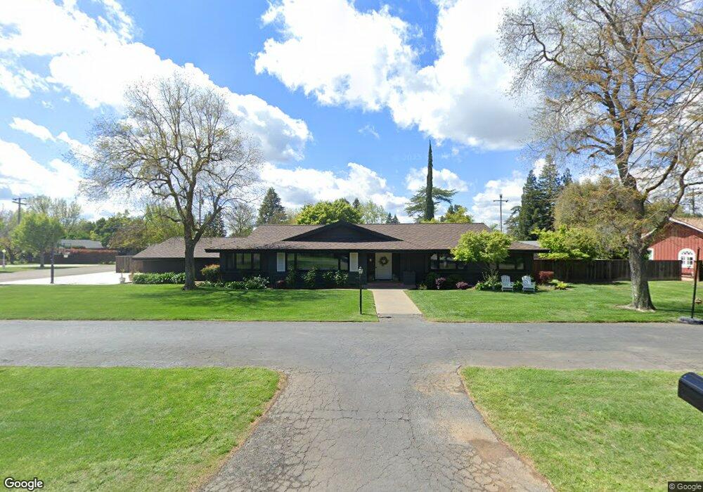
2865 Forist Ln Merced, CA 95340
North Merced NeighborhoodEstimated Value: $506,000 - $585,000
3
Beds
3
Baths
2,134
Sq Ft
$258/Sq Ft
Est. Value
About This Home
This home is located at 2865 Forist Ln, Merced, CA 95340 and is currently estimated at $550,780, approximately $258 per square foot. 2865 Forist Ln is a home located in Merced County with nearby schools including Donn B. Chenoweth Elementary School, Herbert Hoover Middle School, and Merced High School.
Ownership History
Date
Name
Owned For
Owner Type
Purchase Details
Closed on
Sep 6, 2022
Sold by
Marvulli David and Marvulli Natalie L
Bought by
David Marvulli And Natalie Marvulli Revocable
Current Estimated Value
Purchase Details
Closed on
Jul 16, 2019
Sold by
Kirkpatrick Kathleen A and Kirkpatrick Robert S
Bought by
Marvulli David and Marvulli Natalie L
Home Financials for this Owner
Home Financials are based on the most recent Mortgage that was taken out on this home.
Original Mortgage
$348,000
Interest Rate
3.82%
Mortgage Type
New Conventional
Create a Home Valuation Report for This Property
The Home Valuation Report is an in-depth analysis detailing your home's value as well as a comparison with similar homes in the area
Home Values in the Area
Average Home Value in this Area
Purchase History
| Date | Buyer | Sale Price | Title Company |
|---|---|---|---|
| David Marvulli And Natalie Marvulli Revocable | -- | -- | |
| Marvulli David | $435,000 | Transcounty Title Company |
Source: Public Records
Mortgage History
| Date | Status | Borrower | Loan Amount |
|---|---|---|---|
| Previous Owner | Marvulli David | $348,000 |
Source: Public Records
Tax History
| Year | Tax Paid | Tax Assessment Tax Assessment Total Assessment is a certain percentage of the fair market value that is determined by local assessors to be the total taxable value of land and additions on the property. | Land | Improvement |
|---|---|---|---|---|
| 2025 | $5,110 | $491,031 | $103,895 | $387,136 |
| 2024 | $5,110 | $481,404 | $101,858 | $379,546 |
| 2023 | $4,880 | $457,260 | $99,861 | $357,399 |
| 2022 | $4,815 | $448,295 | $97,903 | $350,392 |
| 2021 | $4,803 | $439,506 | $95,984 | $343,522 |
| 2020 | $4,840 | $435,000 | $95,000 | $340,000 |
| 2019 | $1,449 | $125,207 | $19,771 | $105,436 |
| 2018 | $1,324 | $122,753 | $19,384 | $103,369 |
| 2017 | $1,295 | $120,347 | $19,004 | $101,343 |
| 2016 | $1,274 | $117,988 | $18,632 | $99,356 |
| 2015 | $1,253 | $116,217 | $18,353 | $97,864 |
| 2014 | $1,225 | $113,941 | $17,994 | $95,947 |
Source: Public Records
Map
Nearby Homes
- 2849 Montana Ave
- 950 E South Bear Creek Dr
- 891 Hansen Ave
- 688 Elise Ct
- 2777 Agnes Way
- 1490 Cameron Ln
- 1366 E Alexander Ave
- 842 E Alexander Ave
- 2720 Glen Ave
- 2733 10th Ave
- 1785 E North Bear Creek Dr
- 2848 Tahoe Dr
- 3045 Silver Elm Ct
- 2972 Tahoe Dr
- 3009 Colony Park Dr
- 0 E North Bear Creek Dr
- 1 E North Bear Creek Dr
- 2819 Tenaya Dr
- 425 E 27th St
- 1300 Kensington Dr
- 2875 Forist Ln
- 1101 Wyoming Dr
- 2849 Forist Ln
- 101 Wyoming Dr
- 1100 Wyoming Dr
- 1082 Idaho Dr
- 2858 Forist Ln
- 2874 Forist Ln
- 1085 Idaho Dr
- 1081 Arizona Dr
- 1049 Wyoming Dr
- 2883 Forist Ln
- 1050 Wyoming Dr
- 2835 Forist Ln
- 2842 Forist Ln
- 1050 Idaho Dr
- 1085 Arizona Dr
- 1081 Idaho Dr
- 1049 Arizona Dr
- 1251 Reba Way
Your Personal Tour Guide
Ask me questions while you tour the home.