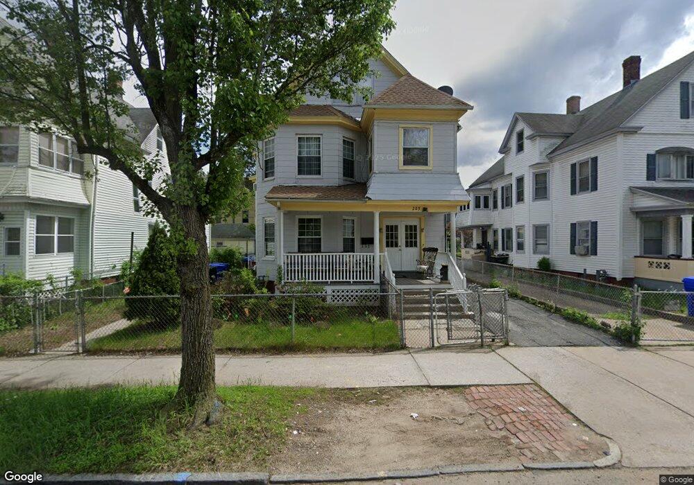
289 Wilbraham Rd Springfield, MA 01109
Upper Hill NeighborhoodEstimated Value: $247,911 - $342,000
6
Beds
2
Baths
2,983
Sq Ft
$105/Sq Ft
Est. Value
About This Home
This home is located at 289 Wilbraham Rd, Springfield, MA 01109 and is currently estimated at $312,728, approximately $104 per square foot. 289 Wilbraham Rd is a home located in Hampden County with nearby schools including John J Duggan Middle, Springfield High School of Science and Technology, and Roger L. Putnam Vocational Technical Academy.
Ownership History
Date
Name
Owned For
Owner Type
Purchase Details
Closed on
Oct 26, 1990
Sold by
Rowtham Derrick K
Bought by
Santos Effrain
Current Estimated Value
Home Financials for this Owner
Home Financials are based on the most recent Mortgage that was taken out on this home.
Original Mortgage
$100,700
Interest Rate
10.08%
Mortgage Type
Purchase Money Mortgage
Create a Home Valuation Report for This Property
The Home Valuation Report is an in-depth analysis detailing your home's value as well as a comparison with similar homes in the area
Home Values in the Area
Average Home Value in this Area
Purchase History
| Date | Buyer | Sale Price | Title Company |
|---|---|---|---|
| Santos Effrain | $106,000 | -- |
Source: Public Records
Mortgage History
| Date | Status | Borrower | Loan Amount |
|---|---|---|---|
| Closed | Santos Effrain | $100,700 |
Source: Public Records
Tax History Compared to Growth
Tax History
| Year | Tax Paid | Tax Assessment Tax Assessment Total Assessment is a certain percentage of the fair market value that is determined by local assessors to be the total taxable value of land and additions on the property. | Land | Improvement |
|---|---|---|---|---|
| 2025 | $3,222 | $205,500 | $30,000 | $175,500 |
| 2024 | $3,018 | $187,900 | $30,000 | $157,900 |
| 2023 | $2,730 | $160,100 | $27,200 | $132,900 |
| 2022 | $3,248 | $172,600 | $25,500 | $147,100 |
| 2021 | $2,799 | $148,100 | $18,100 | $130,000 |
| 2020 | $2,808 | $143,800 | $18,100 | $125,700 |
| 2019 | $2,675 | $135,900 | $15,400 | $120,500 |
| 2018 | $2,562 | $130,200 | $15,400 | $114,800 |
| 2017 | $2,446 | $124,400 | $14,500 | $109,900 |
| 2016 | $2,106 | $107,100 | $14,500 | $92,600 |
| 2015 | $2,073 | $105,400 | $14,500 | $90,900 |
Source: Public Records
Map
Nearby Homes
- 43 Colonial Ave
- 62-64 Bristol St
- 111 Marlborough St
- 88 Dunmoreland St
- 135-137 Suffolk St
- 67 Carlisle St
- 19 Westford Ave
- 124-126 Westford Cir
- 58 Willard Ave
- 158 Norfolk St
- 179 Albemarle St
- 21 Westford Cir
- 65 Montrose St
- 15 Kenyon St
- 140 Northampton Ave
- 52-56 Andrew St
- 867 Roosevelt Ave
- 162 Northampton Ave
- 81 Hayden Ave
- 290 Quincy St
- 293 Wilbraham Rd
- 283 Wilbraham Rd
- 281 Wilbraham Rd
- 14 Middlesex St
- 0 Middlesex St
- 18 Middlesex St Unit 20
- 18-20 Middlesex St
- 301 Wilbraham Rd
- 280-282 Wilbraham Rd
- 280 Wilbraham Rd Unit 282
- 24 Middlesex St
- 21 Wellington St
- 15 Middlesex St
- 276 Wilbraham Rd Unit 278
- 25 Wellington St
- 267 Wilbraham Rd
- 17-19 Middlesex St
- 17 Middlesex St Unit 19
- 270 Wilbraham Rd Unit 272
- 27 Wellington St