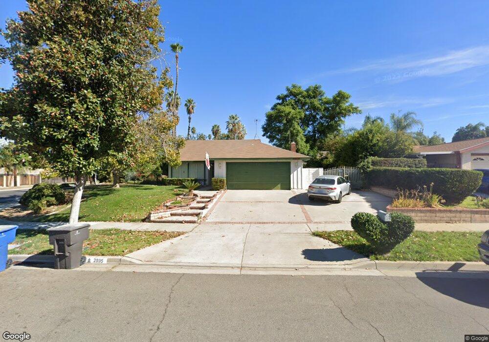
2895 Westridge Rd Riverside, CA 92506
Victoria NeighborhoodEstimated Value: $528,000 - $605,000
3
Beds
2
Baths
1,161
Sq Ft
$485/Sq Ft
Est. Value
About This Home
This home is located at 2895 Westridge Rd, Riverside, CA 92506 and is currently estimated at $562,595, approximately $484 per square foot. 2895 Westridge Rd is a home located in Riverside County with nearby schools including Victoria Elementary School, Matthew Gage Middle School, and Polytechnic High School.
Ownership History
Date
Name
Owned For
Owner Type
Purchase Details
Closed on
Jun 27, 1997
Sold by
Winters Gary P and Farrington Diana Farrington
Bought by
Manges William R and Manges Pamela R
Current Estimated Value
Home Financials for this Owner
Home Financials are based on the most recent Mortgage that was taken out on this home.
Original Mortgage
$107,900
Outstanding Balance
$16,027
Interest Rate
7.91%
Mortgage Type
Purchase Money Mortgage
Estimated Equity
$546,568
Create a Home Valuation Report for This Property
The Home Valuation Report is an in-depth analysis detailing your home's value as well as a comparison with similar homes in the area
Home Values in the Area
Average Home Value in this Area
Purchase History
| Date | Buyer | Sale Price | Title Company |
|---|---|---|---|
| Manges William R | $120,000 | Old Republic Title Company |
Source: Public Records
Mortgage History
| Date | Status | Borrower | Loan Amount |
|---|---|---|---|
| Open | Manges William R | $107,900 |
Source: Public Records
Tax History
| Year | Tax Paid | Tax Assessment Tax Assessment Total Assessment is a certain percentage of the fair market value that is determined by local assessors to be the total taxable value of land and additions on the property. | Land | Improvement |
|---|---|---|---|---|
| 2025 | $2,084 | $195,239 | $65,124 | $130,115 |
| 2023 | $2,084 | $187,660 | $62,597 | $125,063 |
| 2022 | $2,035 | $183,981 | $61,370 | $122,611 |
| 2021 | $2,018 | $180,374 | $60,167 | $120,207 |
| 2020 | $2,003 | $178,526 | $59,551 | $118,975 |
| 2019 | $1,964 | $175,027 | $58,384 | $116,643 |
| 2018 | $1,925 | $171,596 | $57,241 | $114,355 |
| 2017 | $1,890 | $168,232 | $56,119 | $112,113 |
| 2016 | $1,770 | $164,934 | $55,019 | $109,915 |
| 2015 | $1,744 | $162,459 | $54,194 | $108,265 |
| 2014 | $1,726 | $159,280 | $53,134 | $106,146 |
Source: Public Records
Map
Nearby Homes
- 2944 Hyde Park Cir
- 5978 Copperfield Ave
- 2920 Cheyenne Rd
- 2924 Pecos Way
- 6146 Hawarden Dr
- 2667 Victoria Park Dr
- 6539 Marguerita Ave
- 6565 Lorraine Dr
- 2429 Chauncy Place
- 6174 Hawarden Dr
- 2542 Adage Way
- 6624 Banyan Place
- 2565 Laramie Rd
- 3180 Jane St
- 3076 Ronald St
- 2906 Miguel St
- 2367 Deerhorn Dr
- 3170 Ronald St
- 6480 Hawarden Dr
- 2286 Century Ave
- 2885 Westridge Rd
- 2896 Sandberg St
- 2886 Sandberg St
- 2875 Westridge Rd
- 2892 Westridge Rd
- 2907 Westridge Rd
- 2876 Sandberg St
- 2882 Westridge Rd
- 2908 Sandberg St
- 2872 Westridge Rd
- 2865 Westridge Rd
- 2866 Sandberg St
- 2904 Westridge Rd
- 2918 Sandberg St
- 2889 Moorgate Place
- 2921 Westridge Rd
- 2887 Sandberg St
- 2897 Sandberg St
- 2879 Moorgate Place
- 2862 Westridge Rd
Your Personal Tour Guide
Ask me questions while you tour the home.