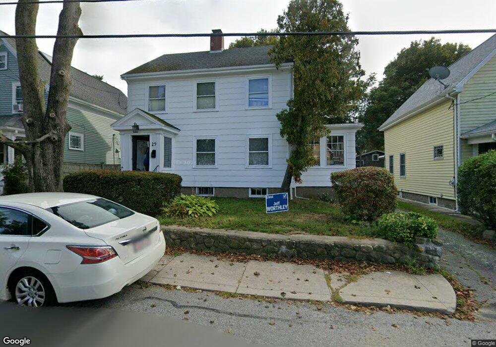
29 Haskell St Gloucester, MA 01930
East Gloucester NeighborhoodEstimated Value: $743,377 - $924,000
3
Beds
1
Bath
1,535
Sq Ft
$547/Sq Ft
Est. Value
About This Home
This home is located at 29 Haskell St, Gloucester, MA 01930 and is currently estimated at $839,344, approximately $546 per square foot. 29 Haskell St is a home located in Essex County with nearby schools including East Gloucester Elementary School, Ralph B O'maley Middle School, and Gloucester High School.
Ownership History
Date
Name
Owned For
Owner Type
Purchase Details
Closed on
May 27, 2004
Sold by
Burns Kathryn G and Burns Ralph W
Bought by
Donahue Gary L
Current Estimated Value
Home Financials for this Owner
Home Financials are based on the most recent Mortgage that was taken out on this home.
Original Mortgage
$281,000
Interest Rate
5.88%
Mortgage Type
Purchase Money Mortgage
Create a Home Valuation Report for This Property
The Home Valuation Report is an in-depth analysis detailing your home's value as well as a comparison with similar homes in the area
Home Values in the Area
Average Home Value in this Area
Purchase History
| Date | Buyer | Sale Price | Title Company |
|---|---|---|---|
| Donahue Gary L | $431,000 | -- |
Source: Public Records
Mortgage History
| Date | Status | Borrower | Loan Amount |
|---|---|---|---|
| Open | Donahue Gary L | $247,500 | |
| Closed | Donahue Gary L | $281,000 |
Source: Public Records
Tax History
| Year | Tax Paid | Tax Assessment Tax Assessment Total Assessment is a certain percentage of the fair market value that is determined by local assessors to be the total taxable value of land and additions on the property. | Land | Improvement |
|---|---|---|---|---|
| 2025 | $6,416 | $660,100 | $262,800 | $397,300 |
| 2024 | $6,301 | $647,600 | $250,300 | $397,300 |
| 2023 | $6,048 | $571,100 | $223,500 | $347,600 |
| 2022 | $5,858 | $499,400 | $194,300 | $305,100 |
| 2021 | $5,658 | $454,800 | $176,700 | $278,100 |
| 2020 | $5,449 | $441,900 | $166,600 | $275,300 |
| 2019 | $5,230 | $412,100 | $166,600 | $245,500 |
| 2018 | $5,054 | $390,900 | $166,600 | $224,300 |
| 2017 | $4,900 | $371,500 | $158,600 | $212,900 |
| 2016 | $4,637 | $340,700 | $150,500 | $190,200 |
| 2015 | $4,457 | $326,500 | $150,500 | $176,000 |
Source: Public Records
Map
Nearby Homes
- 3 Mondello Square
- 197 E Main St Unit 1
- 5 Wise Place
- 36 Eastern Ave
- 26 Marina Dr
- 139A Prospect St
- 60 Rocky Neck Ave Unit 202
- 73 Rocky Neck Ave Unit 2
- 10 Seaview Rd
- 1 Wonson St
- 191 Main St Unit 3
- 191 Main St Unit 2A
- 19 Trask St Unit 2
- 50 Warner St
- 70 Old Nugent Farm Rd
- 113 Pleasant St
- 11 Ocean View Dr
- 15 Raven Ln Unit 15
- 78 Thatcher Rd Unit 6
- 35 Middle St Unit 4
- 27 Haskell St
- 31 Haskell St
- 10 Rocky Pasture Rd
- 33 Haskell St
- 12 Rocky Pasture Rd
- 26 Haskell St
- 8 Rocky Pasture Rd
- 6 Rocky Pasture Rd
- 2 Rocky Pasture Rd
- 14 Rocky Pasture Rd
- 24 Haskell St
- 28 Haskell St
- 37 Haskell St
- 4 Rocky Pasture Rd
- 22 Haskell St
- 17 Traverse St
- 16 Rocky Pasture Rd
- 30 Haskell St
- 15 Traverse St
- 39 Haskell St
Your Personal Tour Guide
Ask me questions while you tour the home.