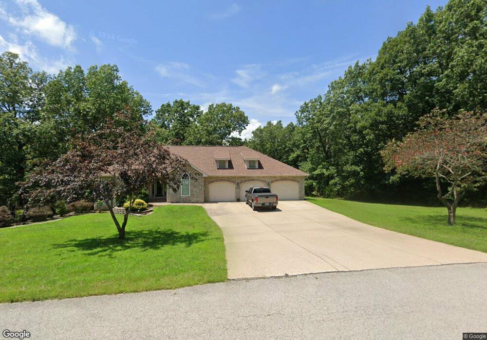
2907 Ginger Dr West Plains, MO 65775
Estimated Value: $250,369 - $329,000
--
Bed
--
Bath
1,944
Sq Ft
$151/Sq Ft
Est. Value
About This Home
This home is located at 2907 Ginger Dr, West Plains, MO 65775 and is currently estimated at $293,842, approximately $151 per square foot. 2907 Ginger Dr is a home with nearby schools including West Plains Senior High School and Faith Assembly Christian School.
Ownership History
Date
Name
Owned For
Owner Type
Purchase Details
Closed on
May 19, 2014
Sold by
Bagby Philip Dean and Bagby Marglynn
Bought by
Mcginnis Ii Gary E and Mcginnis Kara M
Current Estimated Value
Purchase Details
Closed on
Jul 10, 2007
Sold by
Rosenbauer David A and Rosenbauer Andrea M
Bought by
Mcginnis Ii Gary E and Mcginnis Kara M
Home Financials for this Owner
Home Financials are based on the most recent Mortgage that was taken out on this home.
Original Mortgage
$200,000
Interest Rate
6.41%
Mortgage Type
New Conventional
Create a Home Valuation Report for This Property
The Home Valuation Report is an in-depth analysis detailing your home's value as well as a comparison with similar homes in the area
Home Values in the Area
Average Home Value in this Area
Purchase History
| Date | Buyer | Sale Price | Title Company |
|---|---|---|---|
| Mcginnis Ii Gary E | -- | None Available | |
| Mcginnis Ii Gary E | -- | None Available |
Source: Public Records
Mortgage History
| Date | Status | Borrower | Loan Amount |
|---|---|---|---|
| Previous Owner | Mcginnis Ii Gary E | $200,000 |
Source: Public Records
Tax History Compared to Growth
Tax History
| Year | Tax Paid | Tax Assessment Tax Assessment Total Assessment is a certain percentage of the fair market value that is determined by local assessors to be the total taxable value of land and additions on the property. | Land | Improvement |
|---|---|---|---|---|
| 2025 | $1,685 | $40,690 | $6,780 | $33,910 |
| 2024 | $1,675 | $36,330 | -- | -- |
| 2023 | $1,675 | $36,330 | $0 | $0 |
| 2022 | $1,589 | $34,510 | $0 | $0 |
| 2021 | $1,487 | $34,510 | $0 | $0 |
| 2020 | $1,487 | $31,540 | $0 | $0 |
| 2019 | $1,544 | $31,540 | $0 | $0 |
| 2018 | $1,544 | $31,540 | $0 | $0 |
| 2017 | $1,538 | $31,540 | $0 | $0 |
| 2015 | -- | $30,360 | $0 | $0 |
| 2014 | -- | $29,750 | $0 | $0 |
| 2013 | -- | $29,750 | $0 | $0 |
Source: Public Records
Map
Nearby Homes
- 000 Lot 4 Block 13 Morrison Sub
- 3002 Ginger Dr
- 000 Rhonda Dr
- 000 Lot 2 Block 13 Morrison Sub
- 000 Ginger Dr
- 2823 Laurie Ave
- 2704 Jennifer Dr
- 2707 Ridgewood Dr
- 2701 Paula Dr
- 2821 Christie Dr
- 2818 Christie Dr
- 000 Lot 3 Block 13 Morrison Sub
- 2601 Kody Dr
- 000 Lot 2 Block 12 Morrison Sub
- 2502 Kody Dr
- 2405 Deatherage Ave
- 000 Lee Anna Dr
- 2505 Courtney Place
- 000 Mcfarland St
- 2808 Burke Ave
- 2902 Ginger Dr
- 2911 Ginger Dr
- 2903 Paula Dr
- 2819 Ginger Dr
- 2905 Paula Dr
- 2720 Jennifer Dr
- 2720 Jennifer Dr
- 2901 Paula Dr
- 2818 Ginger Dr
- 2909 Paula Dr
- 2904 Rhonda Dr
- 2817 Ginger Dr
- 2719 Jennifer Dr
- 2718 Jennifer Dr
- 2819 Paula Dr
- 2816 Ginger Dr
- 2911 Paula Dr
- 2904 Paula Dr
- 2902 Paula Dr
- 3000 Jennifer Place