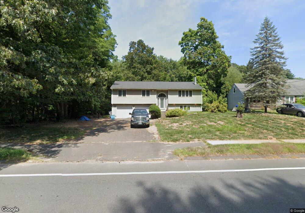
291 Brainard Rd Enfield, CT 06082
Estimated Value: $292,000 - $364,000
4
Beds
2
Baths
1,911
Sq Ft
$171/Sq Ft
Est. Value
About This Home
This home is located at 291 Brainard Rd, Enfield, CT 06082 and is currently estimated at $326,869, approximately $171 per square foot. 291 Brainard Rd is a home located in Hartford County with nearby schools including Prudence Crandall Elementary School, Henry Barnard Elementary School, and John F. Kennedy Middle School.
Ownership History
Date
Name
Owned For
Owner Type
Purchase Details
Closed on
Aug 17, 2020
Sold by
Ramsay Kenneth C and Ramsay Cathleen M
Bought by
Bae Enterprise Llc
Current Estimated Value
Home Financials for this Owner
Home Financials are based on the most recent Mortgage that was taken out on this home.
Original Mortgage
$126,750
Outstanding Balance
$112,436
Interest Rate
3%
Mortgage Type
New Conventional
Estimated Equity
$214,433
Purchase Details
Closed on
Apr 22, 1988
Sold by
Greaves Brenda
Bought by
Ramsay Kenneth
Purchase Details
Closed on
Apr 27, 1987
Sold by
Cichocki Anthony
Bought by
Spazzarini John
Home Financials for this Owner
Home Financials are based on the most recent Mortgage that was taken out on this home.
Original Mortgage
$86,000
Interest Rate
8.97%
Create a Home Valuation Report for This Property
The Home Valuation Report is an in-depth analysis detailing your home's value as well as a comparison with similar homes in the area
Home Values in the Area
Average Home Value in this Area
Purchase History
| Date | Buyer | Sale Price | Title Company |
|---|---|---|---|
| Bae Enterprise Llc | $169,000 | None Available | |
| Ramsay Kenneth | $5,000 | -- | |
| Spazzarini John | $132,500 | -- |
Source: Public Records
Mortgage History
| Date | Status | Borrower | Loan Amount |
|---|---|---|---|
| Open | Bae Enterprise Llc | $126,750 | |
| Previous Owner | Spazzarini John | $100,000 | |
| Previous Owner | Spazzarini John | $100,000 | |
| Previous Owner | Spazzarini John | $102,000 | |
| Previous Owner | Spazzarini John | $86,000 |
Source: Public Records
Tax History Compared to Growth
Tax History
| Year | Tax Paid | Tax Assessment Tax Assessment Total Assessment is a certain percentage of the fair market value that is determined by local assessors to be the total taxable value of land and additions on the property. | Land | Improvement |
|---|---|---|---|---|
| 2025 | $5,929 | $171,100 | $58,700 | $112,400 |
| 2024 | $5,785 | $171,100 | $58,700 | $112,400 |
| 2023 | $5,691 | $171,100 | $58,700 | $112,400 |
| 2022 | $5,234 | $171,100 | $58,700 | $112,400 |
| 2021 | $5,208 | $139,320 | $48,590 | $90,730 |
| 2020 | $5,208 | $139,320 | $48,590 | $90,730 |
| 2019 | $5,208 | $139,320 | $48,590 | $90,730 |
| 2018 | $5,092 | $139,320 | $48,590 | $90,730 |
| 2017 | $4,818 | $139,320 | $48,590 | $90,730 |
| 2016 | $4,673 | $137,390 | $49,850 | $87,540 |
| 2015 | $4,539 | $137,390 | $49,850 | $87,540 |
| 2014 | $4,435 | $137,390 | $49,850 | $87,540 |
Source: Public Records
Map
Nearby Homes
- 14 W Forrest Dr
- 39 Liberty Ln
- 41 Liberty Ln
- 43 Liberty Ln
- 50 Liberty Ln
- 15 Robbin Rd
- 12 Concord Terrace
- 5 Cranberry Hollow Unit 5
- 18 Cranberry Hollow Unit 18
- 30 Alban Rd
- 32 Magnolia Dr
- 12 the Laurels Unit 12
- 20 Gary Rd
- 757 Shaker Rd
- 91 Till St
- 90 Cottage Rd
- 176 Cottage Rd
- 181 Candlewood Dr Unit 181
- 65 W Shore Dr
- 136 Fenwood Rd
- 289 Brainard Rd
- 293 Brainard Rd
- 295 Brainard Rd
- 286 Brainard Rd
- 336 Brainard Rd
- 297 Brainard Rd
- 3 W Forrest Dr
- 296 Brainard Rd
- 5 W Forrest Dr
- 283 Brainard Rd
- 299 Brainard Rd
- 7 W Forest Dr
- 2 W Forrest Dr
- 4 W Forrest Dr
- 301 Brainard Rd
- 281 Brainard Rd
- 9 W Forrest Dr
- 6 W Forrest Dr
- 279 Brainard Rd
- 8 W Forrest Dr