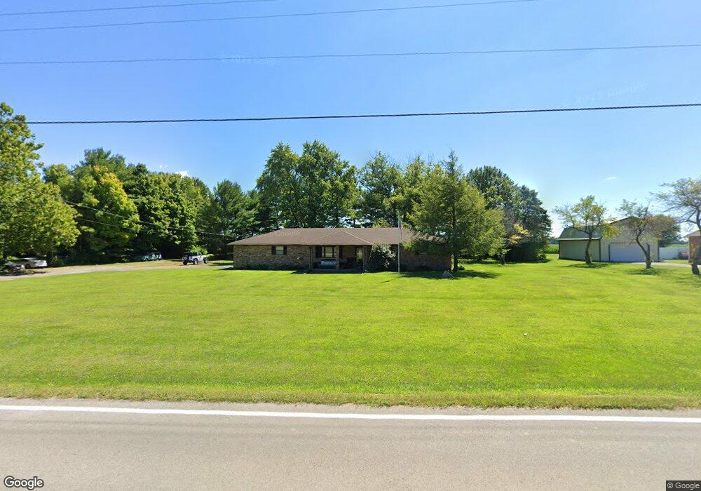
2915 Moorefield Rd Springfield, OH 45502
Estimated Value: $224,000 - $300,000
3
Beds
2
Baths
1,400
Sq Ft
$186/Sq Ft
Est. Value
About This Home
This home is located at 2915 Moorefield Rd, Springfield, OH 45502 and is currently estimated at $260,432, approximately $186 per square foot. 2915 Moorefield Rd is a home located in Clark County with nearby schools including Northridge Elementary School, Kenton Ridge Middle & High School, and Emmanuel Christian Academy.
Ownership History
Date
Name
Owned For
Owner Type
Purchase Details
Closed on
Aug 23, 2002
Sold by
Poland Ivan Ray and Poland Kimberly K
Bought by
Bender Matthew A and Bender Michelle L
Current Estimated Value
Home Financials for this Owner
Home Financials are based on the most recent Mortgage that was taken out on this home.
Original Mortgage
$102,320
Outstanding Balance
$42,293
Interest Rate
6.63%
Estimated Equity
$218,139
Purchase Details
Closed on
Oct 12, 1999
Sold by
Poland Ivan Ray and Poland Kimberly K
Bought by
Poland Ivan Ray and Poland Kimberly K
Purchase Details
Closed on
Apr 29, 1999
Sold by
Estate Of Ivan Ray Poland Sr
Bought by
Poland Ivan Ray
Create a Home Valuation Report for This Property
The Home Valuation Report is an in-depth analysis detailing your home's value as well as a comparison with similar homes in the area
Purchase History
| Date | Buyer | Sale Price | Title Company |
|---|---|---|---|
| Bender Matthew A | $127,900 | -- | |
| Poland Ivan Ray | -- | -- | |
| Poland Ivan Ray | -- | -- |
Source: Public Records
Mortgage History
| Date | Status | Borrower | Loan Amount |
|---|---|---|---|
| Open | Bender Matthew A | $102,320 | |
| Closed | Bender Matthew A | $19,185 |
Source: Public Records
Tax History
| Year | Tax Paid | Tax Assessment Tax Assessment Total Assessment is a certain percentage of the fair market value that is determined by local assessors to be the total taxable value of land and additions on the property. | Land | Improvement |
|---|---|---|---|---|
| 2025 | $2,992 | $79,140 | $17,920 | $61,220 |
| 2024 | $2,894 | $68,410 | $13,910 | $54,500 |
| 2023 | $2,894 | $68,410 | $13,910 | $54,500 |
| 2022 | $2,905 | $68,410 | $13,910 | $54,500 |
| 2021 | $2,817 | $56,230 | $11,400 | $44,830 |
| 2020 | $2,819 | $56,230 | $11,400 | $44,830 |
| 2019 | $2,873 | $56,230 | $11,400 | $44,830 |
| 2018 | $2,634 | $49,470 | $10,550 | $38,920 |
| 2017 | $2,258 | $49,470 | $10,553 | $38,917 |
| 2016 | $2,242 | $49,470 | $10,553 | $38,917 |
| 2015 | $2,167 | $46,064 | $10,553 | $35,511 |
| 2014 | $2,167 | $46,064 | $10,553 | $35,511 |
| 2013 | $2,117 | $46,064 | $10,553 | $35,511 |
Source: Public Records
Map
Nearby Homes
- 4500 Bosart Rd
- 5060 Morris Rd
- 1977 Willoughby Ave
- 1709 Thomas Dr
- 4652 Reno Ln Unit 15
- 1836 Dunseth Ln
- 4028 Ryland Dr Unit 4028
- 4577 Reno Ln Unit 2
- 5033 Ridgewood Rd E
- 4293 Yale St
- 1521 Erika Dr
- 1812 Willow Lakes Dr
- 4446 Ridgewood Rd E Unit 3
- 5564 Ridgewood Rd E Unit 7
- 1921 Elaina Dr
- 1495 Victorian Way
- 1469 Victorian Way
- 4256 Midfield St Unit 9
- 1398 Elizabeth Ct Unit 66
- 1470 Oldham Dr Unit 12
- 2881 Moorefield Rd
- 2957 Moorefield Rd
- 2981 Moorefield Rd
- 2868 Moorefield Rd
- 2992 Moorefield Rd
- 2724 Moorefield Rd
- 3115 Moorefield Rd
- 3165 Moorefield Rd
- 4512 E Ridgewood Ridge
- 2620 Moorefield Rd
- 4266 Moorefield Rd
- 4960 Bosart Rd
- 4928 Bosart Rd
- 4922 Bosart Rd
- 2536 Moorefield Rd
- 4914 Bosart Rd
- 4906 Bosart Rd
- 4880 Bosart Rd
- 4830 Bosart Rd
- 4820 Bosart Rd
Your Personal Tour Guide
Ask me questions while you tour the home.