

2915 S 99w Corning, CA 96021
Estimated payment $2,832/month
Highlights
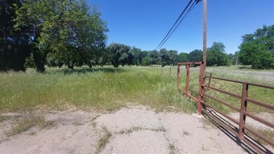
- 5.38 Acre Lot
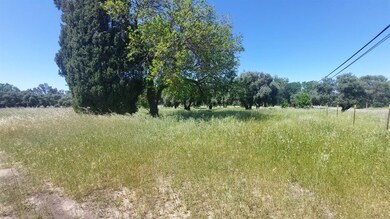
- Orchard
- No HOA
- Pasture Views
- Corner Lot
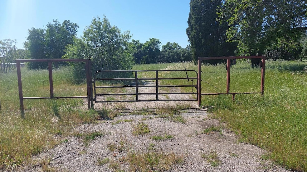
- Security Gate
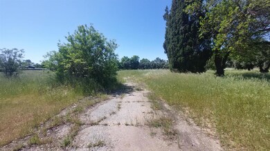
About This Lot
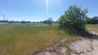
5.38 acres in an incredible location on the Liberal Ave. Interchange with high traffic count sandwiched between Interstate 5 Freeway and State Highway 99W. Only .8 miles to the Rolling Hills Casino and only .3 miles from the South Ave. business hub where the Truck Stops are located. There was an old residence on the property that has been completely removed including the foundation many years ago. There is no record of permits for the existing well and septic system on the property. The exact location of the existing well and septic system are unknown to the owner. Part of the property has an old olive grove. There is a seasonal drainage way through the South side of the property. The property is not perfectly level but mostly flat. The property is fenced on the East, South and West sides and the fence needs repair on the East side along the State HWY 99W. The neighbor to the North has started to construct a metal fence that is unfinished and laying on the ground. The property is in the Corning Irrigation District. The zoning is M-1-S-P, which is light industrial. Details on the zoning can be found on the Tehama County Zoning website.
Property Details
Property Type
- Land
Lot Details
- 5.38 Acre Lot
- Property fronts a freeway
- Partially Fenced Property
- Barbed Wire
- Corner Lot
- Irregular Lot
- Orchard
- Many Trees
- Possible uses of the property include Commercial, Highway/Tourist Service
- Property is zoned M-1, Commercial,Highway/Tourist Services,Industrial
Property Views
- Pasture Views
- Orchard Views
Farming
- Pasture
Utilities
- Natural Gas Not Available
- Private Company Owned Well
- Septic System
- Phone Available
Community Details
- No Home Owners Association
- Maywood Colony Subdivision
Listing and Financial Details
- Assessor Parcel Number 087-230-008-000
Map
Tax History
| Year | Tax Paid | Tax Assessment Tax Assessment Total Assessment is a certain percentage of the fair market value that is determined by local assessors to be the total taxable value of land and additions on the property. | Land | Improvement |
|---|---|---|---|---|
| 2025 | $401 | $33,499 | $22,181 | $11,318 |
| 2023 | $396 | $32,201 | $21,321 | $10,880 |
| 2022 | $391 | $31,570 | $20,903 | $10,667 |
| 2021 | $377 | $30,952 | $20,494 | $10,458 |
| 2020 | $381 | $30,635 | $20,284 | $10,351 |
| 2019 | $367 | $30,036 | $19,887 | $10,149 |
| 2018 | $368 | $29,448 | $19,498 | $9,950 |
| 2017 | $366 | $28,871 | $19,116 | $9,755 |
| 2016 | $345 | $28,306 | $18,742 | $9,564 |
| 2015 | -- | $27,882 | $18,461 | $9,421 |
| 2014 | $338 | $27,337 | $18,100 | $9,237 |
Property History
| Date | Event | Price | List to Sale | Price per Sq Ft |
|---|---|---|---|---|
| 04/18/2025 04/18/25 | For Sale | $545,000 | -- | -- |
Purchase History
| Date | Type | Sale Price | Title Company |
|---|---|---|---|
| Grant Deed | -- | None Listed On Document | |
| Grant Deed | -- | None Listed On Document | |
| Interfamily Deed Transfer | -- | None Available |
Source: MetroList
MLS Number: 225049306
APN: 087-230-008-000
Disclaimer: Certain information contained herein is derived from information provided by parties other than Homes.com. All information provided is deemed reliable, but is not guaranteed to be accurate and should be independently verified.
![]() IDX information is provided exclusively for personal, non-commercial use, and may not be used for any purpose other than to identify prospective properties consumers may be interested in purchasing. Information is deemed reliable but not guaranteed.
IDX information is provided exclusively for personal, non-commercial use, and may not be used for any purpose other than to identify prospective properties consumers may be interested in purchasing. Information is deemed reliable but not guaranteed.
- 22519 Olivewood Rd
- 2790 Foster Ave
- 2946 Kirkwood Rd
- 3646 Kirkwood Rd
- 3781 Columbia Ave
- 00 Loleta Ave
- 3911 Columbia Ave
- 0 Hwy 99 W Unit SN26028885
- 0 Houghton Ave Unit 324045531
- 4019 Marguerite Ave
- 1568 Link St
- 0 Toomes Ave Unit SN25272183
- 0 Toomes Ave Unit SN24222817
- 0 Toomes Ave Unit SN25176211
- 2067 Blossom Ave
- 2018 Donnovan Ave
- 1410 4th Ave
- 1899 1st St
- 1311 6th Ave
- 0 Loleta Ave Unit SN25184964
- 2804 Kirkwood Rd
- 1226 East St Unit 5
- 4200 Nord Hwy
- 4070 Nord Hwy
- 101 Risa Way
- 100 Penzance Ave
- 931-939 W East Ave
- 459 Waterford Dr
- 1155 Delphinium St Unit B
- 370 E Lassen Ave Unit 15
- 874 Pico Place
- 8 San Gabriel Dr Unit B
- 476 E Lassen Ave
- 1 Mayfair Dr
- 1125 W 12th Ave
- 2785 El Paso Way
- 940 E Lassen Ave
- 1055 E Lassen Ave
- 10 Drake Way
- 259 Rio Lindo Ave

Ask me questions while you tour the home.