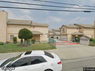
2923 Maxson Rd Unit F El Monte, CA 91732
Mountain View NeighborhoodEstimated Value: $798,000 - $910,000
4
Beds
3
Baths
1,867
Sq Ft
$450/Sq Ft
Est. Value
About This Home
This home is located at 2923 Maxson Rd Unit F, El Monte, CA 91732 and is currently estimated at $840,813, approximately $450 per square foot. 2923 Maxson Rd Unit F is a home located in Los Angeles County with nearby schools including Willard F. Payne Elementary, Mountain View High, and New Life Christian School.
Ownership History
Date
Name
Owned For
Owner Type
Purchase Details
Closed on
Nov 9, 2005
Sold by
Wong Alice Wing Hung and Wong Winnie Wing Mui
Bought by
Truong Kien Tu
Current Estimated Value
Home Financials for this Owner
Home Financials are based on the most recent Mortgage that was taken out on this home.
Original Mortgage
$342,400
Interest Rate
5.93%
Mortgage Type
Fannie Mae Freddie Mac
Create a Home Valuation Report for This Property
The Home Valuation Report is an in-depth analysis detailing your home's value as well as a comparison with similar homes in the area
Home Values in the Area
Average Home Value in this Area
Purchase History
| Date | Buyer | Sale Price | Title Company |
|---|---|---|---|
| Truong Kien Tu | $428,000 | Investors Title Company | |
| Wong Alice Wing Hung | -- | Investors Title Company | |
| Wong Winnie Wing Mui | -- | Investors Title Company |
Source: Public Records
Mortgage History
| Date | Status | Borrower | Loan Amount |
|---|---|---|---|
| Open | Truong Kien Tu | $249,000 | |
| Closed | Truong Kien Tu | $342,400 |
Source: Public Records
Tax History Compared to Growth
Tax History
| Year | Tax Paid | Tax Assessment Tax Assessment Total Assessment is a certain percentage of the fair market value that is determined by local assessors to be the total taxable value of land and additions on the property. | Land | Improvement |
|---|---|---|---|---|
| 2024 | $7,866 | $573,410 | $341,502 | $231,908 |
| 2023 | $7,735 | $562,167 | $334,806 | $227,361 |
| 2022 | $7,432 | $551,145 | $328,242 | $222,903 |
| 2021 | $7,620 | $540,339 | $321,806 | $218,533 |
| 2019 | $7,377 | $524,314 | $312,262 | $212,052 |
| 2018 | $7,074 | $511,000 | $304,000 | $207,000 |
| 2016 | $5,986 | $450,000 | $268,000 | $182,000 |
| 2015 | $5,690 | $425,000 | $253,000 | $172,000 |
| 2014 | $5,670 | $425,000 | $253,000 | $172,000 |
Source: Public Records
Map
Nearby Homes
- 12223 Magnolia St
- 12250 Mirasol Loop Unit E
- 12249 Mirasol Loop Unit D
- 12250 Mirasol Loop Unit D
- 2826 Cogswell Rd Unit A-M
- 11951 Magnolia St
- 2708 Penn Mar Ave
- 11937 Magnolia St Unit 22
- 2743 Cogswell Rd
- 12437 Denholm Dr
- 2711 Caminar Ave
- 2615 Durfee Ave Unit G
- 2615 Durfee Ave Unit H
- 2843 Parkway Dr
- 12247 Elliott Ave Unit D
- 2446 2452 Durfee Ave
- 12346 Felipe St
- 2509 Floradale Ave
- 12145 Wanda St
- 3441 Cogswell Rd Unit B
- 2923 Maxson Rd Unit F
- 2923 Maxson Rd Unit E
- 2923 Maxson Rd Unit D
- 2923 Maxson Rd Unit C
- 2923 Maxson Rd Unit B
- 2923 Maxson Rd Unit A
- 2917 Maxson Rd
- 2929 Maxson Rd Unit F
- 2929 Maxson Rd Unit E
- 2929 Maxson Rd Unit D
- 2929 Maxson Rd Unit C
- 2929 Maxson Rd Unit B
- 2929 Maxson Rd Unit A
- 2921 Maxson Rd
- 2919 Maxson Rd
- 2911 Maxson Rd
- 2909 Maxson Rd
- 2913 Maxson Rd
- 2907 Maxson Rd
- 2942 1/2 Allgeyer Ave