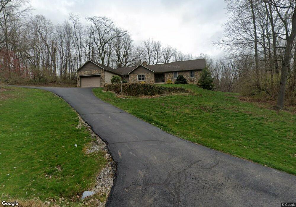
2926 Locust Dr Springfield, OH 45504
Cedar Hills/Broadview NeighborhoodEstimated Value: $368,000 - $480,840
4
Beds
3
Baths
2,740
Sq Ft
$163/Sq Ft
Est. Value
About This Home
This home is located at 2926 Locust Dr, Springfield, OH 45504 and is currently estimated at $445,960, approximately $162 per square foot. 2926 Locust Dr is a home located in Clark County with nearby schools including Possum Elementary School, Shawnee Middle School/High School, and Springfield Christian School.
Ownership History
Date
Name
Owned For
Owner Type
Purchase Details
Closed on
Oct 4, 2013
Sold by
Detrick Daniel H and Detrick Christy D
Bought by
Detrick Karen and Karen Detrick Revocable Trust
Current Estimated Value
Home Financials for this Owner
Home Financials are based on the most recent Mortgage that was taken out on this home.
Original Mortgage
$166,400
Outstanding Balance
$123,926
Interest Rate
4.58%
Mortgage Type
New Conventional
Estimated Equity
$322,034
Purchase Details
Closed on
Oct 20, 2000
Sold by
Lagos Thomas H and Lagos Matina K
Bought by
Detrick Daniel H and Detrick Christy D
Home Financials for this Owner
Home Financials are based on the most recent Mortgage that was taken out on this home.
Original Mortgage
$248,000
Interest Rate
7.96%
Create a Home Valuation Report for This Property
The Home Valuation Report is an in-depth analysis detailing your home's value as well as a comparison with similar homes in the area
Home Values in the Area
Average Home Value in this Area
Purchase History
| Date | Buyer | Sale Price | Title Company |
|---|---|---|---|
| Detrick Karen | $208,100 | Attorney | |
| Detrick Daniel H | $58,700 | -- |
Source: Public Records
Mortgage History
| Date | Status | Borrower | Loan Amount |
|---|---|---|---|
| Open | Detrick Karen | $166,400 | |
| Previous Owner | Detrick Daniel H | $248,000 |
Source: Public Records
Tax History
| Year | Tax Paid | Tax Assessment Tax Assessment Total Assessment is a certain percentage of the fair market value that is determined by local assessors to be the total taxable value of land and additions on the property. | Land | Improvement |
|---|---|---|---|---|
| 2025 | $6,437 | $175,660 | $37,380 | $138,280 |
| 2024 | $6,270 | $128,180 | $19,760 | $108,420 |
| 2023 | $6,270 | $128,180 | $19,760 | $108,420 |
| 2022 | $6,219 | $128,180 | $19,760 | $108,420 |
| 2021 | $5,145 | $94,960 | $16,070 | $78,890 |
| 2020 | $5,187 | $94,960 | $16,070 | $78,890 |
| 2019 | $5,269 | $94,960 | $16,070 | $78,890 |
| 2018 | $5,097 | $90,610 | $16,710 | $73,900 |
| 2017 | $5,224 | $93,870 | $16,709 | $77,161 |
| 2016 | $4,713 | $93,870 | $16,709 | $77,161 |
| 2015 | $4,554 | $93,226 | $16,065 | $77,161 |
| 2014 | $4,566 | $93,226 | $16,065 | $77,161 |
| 2013 | $1,984 | $93,226 | $16,065 | $77,161 |
Source: Public Records
Map
Nearby Homes
- 624 Aberfelda Dr
- 361 Upper Valley Pike
- 2743 Ironwood Dr
- 190 Oakridge Dr
- 917 White Oak Dr
- 925 Upper Valley Pike
- 0 Upper Valley Pike
- 124 Old Mill Rd
- 3891 New Carlisle Pike
- 419 Candace Dr
- 106 Walter St
- 110 Walter St
- 1915 W Washington St
- 1828 W Washington St
- 1715 W North St
- 22 Seever St
- 40 Zischler St
- 202 Seever St
- 4461 New Carlisle Pike
- 1420 Parker Ct
- 2922 Locust Dr
- 506 Shrine Rd
- 2930 Locust Dr
- 501 Basswood Dr
- 2909 Locust Dr
- 519 Basswood Dr
- 2879 Locust Dr
- 527 Basswood Dr
- 450 Shrine Rd
- 3829 Shrine Rd
- 600 White Oak Dr
- 496 Shrine Rd
- 537 Basswood Dr
- 2870 Locust Dr
- 436 Shrine Rd
- 2865 Locust Dr
- 607 Basswood Dr
- 426 Shrine Rd
- 514 Basswood Dr
- 601 White Oak Dr