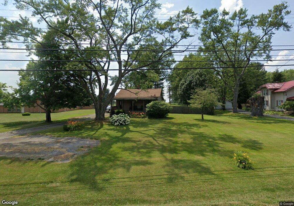
2932 S Canfield Niles Rd Youngstown, OH 44515
Austintown NeighborhoodEstimated Value: $107,442 - $128,000
2
Beds
1
Bath
872
Sq Ft
$136/Sq Ft
Est. Value
About This Home
This home is located at 2932 S Canfield Niles Rd, Youngstown, OH 44515 and is currently estimated at $118,361, approximately $135 per square foot. 2932 S Canfield Niles Rd is a home located in Mahoning County with nearby schools including Austintown Elementary School, Austintown Intermediate School, and Austintown Middle School.
Ownership History
Date
Name
Owned For
Owner Type
Purchase Details
Closed on
Jun 20, 2013
Sold by
Evans John D
Bought by
Federal Home Loan Mortgage Corporation
Current Estimated Value
Purchase Details
Closed on
Oct 2, 2001
Sold by
Development Secretary Of Housing & Urban
Bought by
Wem Darryl R
Home Financials for this Owner
Home Financials are based on the most recent Mortgage that was taken out on this home.
Original Mortgage
$45,800
Interest Rate
6.72%
Purchase Details
Closed on
Apr 26, 2001
Sold by
Cooper Charles T
Bought by
Hud
Purchase Details
Closed on
Feb 6, 2001
Sold by
Cooper Charles T
Bought by
Hud
Purchase Details
Closed on
Jul 29, 1993
Bought by
Cooper Chas T and Cooper Heidi
Create a Home Valuation Report for This Property
The Home Valuation Report is an in-depth analysis detailing your home's value as well as a comparison with similar homes in the area
Home Values in the Area
Average Home Value in this Area
Purchase History
| Date | Buyer | Sale Price | Title Company |
|---|---|---|---|
| Federal Home Loan Mortgage Corporation | $64,000 | None Available | |
| Wem Darryl R | $43,100 | Gateway Title Agency Inc | |
| Hud | $48,000 | -- | |
| Hud | $48,000 | -- | |
| Cooper Chas T | $47,000 | -- |
Source: Public Records
Mortgage History
| Date | Status | Borrower | Loan Amount |
|---|---|---|---|
| Previous Owner | Wem Darryl R | $45,800 |
Source: Public Records
Tax History Compared to Growth
Tax History
| Year | Tax Paid | Tax Assessment Tax Assessment Total Assessment is a certain percentage of the fair market value that is determined by local assessors to be the total taxable value of land and additions on the property. | Land | Improvement |
|---|---|---|---|---|
| 2024 | $1,100 | $23,440 | $8,720 | $14,720 |
| 2023 | $1,083 | $23,440 | $8,720 | $14,720 |
| 2022 | $1,079 | $18,710 | $8,720 | $9,990 |
| 2021 | $1,080 | $18,710 | $8,720 | $9,990 |
| 2020 | $1,084 | $18,710 | $8,720 | $9,990 |
| 2019 | $1,191 | $18,710 | $8,720 | $9,990 |
| 2018 | $1,148 | $18,710 | $8,720 | $9,990 |
| 2017 | $1,102 | $18,710 | $8,720 | $9,990 |
| 2016 | $1,059 | $17,120 | $6,830 | $10,290 |
| 2015 | $1,027 | $17,120 | $6,830 | $10,290 |
| 2014 | $1,032 | $17,120 | $6,830 | $10,290 |
| 2013 | $1,022 | $17,120 | $6,830 | $10,290 |
Source: Public Records
Map
Nearby Homes
- 2792 S Canfield Niles Rd
- 3270 S Canfield Niles Rd
- 5285 Kirk Rd
- 2211 Penny Ln
- 3475 42nd St
- 3481 Forty Second St
- 5678 Cider Mill Crossing
- 4674 Barrington Dr
- 5256 S Saratoga Ave
- 1707 Westhampton Dr
- 4689 Crabwood Dr
- 5179 Willow Crest Ave
- 701 Oberlin Place
- 2493 Frostwood Dr
- 4815 New Rd
- 3695 High Meadow Dr
- 2414 Ardenwood Place
- 6488 S Timberidge Dr
- 4651 Warwick Dr S
- 4643 Warwick Dr S
- 2908 S Canfield Niles Rd
- 2916 S Canfield Niles Rd
- 2900 S Canfield Niles Rd
- 2911 S Canfield Niles Rd
- 2890 S Canfield Niles Rd
- 2888 S Canfield Niles Rd
- 5560 Kirk Rd
- 3052 S Canfield Niles Rd
- 2831 S Canfield Niles Rd
- 2791 S Canfield Niles Rd
- 5450 Kirk Rd
- 5580 Kirk Rd
- 2739 S Canfield Niles Rd
- 2762 S Canfield Niles Rd
- 2732 S Canfield Niles Rd
- 5436 Kirk Rd
- 2722 S Canfield Niles Rd
- 5555 Kirk Rd
- 2723 S Canfield Niles Rd
- 5551 Kirk Rd