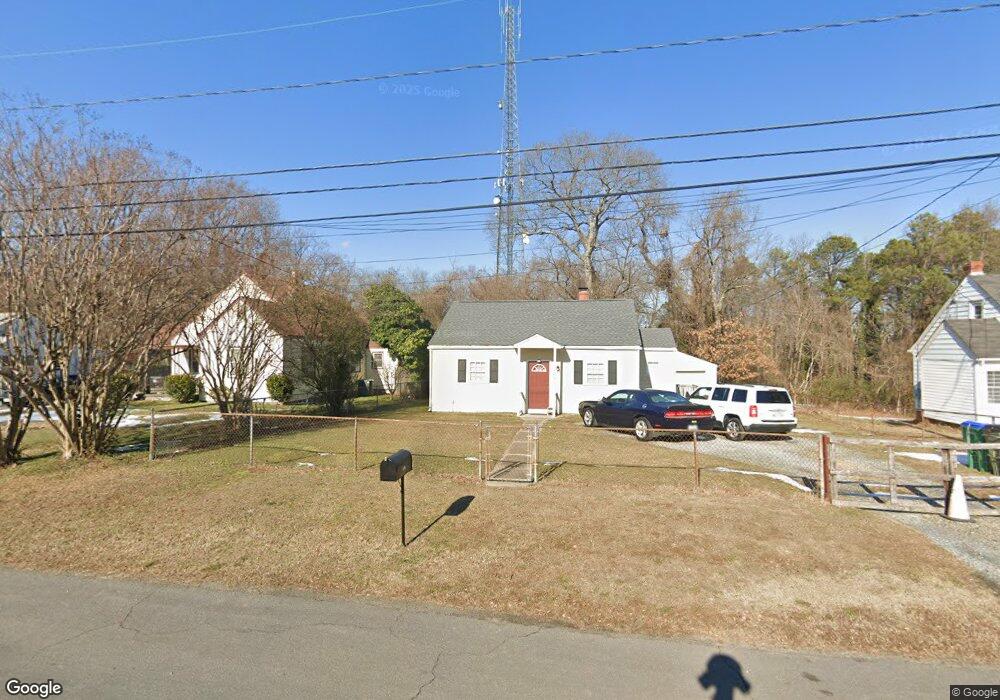
2936 Laurelbrook Dr Richmond, VA 23224
Cofer NeighborhoodEstimated Value: $184,000 - $219,000
3
Beds
2
Baths
732
Sq Ft
$277/Sq Ft
Est. Value
About This Home
This home is located at 2936 Laurelbrook Dr, Richmond, VA 23224 and is currently estimated at $202,700, approximately $276 per square foot. 2936 Laurelbrook Dr is a home located in Richmond City with nearby schools including Cardinal Elementary School, Richmond High School for the Arts, and Open High School.
Ownership History
Date
Name
Owned For
Owner Type
Purchase Details
Closed on
Jun 15, 2017
Sold by
Laurelbrook Drive Series A Series Of D &
Bought by
Mcauliffe William
Current Estimated Value
Purchase Details
Closed on
Apr 20, 2007
Sold by
Perry D Sam
Bought by
Stockner Gary
Purchase Details
Closed on
Apr 4, 2007
Sold by
T N T Prosperous Real Est
Bought by
Perry D Sam
Purchase Details
Closed on
Aug 10, 1998
Sold by
Hogan Glenn
Bought by
Colby Edward W
Home Financials for this Owner
Home Financials are based on the most recent Mortgage that was taken out on this home.
Original Mortgage
$51,840
Interest Rate
6.92%
Mortgage Type
FHA
Purchase Details
Closed on
Sep 2, 1997
Bought by
Hogan
Home Financials for this Owner
Home Financials are based on the most recent Mortgage that was taken out on this home.
Original Mortgage
$24,000
Interest Rate
7.41%
Mortgage Type
New Conventional
Purchase Details
Closed on
Jan 16, 1997
Sold by
Lunsford Earl G and Lunsford Marilyn K
Bought by
Secretary Of Hud
Create a Home Valuation Report for This Property
The Home Valuation Report is an in-depth analysis detailing your home's value as well as a comparison with similar homes in the area
Home Values in the Area
Average Home Value in this Area
Purchase History
| Date | Buyer | Sale Price | Title Company |
|---|---|---|---|
| Mcauliffe William | $130,000 | Attorney | |
| Stockner Gary | $82,000 | -- | |
| Perry D Sam | $62,000 | -- | |
| Colby Edward W | $52,000 | -- | |
| Hogan | -- | -- | |
| Secretary Of Hud | $15,500 | -- |
Source: Public Records
Mortgage History
| Date | Status | Borrower | Loan Amount |
|---|---|---|---|
| Previous Owner | Secretary Of Hud | $51,840 | |
| Previous Owner | Secretary Of Hud | $24,000 |
Source: Public Records
Tax History Compared to Growth
Tax History
| Year | Tax Paid | Tax Assessment Tax Assessment Total Assessment is a certain percentage of the fair market value that is determined by local assessors to be the total taxable value of land and additions on the property. | Land | Improvement |
|---|---|---|---|---|
| 2025 | $2,076 | $173,000 | $54,000 | $119,000 |
| 2024 | $1,944 | $162,000 | $40,000 | $122,000 |
| 2023 | $1,920 | $160,000 | $40,000 | $120,000 |
| 2022 | $1,704 | $142,000 | $40,000 | $102,000 |
| 2021 | $1,296 | $111,000 | $25,000 | $86,000 |
| 2020 | $1,296 | $108,000 | $25,000 | $83,000 |
| 2019 | $1,210 | $101,000 | $25,000 | $76,000 |
| 2018 | $948 | $79,000 | $15,000 | $64,000 |
| 2017 | $948 | $79,000 | $15,000 | $64,000 |
| 2016 | $948 | $79,000 | $15,000 | $64,000 |
| 2015 | $948 | $79,000 | $15,000 | $64,000 |
| 2014 | $948 | $79,000 | $15,000 | $64,000 |
Source: Public Records
Map
Nearby Homes
- 1517 Bangle Dr
- 3112 Lost Ln
- 1655 Hopkins Rd
- 1503 Columbia St
- 3057 Maury St
- 3107 Logandale Ave
- 2413 Ingram Ave
- 2404 Halifax Ave
- 2315 Joplin Ave
- 1322 Lynhaven Ave
- 2318 Gordon Ave
- 1425 Overlook St
- 3307 Stockton St
- 3208 Decatur St
- 2307 Wright Ave
- 2303 Fairfax Ave
- 3928 E Broad Rock Rd
- 3061 Decatur St
- 2303 Warwick Ave
- 3415 Decatur St
- 2940 Laurelbrook Dr
- 2932 Laurelbrook Dr
- 3000 Laurelbrook Dr
- 3004 Laurelbrook Dr
- 1401 Bangle Dr
- 1400 Bangle Dr
- 3010 Laurelbrook Dr
- 1409 Bangle Dr
- 3007 Laurelbrook Dr
- 1408 Bangle Dr
- 3011 Laurelbrook Dr
- 1413 Bangle Dr
- 3015 Laurelbrook Dr
- 1416 Bangle Dr
- 3016 Laurelbrook Dr
- 1501 Bangle Dr
- 3012 Hiden Rd
- 3019 Laurelbrook Dr
- 2800 Laurelbrook Dr
- 1503 Bangle Dr