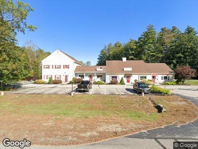
294 State Route 101 Amherst, NH 03031
Estimated Value: $287,653
--
Bed
--
Bath
1,396
Sq Ft
$206/Sq Ft
Est. Value
About This Home
This home is located at 294 State Route 101, Amherst, NH 03031 and is currently estimated at $287,653, approximately $206 per square foot. 294 State Route 101 is a home located in Hillsborough County with nearby schools including Wilkins Elementary School, Amherst Middle School, and Souhegan Cooperative High School.
Ownership History
Date
Name
Owned For
Owner Type
Purchase Details
Closed on
Aug 11, 2000
Sold by
Fifty Franklin St Lp
Bought by
Ackerson Peter T
Current Estimated Value
Home Financials for this Owner
Home Financials are based on the most recent Mortgage that was taken out on this home.
Original Mortgage
$80,000
Outstanding Balance
$30,948
Interest Rate
8.21%
Mortgage Type
Commercial
Estimated Equity
$256,705
Create a Home Valuation Report for This Property
The Home Valuation Report is an in-depth analysis detailing your home's value as well as a comparison with similar homes in the area
Home Values in the Area
Average Home Value in this Area
Purchase History
| Date | Buyer | Sale Price | Title Company |
|---|---|---|---|
| Ackerson Peter T | $83,200 | -- | |
| Ackerson Peter T | $83,200 | -- |
Source: Public Records
Mortgage History
| Date | Status | Borrower | Loan Amount |
|---|---|---|---|
| Open | Ackerson Peter T | $80,000 | |
| Closed | Ackerson Peter T | $80,000 |
Source: Public Records
Tax History Compared to Growth
Tax History
| Year | Tax Paid | Tax Assessment Tax Assessment Total Assessment is a certain percentage of the fair market value that is determined by local assessors to be the total taxable value of land and additions on the property. | Land | Improvement |
|---|---|---|---|---|
| 2024 | $1,850 | $80,700 | $0 | $80,700 |
| 2023 | $1,766 | $80,700 | $0 | $80,700 |
| 2022 | $1,705 | $80,700 | $0 | $80,700 |
| 2021 | $1,720 | $80,700 | $0 | $80,700 |
| 2020 | $2,028 | $71,200 | $0 | $71,200 |
| 2019 | $1,920 | $71,200 | $0 | $71,200 |
| 2018 | $1,939 | $71,200 | $0 | $71,200 |
| 2017 | $1,852 | $71,200 | $0 | $71,200 |
| 2016 | $1,787 | $71,200 | $0 | $71,200 |
| 2015 | $2,031 | $76,700 | $0 | $76,700 |
| 2014 | $2,045 | $76,700 | $0 | $76,700 |
| 2013 | -- | $76,700 | $0 | $76,700 |
Source: Public Records
Map
Nearby Homes
- 12 Nathaniel Dr
- 13 Holly Hill Dr
- 20 Holly Hill Dr
- 28 Old Manchester Rd
- 10 Greenbriar Ln
- 59 Horace Greeley Rd Unit 10-56-04
- 11 Clark Island Rd
- 70 Broadway
- 4 Norton St
- 13 Milford St
- 19 Pinnacle Rd
- 24 Longa Rd
- 4 Odell Dr
- 54-A Parkhurst Rd
- 76 Joppa Hill Rd
- 94 MacK Hill Rd Unit Lot - 7-40-0
- 94 MacK Hill Rd
- 103 MacK Hill Rd
- 11 Shadow Ln
- 25 Fells Dr
- 294 State Route 101
- 294 State Route 101 Unit 5
- 294 New Hampshire 101 Unit 4
- 294 New Hampshire 101
- 300 State Route 101
- 292 State Route 101
- 2 Williamsburg Dr
- 59 Old Manchester Rd
- 64 Old Manchester Rd
- 1 Williamsburg Dr
- 292 New Hampshire 101
- 4 Williamsburg Dr
- 57 Old Manchester Rd
- 302 State Route 101
- 3 Williamsburg Dr
- 4 Schoolhouse Rd
- 304 State Route 101
- 4 Madison Ln
- 55 Old Manchester Rd
- 3 Madison Ln