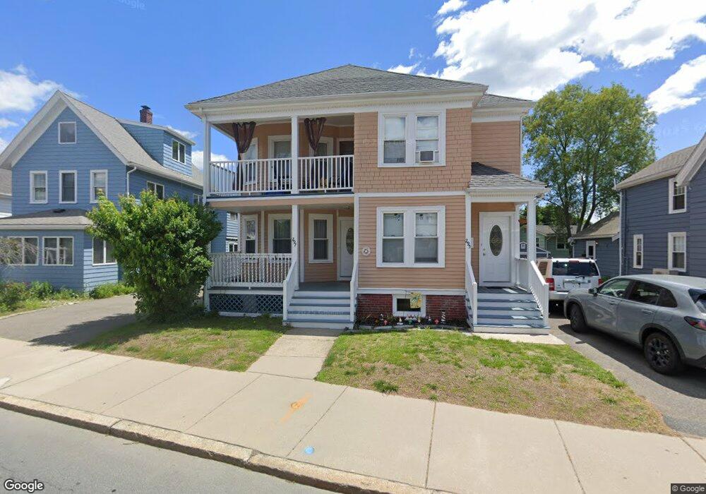
295 Winthrop St Unit 297 Winthrop, MA 02152
Downtown Winthrop NeighborhoodEstimated Value: $677,000 - $854,000
6
Beds
2
Baths
2,358
Sq Ft
$328/Sq Ft
Est. Value
About This Home
This home is located at 295 Winthrop St Unit 297, Winthrop, MA 02152 and is currently estimated at $773,444, approximately $328 per square foot. 295 Winthrop St Unit 297 is a home located in Suffolk County with nearby schools including William P. Gorman/Fort Banks Elementary School, Arthur T. Cummings Elementary School, and Winthrop Middle School.
Ownership History
Date
Name
Owned For
Owner Type
Purchase Details
Closed on
Sep 12, 2012
Sold by
Montgomery Diane F and Veno Jean T
Bought by
Connolly Christopher D
Current Estimated Value
Home Financials for this Owner
Home Financials are based on the most recent Mortgage that was taken out on this home.
Original Mortgage
$257,045
Outstanding Balance
$179,367
Interest Rate
3.75%
Mortgage Type
FHA
Estimated Equity
$594,077
Create a Home Valuation Report for This Property
The Home Valuation Report is an in-depth analysis detailing your home's value as well as a comparison with similar homes in the area
Home Values in the Area
Average Home Value in this Area
Purchase History
| Date | Buyer | Sale Price | Title Company |
|---|---|---|---|
| Connolly Christopher D | $275,500 | -- |
Source: Public Records
Mortgage History
| Date | Status | Borrower | Loan Amount |
|---|---|---|---|
| Open | Connolly Christopher D | $257,045 |
Source: Public Records
Tax History Compared to Growth
Tax History
| Year | Tax Paid | Tax Assessment Tax Assessment Total Assessment is a certain percentage of the fair market value that is determined by local assessors to be the total taxable value of land and additions on the property. | Land | Improvement |
|---|---|---|---|---|
| 2025 | $7,043 | $682,500 | $328,900 | $353,600 |
| 2024 | $6,607 | $634,100 | $316,100 | $318,000 |
| 2023 | $6,851 | $640,300 | $289,400 | $350,900 |
| 2022 | $6,735 | $572,700 | $258,000 | $314,700 |
| 2021 | $6,581 | $519,000 | $230,400 | $288,600 |
| 2020 | $6,424 | $509,000 | $230,400 | $278,600 |
| 2019 | $6,311 | $478,800 | $212,300 | $266,500 |
| 2018 | $6,127 | $432,700 | $182,300 | $250,400 |
| 2017 | $5,636 | $391,100 | $164,800 | $226,300 |
| 2016 | $5,297 | $344,600 | $140,300 | $204,300 |
| 2015 | $4,709 | $328,400 | $136,200 | $192,200 |
| 2014 | $4,478 | $287,400 | $121,300 | $166,100 |
Source: Public Records
Map
Nearby Homes
- 87 Hermon St
- 9 Atlantic St Unit 2
- 34 Fremont St
- 174 Winthrop St Unit 2
- 426 Winthrop St
- 441 Winthrop St
- 9 Marshall St
- 50-52 Wilshire St
- 70 Edgehill Rd
- 10 Somerset Ave Unit 405
- 10 Somerset Ave Unit 403
- 10 Somerset Ave Unit 404
- 10 Somerset Ave Unit 408
- 10 Somerset Ave Unit 201
- 10 Somerset Ave Unit 211
- 10 Somerset Ave Unit 206
- 3 Buckthorn Terrace Unit 2
- 35 Somerset Ave Unit 6
- 800 Governors Dr Unit 6
- 1100 Governors Dr Unit 6
- 297 Winthrop St Unit 1
- 301 Winthrop St
- 305 Winthrop St
- 291 Winthrop St
- 292 Winthrop St
- 26 Oceanview Way
- 12 George St Unit 14
- 15 Oceanview Way
- 286 Winthrop St
- 54 Belcher St
- 57 Oceanview St
- 18 George St
- 25 Oceanview Way
- 320 Winthrop St
- 278 Winthrop St
- 278 Winthrop St Unit 2
- 22 George St
- 48 Belcher St Unit 50
- 325 Winthrop St
- 319 Winthrop St