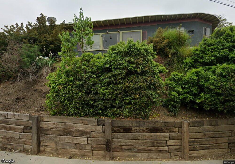
2951 Delor Dr Los Angeles, CA 90032
El Sereno NeighborhoodEstimated Value: $782,000 - $941,000
2
Beds
1
Bath
1,470
Sq Ft
$601/Sq Ft
Est. Value
About This Home
This home is located at 2951 Delor Dr, Los Angeles, CA 90032 and is currently estimated at $883,661, approximately $601 per square foot. 2951 Delor Dr is a home located in Los Angeles County with nearby schools including Sierra Park Elementary, El Sereno Middle School, and Woodrow Wilson Senior High.
Ownership History
Date
Name
Owned For
Owner Type
Purchase Details
Closed on
Jun 13, 2019
Sold by
Martinez Cynthia M
Bought by
Martinez Cynthia M and Cynthia Marie Martinez Living
Current Estimated Value
Purchase Details
Closed on
Feb 3, 1995
Sold by
Miller Louise M and Elizabeth M Scott Living Trust
Bought by
Martinez Cynthia M
Home Financials for this Owner
Home Financials are based on the most recent Mortgage that was taken out on this home.
Original Mortgage
$134,000
Interest Rate
9.27%
Create a Home Valuation Report for This Property
The Home Valuation Report is an in-depth analysis detailing your home's value as well as a comparison with similar homes in the area
Home Values in the Area
Average Home Value in this Area
Purchase History
| Date | Buyer | Sale Price | Title Company |
|---|---|---|---|
| Martinez Cynthia M | -- | None Available | |
| Martinez Cynthia M | $147,000 | North American Title Company |
Source: Public Records
Mortgage History
| Date | Status | Borrower | Loan Amount |
|---|---|---|---|
| Closed | Martinez Cynthia M | $134,000 |
Source: Public Records
Tax History Compared to Growth
Tax History
| Year | Tax Paid | Tax Assessment Tax Assessment Total Assessment is a certain percentage of the fair market value that is determined by local assessors to be the total taxable value of land and additions on the property. | Land | Improvement |
|---|---|---|---|---|
| 2025 | $3,355 | $246,888 | $181,225 | $65,663 |
| 2024 | $3,355 | $242,048 | $177,672 | $64,376 |
| 2023 | $3,297 | $237,303 | $174,189 | $63,114 |
| 2022 | $3,159 | $232,651 | $170,774 | $61,877 |
| 2021 | $3,116 | $228,090 | $167,426 | $60,664 |
| 2019 | $3,032 | $221,326 | $162,461 | $58,865 |
| 2018 | $2,864 | $216,987 | $159,276 | $57,711 |
| 2016 | $2,729 | $208,563 | $153,092 | $55,471 |
| 2015 | $2,692 | $205,431 | $150,793 | $54,638 |
| 2014 | $2,709 | $201,408 | $147,840 | $53,568 |
Source: Public Records
Map
Nearby Homes
- 5059 Lynnfield St
- 2871 Budau Ave Unit 2
- 2661 N Adkins Ave
- 3100 Pueblo Ave
- 4962 Gambier St
- 4951 Lynnfield St
- 2717 Chadwick Cir
- 3204 Pueblo Ave
- 5274 Ithaca Ave
- 5158 Templeton St
- 4926 Templeton St
- 3216 Warwick Ave
- 2912 Covina St
- 3323 Linda Vista Terrace
- 2706 Budau Ave
- 3202 Farnsworth Ave
- 2815 N Round
- 2721 N Onyxdr
- 4414 Rose Hill W
- 5017 Ithaca Ave
- 0 Round Dr
- 0 Round Dr Unit MB20189985
- 0 Round Dr Unit 8-309587
- 0 Round Dr Unit MB15180022
- 0 Round Dr Unit 11-536517
- 2930 Adkins Ave
- 2931 Delor Dr
- 2942 Delor Dr
- 2952 Delor Dr
- 0 Delor Unit WS14071643
- 2932 Delor Dr
- 2937 Haven St
- 2922 Adkins Ave
- 2925 Haven St
- 2937 Adkins Ave
- 2931 Adkins Ave
- 2926 Delor Dr
- 2941 Haven St
- 2929 Haven St
- 2943 Adkins Ave