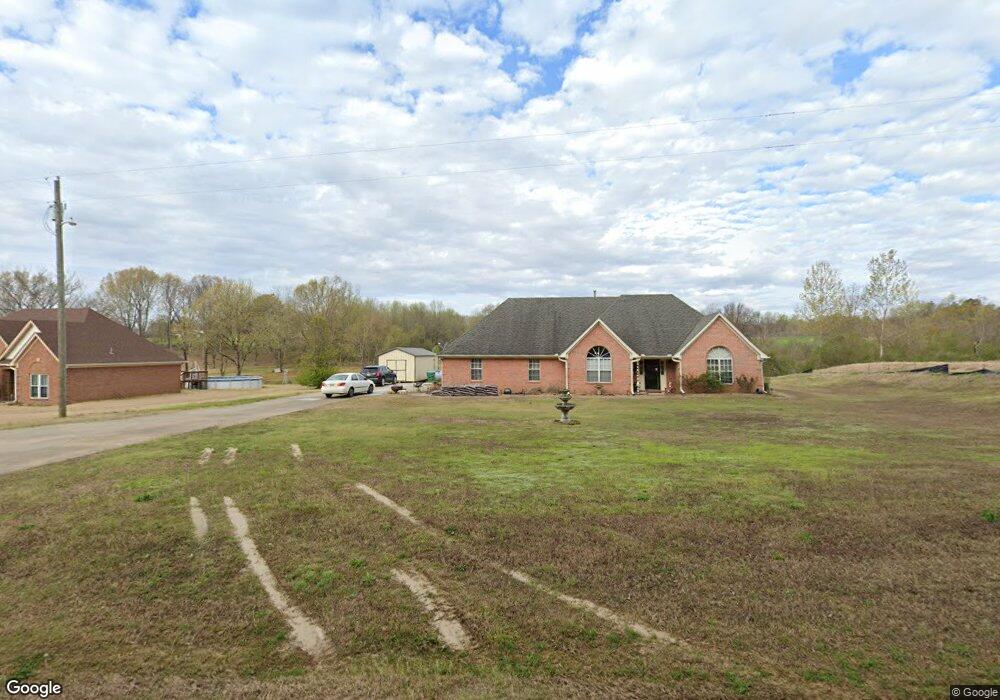
2963 Highway 301 S Hernando, MS 38632
Lake Cormorant NeighborhoodEstimated Value: $261,000 - $292,000
3
Beds
--
Bath
2,037
Sq Ft
$135/Sq Ft
Est. Value
About This Home
This home is located at 2963 Highway 301 S, Hernando, MS 38632 and is currently estimated at $274,784, approximately $134 per square foot. 2963 Highway 301 S is a home located in DeSoto County with nearby schools including Lake Cormorant Elementary School, Horn Lake Intermediate School, and Horn Lake Middle School.
Ownership History
Date
Name
Owned For
Owner Type
Purchase Details
Closed on
Jan 31, 2013
Sold by
Secretary Of Hud
Bought by
Burns Landon H
Current Estimated Value
Home Financials for this Owner
Home Financials are based on the most recent Mortgage that was taken out on this home.
Original Mortgage
$82,500
Interest Rate
3.38%
Mortgage Type
Future Advance Clause Open End Mortgage
Purchase Details
Closed on
Aug 9, 2012
Sold by
Liberato Edwin and Liberato Brenda Y
Bought by
Wells Fargo Bank Na
Create a Home Valuation Report for This Property
The Home Valuation Report is an in-depth analysis detailing your home's value as well as a comparison with similar homes in the area
Home Values in the Area
Average Home Value in this Area
Purchase History
| Date | Buyer | Sale Price | Title Company |
|---|---|---|---|
| Burns Landon H | -- | None Available | |
| Wells Fargo Bank Na | $171,698 | None Available |
Source: Public Records
Mortgage History
| Date | Status | Borrower | Loan Amount |
|---|---|---|---|
| Closed | Burns Landon H | $82,500 |
Source: Public Records
Tax History Compared to Growth
Tax History
| Year | Tax Paid | Tax Assessment Tax Assessment Total Assessment is a certain percentage of the fair market value that is determined by local assessors to be the total taxable value of land and additions on the property. | Land | Improvement |
|---|---|---|---|---|
| 2024 | $1,244 | $12,321 | $1,570 | $10,751 |
| 2023 | $1,244 | $12,259 | $0 | $0 |
| 2022 | $1,238 | $12,259 | $1,570 | $10,689 |
| 2021 | $1,238 | $12,259 | $1,570 | $10,689 |
| 2020 | $1,151 | $11,403 | $0 | $0 |
| 2019 | $1,151 | $11,403 | $1,570 | $9,833 |
| 2017 | $1,105 | $20,156 | $10,863 | $9,293 |
| 2016 | $1,105 | $10,863 | $1,570 | $9,293 |
| 2015 | $1,105 | $20,156 | $10,863 | $9,293 |
| 2014 | $1,105 | $10,863 | $0 | $0 |
| 2013 | $888 | $10,863 | $0 | $0 |
Source: Public Records
Map
Nearby Homes
- 2297 Mississippi 301
- 2373 Mississippi 301
- 2234 Mississippi 301
- 3740 Mississippi 301
- 3815 Mississippi 301
- 10117 Emerald Forest Dr
- 9 Baldwin Rd
- 2670 Emerald Way Dr
- 9640 Barbee Rd
- 10437 Emerald Cove
- 10680 High Rd
- 10825 Ben Vorlich's Head
- 1996 Tanyard Rd
- 4577 Bluff Rd
- 3336 Monans Rill Cove
- 3222 High Rd
- 3310 Monans Rill Cove
- 1915 Mattaha Dr
- 3670 Glen Artney Cove
- 11048 Horseshoe Bend
- 2997 Highway 301 S
- 2952 Highway Unit 301
- 2297 Highway 301 S
- 2952 Highway 301 S Unit 301
- 2952 Highway 301 S
- 2997 S Hwy Unit 301
- 2997 Highway Unit 301
- 2880 Highway 301 S
- 8900 W Oak Grove Rd
- 2510 Highway 301 S
- 2500 Highway 301 S
- 8864 W Oak Grove Rd
- 8845 W Oak Grove Rd
- 3071 Highway 301 S
- 2710 Highway Unit 301
- 5 Highland Meadows Minor Lot
- 2301 Highway 301 S
- 8890 W Oak Grove Rd
- 2404 Highway 301 S
- 2394 Highway 301 S