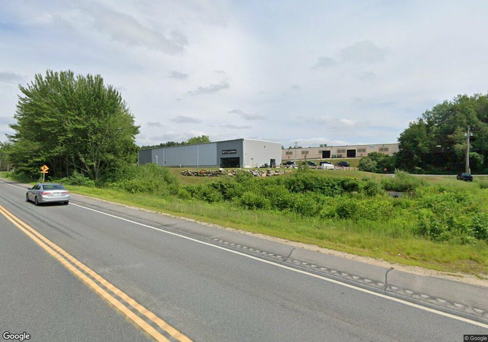
297 Central St Hudson, NH 03051
--
Bed
--
Bath
7,500
Sq Ft
1.43
Acres
About This Home
This home is located at 297 Central St, Hudson, NH 03051. 297 Central St is a home located in Hillsborough County.
Ownership History
Date
Name
Owned For
Owner Type
Purchase Details
Closed on
May 16, 2005
Sold by
Jmoore Props Llc
Bought by
Ortiz Jorge L
Home Financials for this Owner
Home Financials are based on the most recent Mortgage that was taken out on this home.
Original Mortgage
$334,000
Outstanding Balance
$176,493
Interest Rate
6.05%
Mortgage Type
Commercial
Purchase Details
Closed on
Sep 12, 2001
Sold by
Clark Theodore H
Bought by
Jmoore Props Llc
Home Financials for this Owner
Home Financials are based on the most recent Mortgage that was taken out on this home.
Original Mortgage
$150,000
Interest Rate
6.99%
Mortgage Type
Purchase Money Mortgage
Create a Home Valuation Report for This Property
The Home Valuation Report is an in-depth analysis detailing your home's value as well as a comparison with similar homes in the area
Home Values in the Area
Average Home Value in this Area
Purchase History
| Date | Buyer | Sale Price | Title Company |
|---|---|---|---|
| Ortiz Jorge L | $334,000 | -- | |
| Jmoore Props Llc | $169,900 | -- |
Source: Public Records
Mortgage History
| Date | Status | Borrower | Loan Amount |
|---|---|---|---|
| Open | Jmoore Props Llc | $334,000 | |
| Previous Owner | Jmoore Props Llc | $150,000 |
Source: Public Records
Tax History Compared to Growth
Tax History
| Year | Tax Paid | Tax Assessment Tax Assessment Total Assessment is a certain percentage of the fair market value that is determined by local assessors to be the total taxable value of land and additions on the property. | Land | Improvement |
|---|---|---|---|---|
| 2024 | $17,671 | $1,074,200 | $407,800 | $666,400 |
| 2023 | $16,843 | $1,074,200 | $407,800 | $666,400 |
| 2022 | $14,176 | $965,000 | $407,800 | $557,200 |
| 2021 | $5,779 | $266,700 | $266,700 | $0 |
| 2020 | $5,699 | $266,700 | $266,700 | $0 |
| 2019 | $5,409 | $266,700 | $266,700 | $0 |
| 2018 | $5,361 | $266,700 | $266,700 | $0 |
| 2017 | $6,186 | $313,700 | $313,700 | $0 |
| 2016 | $6,266 | $285,200 | $285,200 | $0 |
| 2015 | $6,061 | $285,200 | $285,200 | $0 |
| 2014 | $5,941 | $285,200 | $285,200 | $0 |
| 2013 | $5,864 | $285,200 | $285,200 | $0 |
Source: Public Records
Map
Nearby Homes
- 31 Shadowbrook Dr
- 15 Intervale Ct
- 53 Kimball Hill Rd Unit A
- 53 Kimball Hill Rd
- 27 Windsor Ln Unit B
- 21 Windsor Ln Unit A
- 56 Terraceview Dr
- 4 Hilltop Dr
- 37 Dugout Rd Unit B
- 319 Fox Run Rd
- 22 Oliver Dr
- 74 Speare Rd
- 6 Lund Dr
- 5 Kestrel Ln
- 11 Teloian Dr
- 49 Cobblestone Dr
- 9 Sunshine Dr Unit A
- 8 Cheney Dr
- 11 Scottsdale Dr
- 152 Ferry St
- 59 Windham Rd
- 59 Windham Rd Unit D
- 59 Windham Rd Unit B
- 49 Windham Rd
- 51 Windham Rd Unit 51A
- 45 Windham Rd
- 45D Windham Rd
- 45 Windham Rd
- 45B Windham Rd
- 45A Windham Rd
- 49 Windham Rd
- 49C Windham Rd
- 49 Windham Rd
- 51 Windham Rd
- 51B Windham Rd
- 51 Windham Rd
- 49 Windham Rd Unit 49A
- 45A Windham Rd Unit 45D
- 49 Windham Rd Unit A
- 45 Windham Rd Unit D