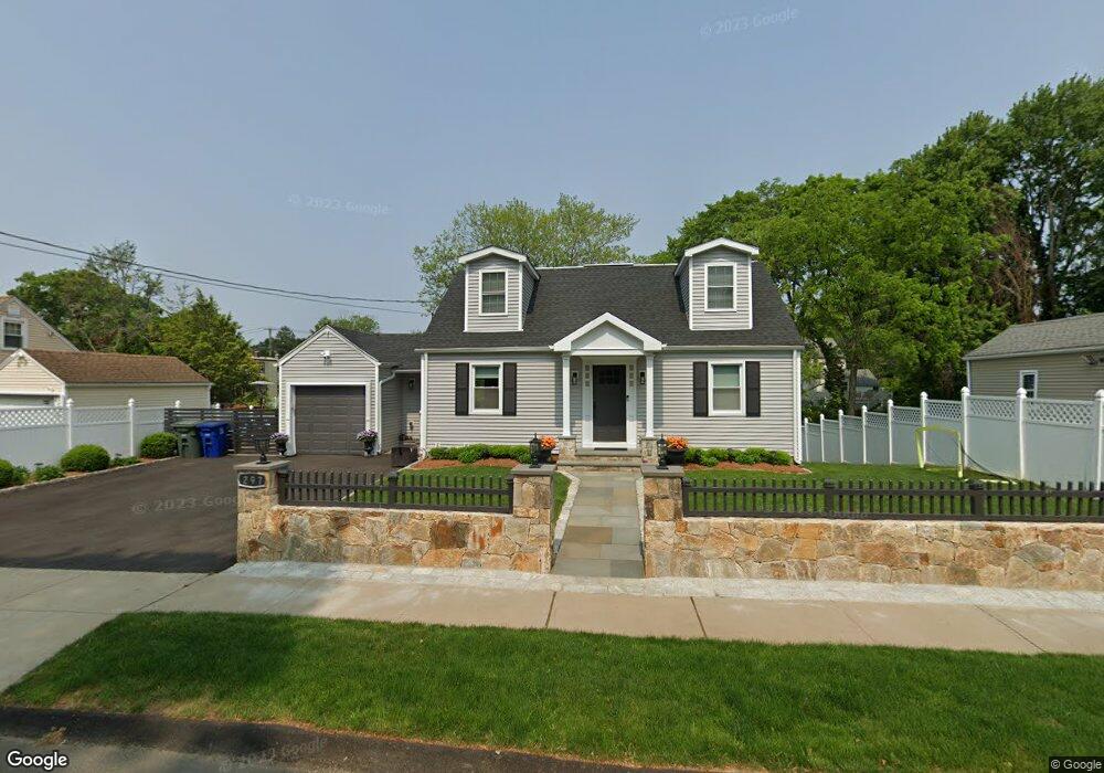
297 Hooker Rd Bridgeport, CT 06610
North Bridgeport NeighborhoodEstimated Value: $339,054 - $375,000
3
Beds
1
Bath
1,387
Sq Ft
$258/Sq Ft
Est. Value
About This Home
This home is located at 297 Hooker Rd, Bridgeport, CT 06610 and is currently estimated at $357,764, approximately $257 per square foot. 297 Hooker Rd is a home located in Fairfield County with nearby schools including Hooker School and Harding High School.
Ownership History
Date
Name
Owned For
Owner Type
Purchase Details
Closed on
Aug 30, 2005
Sold by
Costa Alberto and Costa Belmira
Bought by
Arevalo Edwin and Arevalo Jose
Current Estimated Value
Home Financials for this Owner
Home Financials are based on the most recent Mortgage that was taken out on this home.
Original Mortgage
$253,800
Interest Rate
6.47%
Create a Home Valuation Report for This Property
The Home Valuation Report is an in-depth analysis detailing your home's value as well as a comparison with similar homes in the area
Home Values in the Area
Average Home Value in this Area
Purchase History
| Date | Buyer | Sale Price | Title Company |
|---|---|---|---|
| Arevalo Edwin | $267,000 | -- | |
| Arevalo Edwin | $267,000 | -- |
Source: Public Records
Mortgage History
| Date | Status | Borrower | Loan Amount |
|---|---|---|---|
| Open | Arevalo Edwin | $260,300 | |
| Closed | Arevalo Edwin | $253,800 |
Source: Public Records
Tax History
| Year | Tax Paid | Tax Assessment Tax Assessment Total Assessment is a certain percentage of the fair market value that is determined by local assessors to be the total taxable value of land and additions on the property. | Land | Improvement |
|---|---|---|---|---|
| 2025 | $5,757 | $132,500 | $53,910 | $78,590 |
| 2024 | $5,757 | $132,500 | $53,910 | $78,590 |
| 2023 | $5,757 | $132,500 | $53,910 | $78,590 |
| 2022 | $5,757 | $132,500 | $53,910 | $78,590 |
| 2021 | $5,272 | $121,330 | $53,910 | $67,420 |
| 2020 | $5,501 | $101,890 | $44,250 | $57,640 |
| 2019 | $5,501 | $101,890 | $44,250 | $57,640 |
| 2018 | $5,540 | $101,890 | $44,250 | $57,640 |
| 2017 | $5,540 | $101,890 | $44,250 | $57,640 |
| 2016 | $5,540 | $101,890 | $44,250 | $57,640 |
| 2015 | $5,081 | $120,400 | $43,250 | $77,150 |
| 2014 | $5,081 | $120,400 | $43,250 | $77,150 |
Source: Public Records
Map
Nearby Homes
- 3699 Broadbridge Ave Unit 330
- 3699 Broadbridge Ave Unit 101
- 11 Knollcrest Dr
- 119 Jennings Ave
- 120 Huntington Turnpike Unit 202
- 285 Hillcrest Rd
- 250 Dayton Rd
- 132 Virginia Ave Unit 132
- 211 Louisiana Ave Unit D
- 186 Louisiana Ave Unit D
- 207 Hillcrest Rd
- 11 Nob Hill Cir
- 156 Dayton Rd
- 261 Pennsylvania Ave
- 154 Virginia Ave Unit B
- 33 Louisiana Ave Unit 35
- 74 Hollywood Ave
- 9 Sunnyridge Pkwy
- 60 Quail Trail
- 72 Broadmere Rd
- 315 Hooker Rd
- 283 Hooker Rd
- 310 Hooker Rd
- 810 Huntington Turnpike
- 329 Hooker Rd
- 800 Huntington Turnpike
- 39 E Pasadena Place
- 294 Hooker Rd
- 280 Hooker Rd
- 322 Hooker Rd
- 844 Huntington Turnpike
- 820 Huntington Turnpike
- 15 E Pasadena Place
- 339 Hooker Rd
- 75 E Pasadena Place
- 338 Hooker Rd
- 860 Huntington Turnpike
- 355 Hooker Rd
- 799 Huntington Turnpike
- 350 Hooker Rd
Your Personal Tour Guide
Ask me questions while you tour the home.