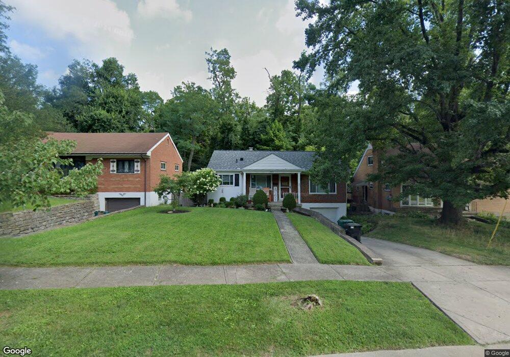
2972 Hull Ave Cincinnati, OH 45211
Westwood NeighborhoodEstimated Value: $151,000 - $275,000
2
Beds
1
Bath
971
Sq Ft
$219/Sq Ft
Est. Value
About This Home
This home is located at 2972 Hull Ave, Cincinnati, OH 45211 and is currently estimated at $212,526, approximately $218 per square foot. 2972 Hull Ave is a home located in Hamilton County with nearby schools including Western Hills High School, Gilbert A. Dater High School, and Robert A. Taft Information Technology High School.
Ownership History
Date
Name
Owned For
Owner Type
Purchase Details
Closed on
May 16, 2003
Sold by
Katherine Schmidt Mary and Katherine James A
Bought by
Degroff Jennifer L
Current Estimated Value
Home Financials for this Owner
Home Financials are based on the most recent Mortgage that was taken out on this home.
Original Mortgage
$92,400
Outstanding Balance
$39,781
Interest Rate
5.9%
Mortgage Type
Unknown
Estimated Equity
$172,745
Purchase Details
Closed on
Sep 9, 1998
Sold by
Schrand Joe G and Schrand Cynthia L
Bought by
Schmidt Mary Katherine
Create a Home Valuation Report for This Property
The Home Valuation Report is an in-depth analysis detailing your home's value as well as a comparison with similar homes in the area
Home Values in the Area
Average Home Value in this Area
Purchase History
| Date | Buyer | Sale Price | Title Company |
|---|---|---|---|
| Degroff Jennifer L | $97,300 | -- | |
| Schmidt Mary Katherine | $74,000 | -- |
Source: Public Records
Mortgage History
| Date | Status | Borrower | Loan Amount |
|---|---|---|---|
| Open | Degroff Jennifer L | $92,400 |
Source: Public Records
Tax History Compared to Growth
Tax History
| Year | Tax Paid | Tax Assessment Tax Assessment Total Assessment is a certain percentage of the fair market value that is determined by local assessors to be the total taxable value of land and additions on the property. | Land | Improvement |
|---|---|---|---|---|
| 2025 | $2,812 | $45,501 | $6,906 | $38,595 |
| 2024 | $2,727 | $45,501 | $6,906 | $38,595 |
| 2023 | $2,788 | $45,501 | $6,906 | $38,595 |
| 2022 | $1,868 | $27,265 | $5,607 | $21,658 |
| 2021 | $1,795 | $27,265 | $5,607 | $21,658 |
| 2020 | $1,847 | $27,265 | $5,607 | $21,658 |
| 2019 | $1,835 | $24,784 | $5,096 | $19,688 |
| 2018 | $1,838 | $24,784 | $5,096 | $19,688 |
| 2017 | $1,746 | $24,784 | $5,096 | $19,688 |
| 2016 | $2,009 | $28,137 | $5,919 | $22,218 |
| 2015 | $1,811 | $28,137 | $5,919 | $22,218 |
| 2014 | $1,824 | $28,137 | $5,919 | $22,218 |
| 2013 | $1,932 | $29,310 | $6,164 | $23,146 |
Source: Public Records
Map
Nearby Homes
- 2945 Feltz Ave
- 2919 Temple Ave
- 2908 Montclair Ave
- 3850 Taft Ave
- 3869 Meyerfeld Ave
- 3311 Augusta Ave
- 2218 Harrison Ave
- 3309 Phoenix Ave
- 3418 Gamble Ave
- 3613 Everett Ave
- 3325 Camvic Terrace
- 3424 Craig Ave
- 2842 Montana Ave
- 2838 Montana Ave
- 2824 Montana Ave
- 3515 Mozart Ave
- 3226 Herbert Ave
- 3121 Mary Jane Dr
- 2903 Daytona Ave
- 2905 Daytona Ave