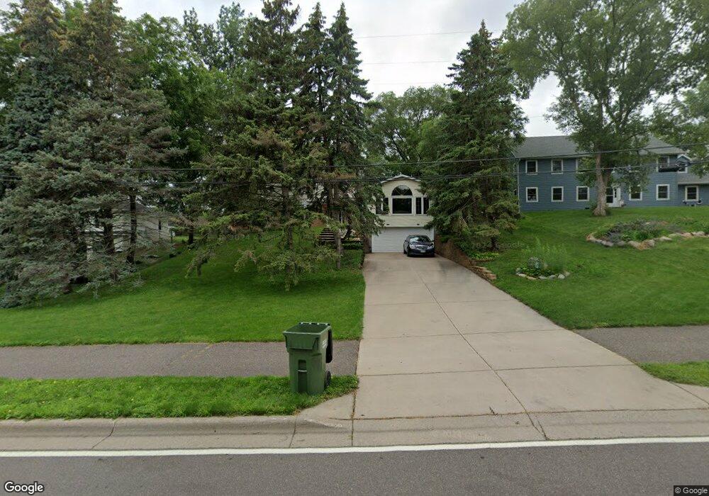
2975 W Owasso Blvd Saint Paul, MN 55113
Lake Owasso NeighborhoodEstimated Value: $431,915 - $509,000
4
Beds
2
Baths
2,500
Sq Ft
$190/Sq Ft
Est. Value
About This Home
This home is located at 2975 W Owasso Blvd, Saint Paul, MN 55113 and is currently estimated at $476,229, approximately $190 per square foot. 2975 W Owasso Blvd is a home located in Ramsey County with nearby schools including Emmet D. Williams Elementary School, Roseville Area Middle School, and Roseville Area Senior High School.
Ownership History
Date
Name
Owned For
Owner Type
Purchase Details
Closed on
Mar 24, 2016
Sold by
Jackson Tammy Jean and Jackson David W
Bought by
Jackson Tammy Jean and Jackson David W
Current Estimated Value
Purchase Details
Closed on
Oct 10, 2013
Sold by
Chehouri Tammy Jean
Bought by
Chehouri Tammy Jean and Jackson David W
Home Financials for this Owner
Home Financials are based on the most recent Mortgage that was taken out on this home.
Original Mortgage
$115,000
Outstanding Balance
$86,715
Interest Rate
4.59%
Mortgage Type
New Conventional
Estimated Equity
$389,514
Create a Home Valuation Report for This Property
The Home Valuation Report is an in-depth analysis detailing your home's value as well as a comparison with similar homes in the area
Home Values in the Area
Average Home Value in this Area
Purchase History
| Date | Buyer | Sale Price | Title Company |
|---|---|---|---|
| Jackson Tammy Jean | -- | None Available | |
| Chehouri Tammy Jean | $515 | Land Title Inc |
Source: Public Records
Mortgage History
| Date | Status | Borrower | Loan Amount |
|---|---|---|---|
| Open | Chehouri Tammy Jean | $115,000 |
Source: Public Records
Tax History Compared to Growth
Tax History
| Year | Tax Paid | Tax Assessment Tax Assessment Total Assessment is a certain percentage of the fair market value that is determined by local assessors to be the total taxable value of land and additions on the property. | Land | Improvement |
|---|---|---|---|---|
| 2025 | $5,432 | $396,100 | $100,000 | $296,100 |
| 2023 | $5,432 | $386,000 | $90,000 | $296,000 |
| 2022 | $4,514 | $351,200 | $90,000 | $261,200 |
| 2021 | $4,260 | $306,000 | $90,000 | $216,000 |
| 2020 | $4,772 | $308,600 | $80,000 | $228,600 |
| 2019 | $4,814 | $322,100 | $80,000 | $242,100 |
| 2018 | $4,808 | $316,300 | $90,300 | $226,000 |
| 2017 | $4,374 | $308,000 | $90,300 | $217,700 |
| 2016 | $4,294 | $0 | $0 | $0 |
| 2015 | $4,562 | $289,700 | $96,300 | $193,400 |
| 2014 | $3,868 | $0 | $0 | $0 |
Source: Public Records
Map
Nearby Homes
- 3071 Avon St N
- 2870 Victoria St N
- 2860 Victoria St N
- 613 S Owasso Blvd W
- 3163 Christopher Ln
- 932 Orchard Ln
- Ashby Plan at Victoria Shores
- 956 Orchard Ln
- 771 Terrace Dr
- 2816 Oxford St N
- 2748 Kent St
- 955 Woodhill Dr
- 3076 Lexington Ave N Unit A6
- 2867 Lexington Place N
- 667 County Road C W
- 540 Woodhill Dr Unit 71
- 2730 Dale St N Unit D101
- 2730 Dale St N Unit D309
- 2720 Dale St N Unit C208
- 2690 Oxford St N Unit 209
- 2965 W Owasso Blvd
- 2981 W Owasso Blvd
- 812 Millwood Ave
- 2955 W Owasso Blvd
- 814 Millwood Ave
- 810 Millwood Ave
- 2987 W Owasso Blvd
- 2968 W Owasso Blvd
- 2960 W Owasso Blvd
- 816 Millwood Ave
- 808 Millwood Ave
- 2945 W Owasso Blvd
- 818 Millwood Ave
- 806 Millwood Ave
- 813 Millwood Ave
- 2982 W Owasso Blvd
- 811 Millwood Ave
- 820 Millwood Ave
- 2986 W Owasso Blvd
- 2950 W Owasso Blvd