Estimated Value: $414,000 - $442,879
4
Beds
3
Baths
2,288
Sq Ft
$187/Sq Ft
Est. Value
About This Home
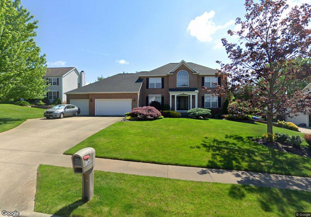
This home is located at 2977 Quail Ridge, Akron, OH 44319 and is currently estimated at $427,720, approximately $186 per square foot. 2977 Quail Ridge is a home located in Summit County with nearby schools including Greenwood Elementary School, Green Intermediate Elementary School, and Green Primary School.
Ownership History
Date
Name
Owned For
Owner Type
Purchase Details
Closed on
Jun 2, 1999
Sold by
Robinhood Development Llc
Bought by
Fausnight Jeffrey S and Fausnight Lila K
Current Estimated Value
Home Financials for this Owner
Home Financials are based on the most recent Mortgage that was taken out on this home.
Original Mortgage
$190,000
Outstanding Balance
$49,655
Interest Rate
6.94%
Estimated Equity
$378,065
Create a Home Valuation Report for This Property
The Home Valuation Report is an in-depth analysis detailing your home's value as well as a comparison with similar homes in the area
Home Values in the Area
Average Home Value in this Area
Purchase History
| Date | Buyer | Sale Price | Title Company |
|---|---|---|---|
| Fausnight Jeffrey S | $235,950 | Bond & Associates Title Agen |
Source: Public Records
Mortgage History
| Date | Status | Borrower | Loan Amount |
|---|---|---|---|
| Open | Fausnight Jeffrey S | $190,000 |
Source: Public Records
Tax History Compared to Growth
Tax History
| Year | Tax Paid | Tax Assessment Tax Assessment Total Assessment is a certain percentage of the fair market value that is determined by local assessors to be the total taxable value of land and additions on the property. | Land | Improvement |
|---|---|---|---|---|
| 2025 | $6,064 | $127,530 | $22,243 | $105,287 |
| 2024 | $6,064 | $127,530 | $22,243 | $105,287 |
| 2023 | $6,064 | $127,530 | $22,243 | $105,287 |
| 2022 | $4,910 | $92,558 | $16,118 | $76,440 |
| 2021 | $4,609 | $92,558 | $16,118 | $76,440 |
| 2020 | $4,519 | $92,560 | $16,120 | $76,440 |
| 2019 | $4,517 | $86,690 | $15,640 | $71,050 |
| 2018 | $4,616 | $86,690 | $15,640 | $71,050 |
| 2017 | $4,231 | $86,690 | $15,640 | $71,050 |
| 2016 | $4,210 | $74,440 | $15,640 | $58,800 |
| 2015 | $4,231 | $74,440 | $15,640 | $58,800 |
| 2014 | $4,202 | $74,440 | $15,640 | $58,800 |
| 2013 | $4,239 | $74,700 | $15,640 | $59,060 |
Source: Public Records
Map
Nearby Homes
- 3113 Sparrows Crest
- 652 Bobwhite Trail
- 399 Abbyshire Rd
- 435 Bonshire Rd
- 0 Bayview Terrace
- 3145 Daisy Ave
- 3845 Cayugas Dr
- 111 Magua Dr
- 0 Fortuna Dr Unit 5005346
- 3785 S Main St
- TBD Heron Watch Dr
- 0 Sandy Beach Dr
- 3870 S Main St
- 960 Impala Dr
- 1096 Cookhill Cir Unit 50
- 652 S Sheraton Dr
- 2872 Ironwood Dr
- 988 E Turkeyfoot Lake Rd
- 3350 S Main St
- 583 Knollwood Dr
- 2985 Quail Ridge
- 2969 Quail Ridge
- 3092 Sparrows Crest
- 3100 Sparrows Crest
- 3084 Sparrows Crest
- 2961 Quail Ridge
- 2993 Quail Ridge
- 2978 Quail Ridge
- 2986 Quail Ridge
- 3108 Sparrows Crest
- 3076 Sparrows Crest
- 2970 Quail Ridge
- 2962 Quail Ridge
- 2994 Quail Ridge
- 3001 Quail Ridge
- 3116 Sparrows Crest
- 3068 Sparrows Crest
- 3171 Doves Crossing
- 3097 Sparrows Crest
- 3089 Sparrows Crest