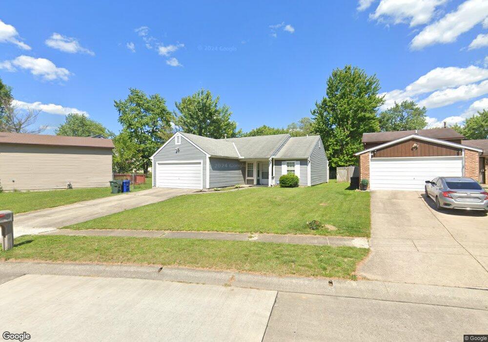
2992 Argonne Ct Columbus, OH 43232
Walnut Heights NeighborhoodEstimated Value: $216,000 - $265,000
3
Beds
2
Baths
1,182
Sq Ft
$198/Sq Ft
Est. Value
About This Home
This home is located at 2992 Argonne Ct, Columbus, OH 43232 and is currently estimated at $234,563, approximately $198 per square foot. 2992 Argonne Ct is a home located in Franklin County with nearby schools including Liberty Elementary School, Yorktown Middle School, and Independence High School.
Ownership History
Date
Name
Owned For
Owner Type
Purchase Details
Closed on
May 19, 2017
Sold by
Lynd Marilyn K
Bought by
Gillman Tamatha W
Current Estimated Value
Home Financials for this Owner
Home Financials are based on the most recent Mortgage that was taken out on this home.
Original Mortgage
$106,043
Outstanding Balance
$89,714
Interest Rate
4.75%
Mortgage Type
FHA
Estimated Equity
$144,849
Purchase Details
Closed on
Jan 25, 1989
Create a Home Valuation Report for This Property
The Home Valuation Report is an in-depth analysis detailing your home's value as well as a comparison with similar homes in the area
Home Values in the Area
Average Home Value in this Area
Purchase History
| Date | Buyer | Sale Price | Title Company |
|---|---|---|---|
| Gillman Tamatha W | $108,000 | None Available | |
| -- | $67,800 | -- |
Source: Public Records
Mortgage History
| Date | Status | Borrower | Loan Amount |
|---|---|---|---|
| Open | Gillman Tamatha W | $106,043 |
Source: Public Records
Tax History Compared to Growth
Tax History
| Year | Tax Paid | Tax Assessment Tax Assessment Total Assessment is a certain percentage of the fair market value that is determined by local assessors to be the total taxable value of land and additions on the property. | Land | Improvement |
|---|---|---|---|---|
| 2024 | $2,832 | $63,110 | $17,820 | $45,290 |
| 2023 | $2,796 | $63,105 | $17,815 | $45,290 |
| 2022 | $1,868 | $36,020 | $6,300 | $29,720 |
| 2021 | $1,871 | $36,020 | $6,300 | $29,720 |
| 2020 | $1,874 | $36,020 | $6,300 | $29,720 |
| 2019 | $1,841 | $30,350 | $5,250 | $25,100 |
| 2018 | $1,812 | $30,350 | $5,250 | $25,100 |
| 2017 | $1,904 | $30,350 | $5,250 | $25,100 |
| 2016 | $1,969 | $29,720 | $6,130 | $23,590 |
| 2015 | $1,787 | $29,720 | $6,130 | $23,590 |
| 2014 | $1,792 | $29,720 | $6,130 | $23,590 |
| 2013 | $981 | $33,005 | $6,790 | $26,215 |
Source: Public Records
Map
Nearby Homes
- 5401 Spire Ln
- 5373 Spire Ln
- 5377 Bleaker Ave
- 2998 Osgood Rd E
- 5278 Glenbriar Ct
- 3148 Aldgate St
- 3198 Gallant Dr
- 2730 Raphael Dr
- 2705 Denmark Rd
- 2991 Blue Moon Dr
- 5125 Upton Rd N
- 2744 Barrows Rd
- 2736 Barrows Rd
- 2651 Brownfield Rd
- 5011 Refugee Rd
- 3289 Kady Ln
- 5323 Sundale Place S
- 5882 Abernathy Ln Unit 5882F
- 5422 Everson Rd N
- 3387 Retriever Rd
- 3000 Argonne Ct
- 5401 Paladim Rd
- 3006 Argonne Ct
- 5405 Paladim Rd
- 3012 Argonne Ct
- 2995 Falcon Bridge Dr
- 2983 Falcon Bridge Dr
- 3003 Falcon Bridge Dr
- 2995 Argonne Ct
- 3011 Falcon Bridge Dr
- 2971 Falcon Bridge Dr
- 3003 Argonne Ct
- 3018 Argonne Ct
- 3017 Falcon Bridge Dr
- 2961 Falcon Bridge Dr
- 5398 Paladim Rd
- 3011 Argonne Ct
- 3023 Falcon Bridge Dr
- 5406 Paladim Rd
- 3024 Argonne Ct