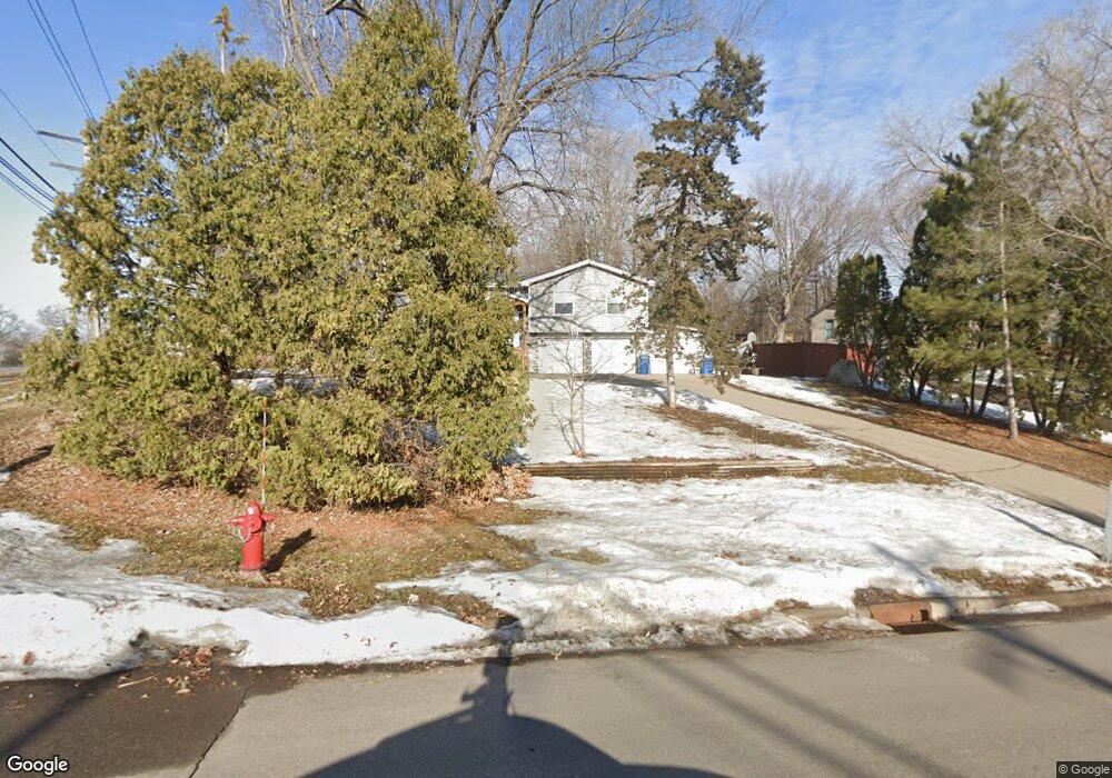
2995 Egan Ave Saint Paul, MN 55121
Estimated Value: $414,000 - $451,000
4
Beds
3
Baths
1,367
Sq Ft
$318/Sq Ft
Est. Value
About This Home
This home is located at 2995 Egan Ave, Saint Paul, MN 55121 and is currently estimated at $434,233, approximately $317 per square foot. 2995 Egan Ave is a home located in Dakota County with nearby schools including Pilot Knob STEM Magnet School, Friendly Hills Middle School, and Two Rivers High School.
Ownership History
Date
Name
Owned For
Owner Type
Purchase Details
Closed on
Mar 28, 2011
Sold by
Federal National Mortgage Association
Bought by
West Laura B
Current Estimated Value
Home Financials for this Owner
Home Financials are based on the most recent Mortgage that was taken out on this home.
Original Mortgage
$118,200
Outstanding Balance
$84,162
Interest Rate
5.5%
Mortgage Type
FHA
Estimated Equity
$350,071
Purchase Details
Closed on
Apr 25, 1999
Sold by
Roxberg Rehab Inc
Bought by
Wandersee Cynthia L and Treichel Robert L
Purchase Details
Closed on
May 15, 1998
Sold by
Security Pacific National Bank
Bought by
Roxberg Stacy M
Create a Home Valuation Report for This Property
The Home Valuation Report is an in-depth analysis detailing your home's value as well as a comparison with similar homes in the area
Home Values in the Area
Average Home Value in this Area
Purchase History
| Date | Buyer | Sale Price | Title Company |
|---|---|---|---|
| West Laura B | -- | Minnesota Abstract & Title | |
| Wandersee Cynthia L | $149,000 | -- | |
| Roxberg Stacy M | $81,500 | -- |
Source: Public Records
Mortgage History
| Date | Status | Borrower | Loan Amount |
|---|---|---|---|
| Open | West Laura B | $118,200 |
Source: Public Records
Tax History
| Year | Tax Paid | Tax Assessment Tax Assessment Total Assessment is a certain percentage of the fair market value that is determined by local assessors to be the total taxable value of land and additions on the property. | Land | Improvement |
|---|---|---|---|---|
| 2024 | $1,896 | $352,100 | $95,900 | $256,200 |
| 2023 | $1,896 | $362,300 | $96,200 | $266,100 |
| 2022 | $2,770 | $352,000 | $96,000 | $256,000 |
| 2021 | $2,576 | $298,600 | $83,400 | $215,200 |
| 2020 | $2,680 | $271,600 | $71,400 | $200,200 |
| 2019 | $2,752 | $272,800 | $68,000 | $204,800 |
| 2018 | $2,274 | $268,600 | $64,800 | $203,800 |
| 2017 | $2,260 | $229,500 | $61,700 | $167,800 |
| 2016 | $2,161 | $219,000 | $58,700 | $160,300 |
| 2015 | $2,175 | $190,461 | $53,519 | $136,942 |
| 2014 | -- | $185,338 | $51,826 | $133,512 |
| 2013 | -- | $174,438 | $46,529 | $127,909 |
Source: Public Records
Map
Nearby Homes
- 1360 Lone Oak Rd
- 3030 Shields Dr Unit 105
- 3050 Shields Dr Unit 103
- 3016 Timberwood Trail Unit 2
- 1329 Towerview Rd
- 2850 Pilot Knob Rd
- 3159 Quarry Ct
- 3062 Woodlark Ln
- 3112 Farnum Dr Unit A
- 1700 Four Oaks Rd Unit 314B
- 1603 Raindrop Dr
- 3245 Evergreen Dr
- 1621 City View Dr
- 3426 Highlander Dr
- 3271 Valley Ridge Dr Unit 33
- 1544 Greenwood Ct N
- 1490 Woodview Ave E
- 3470 Greenwood Ct S
- 1654 Hunt Dr
- 1650 Hunt Dr
- 2985 Egan Ave
- 2998 Burnside Ave
- 2990 Burnside Ave
- 2990 Egan Ave
- 1380 Lone Oak Rd
- 2975 Egan Ave
- 2984 Burnside Ave
- 2980 Egan Ave
- 1384 Rainier Ln
- 1382 Lone Oak Rd
- 2995 Burnside Ave
- 2976 Burnside Ave
- 2945 Egan Ave
- 2970 Egan Ave
- 1386 Lone Oak Rd
- 1390 Rainier Ln
- 2960 Egan Ave
- 1395 Lone Oak Rd
- 1383 Rainier Ln
- 2970 Burnside Ave
Your Personal Tour Guide
Ask me questions while you tour the home.