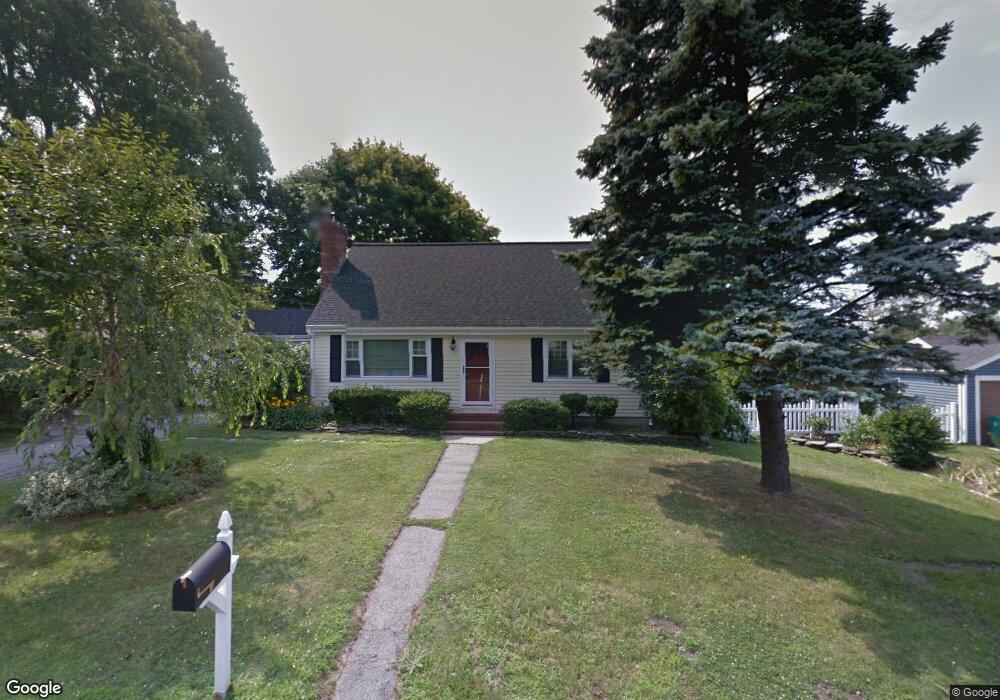
3 Longmeadow Ave Middletown, RI 02842
Estimated Value: $704,012 - $949,000
4
Beds
2
Baths
1,939
Sq Ft
$448/Sq Ft
Est. Value
About This Home
This home is located at 3 Longmeadow Ave, Middletown, RI 02842 and is currently estimated at $868,253, approximately $447 per square foot. 3 Longmeadow Ave is a home located in Newport County with nearby schools including Middletown High School, All Saints STEAM Academy, and St Michael's Country Day School.
Ownership History
Date
Name
Owned For
Owner Type
Purchase Details
Closed on
Aug 10, 2006
Sold by
Booms Brian
Bought by
Bradshaw Kenneth and Bradshaw Patricia
Current Estimated Value
Purchase Details
Closed on
Oct 28, 2005
Sold by
Wilson Margaret G
Bought by
Booms Brian W
Purchase Details
Closed on
Aug 25, 1999
Sold by
Quinn Paul V and Quinn Annmarie S
Bought by
Wilson Margaret G
Create a Home Valuation Report for This Property
The Home Valuation Report is an in-depth analysis detailing your home's value as well as a comparison with similar homes in the area
Home Values in the Area
Average Home Value in this Area
Purchase History
| Date | Buyer | Sale Price | Title Company |
|---|---|---|---|
| Bradshaw Kenneth | $450,000 | -- | |
| Booms Brian W | $405,000 | -- | |
| Wilson Margaret G | $213,500 | -- |
Source: Public Records
Mortgage History
| Date | Status | Borrower | Loan Amount |
|---|---|---|---|
| Open | Wilson Margaret G | $289,123 | |
| Closed | Wilson Margaret G | $355,500 | |
| Closed | Wilson Margaret G | $400,000 |
Source: Public Records
Tax History Compared to Growth
Tax History
| Year | Tax Paid | Tax Assessment Tax Assessment Total Assessment is a certain percentage of the fair market value that is determined by local assessors to be the total taxable value of land and additions on the property. | Land | Improvement |
|---|---|---|---|---|
| 2025 | $7,438 | $630,900 | $363,900 | $267,000 |
| 2024 | $7,104 | $630,900 | $363,900 | $267,000 |
| 2023 | $5,760 | $457,500 | $264,100 | $193,400 |
| 2022 | $5,499 | $457,500 | $264,100 | $193,400 |
| 2021 | $5,499 | $457,500 | $264,100 | $193,400 |
| 2020 | $5,168 | $375,600 | $204,200 | $171,400 |
| 2018 | $5,165 | $375,600 | $204,200 | $171,400 |
| 2016 | $5,163 | $334,800 | $161,700 | $173,100 |
| 2015 | $5,035 | $334,800 | $161,700 | $173,100 |
| 2014 | $5,133 | $319,400 | $147,000 | $172,400 |
| 2013 | $5,018 | $319,400 | $147,000 | $172,400 |
Source: Public Records
Map
Nearby Homes
- 138 Green End Ave
- 476 Green End Ave
- 0 Honeyman Ave
- 55 John Clarke Rd Unit 8
- 55 John Clarke Rd Unit 3
- 1 Shangri-La Ln
- 74 Valley Rd
- 149 W Main Rd
- 117 W Main Rd
- 67 Linden St
- 6 Wabasso Terrace
- 36 Kay Blvd
- 318 Corey Ln
- 0 Wolcott Ave
- 5 Elliot Place
- 310 Corey Ln
- 19 Princeton St Unit 21
- 223 Corey Ln
- 65 Maple Ave
- 119 Corey Ln
- 4 Winthrop Dr
- 1 Longmeadow Ave
- 5 Longmeadow Ave
- 2 Winthrop Dr
- 4 Longmeadow Ave
- 6 Longmeadow Ave
- 6 Winthrop Dr
- 384 Valley Rd
- 7 Longmeadow Ave
- 3 Winthrop Dr
- 8 Longmeadow Ave
- 1 Winthrop Dr
- 5 Winthrop Dr
- 8 Winthrop Dr
- 9 Longmeadow Ave
- 391 Valley Rd
- 385 Valley Rd
- 10 Continental Dr
- 10 Longmeadow Ave
- 8 Continental Dr