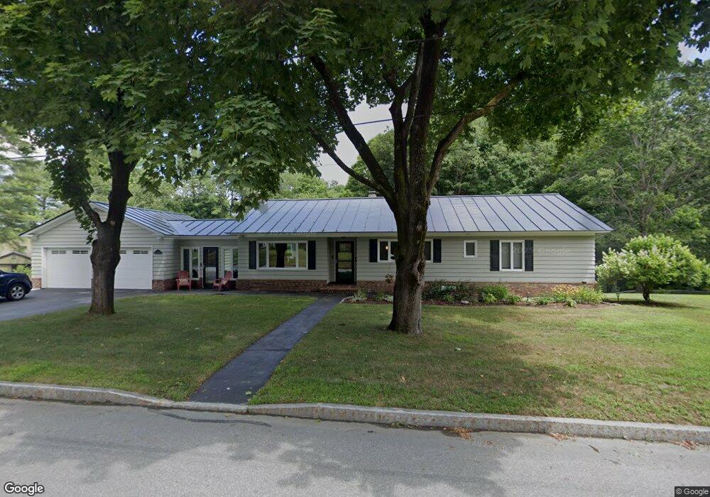
3 Powers St West Lebanon, NH 03784
Estimated Value: $510,000 - $593,000
3
Beds
3
Baths
1,608
Sq Ft
$337/Sq Ft
Est. Value
About This Home
This home is located at 3 Powers St, West Lebanon, NH 03784 and is currently estimated at $541,842, approximately $336 per square foot. 3 Powers St is a home located in Grafton County with nearby schools including Mt. Lebanon School, Lebanon Middle School, and Lebanon High School.
Ownership History
Date
Name
Owned For
Owner Type
Purchase Details
Closed on
Apr 7, 1998
Sold by
Flanagan Patrick E and Flanagan Christine S
Bought by
Smith Eric
Current Estimated Value
Home Financials for this Owner
Home Financials are based on the most recent Mortgage that was taken out on this home.
Original Mortgage
$85,000
Outstanding Balance
$15,840
Interest Rate
6.89%
Estimated Equity
$526,002
Create a Home Valuation Report for This Property
The Home Valuation Report is an in-depth analysis detailing your home's value as well as a comparison with similar homes in the area
Home Values in the Area
Average Home Value in this Area
Purchase History
| Date | Buyer | Sale Price | Title Company |
|---|---|---|---|
| Smith Eric | $149,900 | -- |
Source: Public Records
Mortgage History
| Date | Status | Borrower | Loan Amount |
|---|---|---|---|
| Open | Smith Eric | $85,000 |
Source: Public Records
Tax History Compared to Growth
Tax History
| Year | Tax Paid | Tax Assessment Tax Assessment Total Assessment is a certain percentage of the fair market value that is determined by local assessors to be the total taxable value of land and additions on the property. | Land | Improvement |
|---|---|---|---|---|
| 2024 | $9,666 | $367,800 | $100,700 | $267,100 |
| 2023 | $8,930 | $367,800 | $100,700 | $267,100 |
| 2022 | $8,476 | $367,900 | $100,800 | $267,100 |
| 2021 | $6,904 | $255,900 | $67,600 | $188,300 |
| 2019 | $6,605 | $217,500 | $70,200 | $147,300 |
| 2018 | $6,464 | $217,500 | $70,200 | $147,300 |
| 2017 | $6,325 | $217,500 | $70,200 | $147,300 |
| 2016 | $6,118 | $217,500 | $70,200 | $147,300 |
| 2015 | $6,005 | $217,500 | $70,200 | $147,300 |
| 2014 | $5,798 | $220,700 | $70,200 | $150,500 |
| 2013 | $5,658 | $221,800 | $71,300 | $150,500 |
Source: Public Records
Map
Nearby Homes
- 3 Maple St
- 36-48 S Main St
- 15 Old Pine Tree Cemetery Rd
- 13 Pasture Ln
- 4 Black Bear Ct
- 11 Rock Ridge Blvd
- 94 Dogwood Cir
- 35 Railroad Row Unit C3-2
- 48 Fairview Terrace
- 40 Union St
- 13 Bullard St Unit 15
- 184 Hazen St
- 260 Highland Ave
- 113 Hanover St
- 25 Marshall Ave
- 722 Fairview Terrace
- 27 Ash St
- 1049 N Main St
- 204 Mechanic St Unit 12
- 1015 Maple St
- 6 Village Green Unit 6
- 7 Powers St
- 26 Floyd Ave
- 3 Village Green Unit 3
- 27 Floyd Ave
- 25 Floyd Ave
- 26 Batchelder Ave
- 19 Batchelder Ave
- 19 Floyd Ave
- 25 Cottage Cir
- 16 Village Green Unit 16
- 20 Powers St
- 17 Batchelder Ave
- 31 Cottage Cir
- 17 Floyd Ave
- 29 Cottage Cir
- 22 Batchelder Ave
- 10 Floyd Ave
- 15 Floyd Ave
- 53 Village Green Unit 53