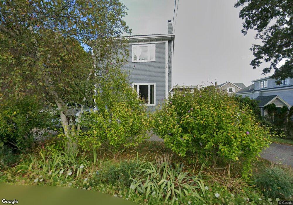
3 Warwick Rd Gloucester, MA 01930
East Gloucester NeighborhoodEstimated Value: $676,000 - $1,147,000
1
Bed
2
Baths
1,134
Sq Ft
$757/Sq Ft
Est. Value
About This Home
This home is located at 3 Warwick Rd, Gloucester, MA 01930 and is currently estimated at $858,176, approximately $756 per square foot. 3 Warwick Rd is a home located in Essex County with nearby schools including East Gloucester Elementary School, Ralph B O'maley Middle School, and Gloucester High School.
Ownership History
Date
Name
Owned For
Owner Type
Purchase Details
Closed on
Oct 8, 1998
Sold by
Aparo James M
Bought by
Morey Christine L
Current Estimated Value
Purchase Details
Closed on
Dec 9, 1994
Sold by
Gibbs Muriel E
Bought by
Aparo James M
Home Financials for this Owner
Home Financials are based on the most recent Mortgage that was taken out on this home.
Original Mortgage
$78,400
Interest Rate
9%
Mortgage Type
Purchase Money Mortgage
Create a Home Valuation Report for This Property
The Home Valuation Report is an in-depth analysis detailing your home's value as well as a comparison with similar homes in the area
Home Values in the Area
Average Home Value in this Area
Purchase History
| Date | Buyer | Sale Price | Title Company |
|---|---|---|---|
| Morey Christine L | $23,000 | -- | |
| Aparo James M | $98,000 | -- |
Source: Public Records
Mortgage History
| Date | Status | Borrower | Loan Amount |
|---|---|---|---|
| Previous Owner | Aparo James M | $78,400 |
Source: Public Records
Tax History
| Year | Tax Paid | Tax Assessment Tax Assessment Total Assessment is a certain percentage of the fair market value that is determined by local assessors to be the total taxable value of land and additions on the property. | Land | Improvement |
|---|---|---|---|---|
| 2025 | $9,032 | $929,200 | $563,300 | $365,900 |
| 2024 | $8,782 | $902,600 | $536,700 | $365,900 |
| 2023 | $8,461 | $799,000 | $479,100 | $319,900 |
| 2022 | $8,161 | $695,700 | $416,700 | $279,000 |
| 2021 | $7,872 | $632,800 | $378,800 | $254,000 |
| 2020 | $6,651 | $539,400 | $313,600 | $225,800 |
| 2019 | $5,731 | $451,600 | $252,600 | $199,000 |
| 2018 | $5,587 | $432,100 | $252,600 | $179,500 |
| 2017 | $5,418 | $410,800 | $240,600 | $170,200 |
| 2016 | $5,149 | $378,300 | $228,300 | $150,000 |
| 2015 | $5,161 | $378,100 | $236,200 | $141,900 |
Source: Public Records
Map
Nearby Homes
- 25 Salt Island Rd
- 78 Thatcher Rd Unit 6
- 32 Witham St Unit B
- 70 Old Nugent Farm Rd
- 148 Long Beach
- 33 Highview Rd
- 26 Marina Dr
- 5 Wise Place
- 3 Mondello Square
- 36 Eastern Ave
- 175 South St
- 197 E Main St Unit 1
- 139A Prospect St
- 177 Main St
- 19 Trask St Unit 2
- 10 Seaview Rd
- 50 Warner St
- 34R Summer St
- 60 Rocky Neck Ave Unit 202
- 48 Eden Rd
- 5 Warwick Rd
- 42 Salt Island Rd
- 44 Salt Island Rd
- 7 Palfrey Rd
- 7 Palfrey Rd Unit 2a
- 6 Warwick Rd
- 4 Warwick Rd
- 7 Warwick Rd
- 8 Warwick Rd
- 5 Palfrey Rd
- 10 Warwick Rd
- 3 Palfrey Rd
- 3 Palfrey Rd Unit 1
- 3 Palfrey Rd
- 3 Palfrey Road Winter
- 3 Palfrey Winter
- 7 Prospect Terrace
- 9 Warwick Rd
- 12 Palfrey Rd
- 10 Palfrey Rd
Your Personal Tour Guide
Ask me questions while you tour the home.