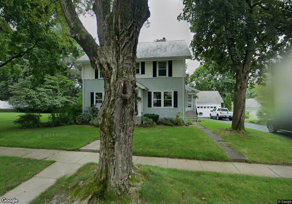
30 Laconia Rd Worcester, MA 01609
Forest Grove NeighborhoodEstimated Value: $631,000 - $713,000
4
Beds
3
Baths
2,850
Sq Ft
$234/Sq Ft
Est. Value
About This Home
This home is located at 30 Laconia Rd, Worcester, MA 01609 and is currently estimated at $666,207, approximately $233 per square foot. 30 Laconia Rd is a home located in Worcester County with nearby schools including Nelson Place Elementary School, Jacob Hiatt Magnet School, and Chandler Magnet.
Ownership History
Date
Name
Owned For
Owner Type
Purchase Details
Closed on
Apr 3, 2017
Sold by
Prunier Robert P and Prunier Gretchen L
Bought by
Prunier Robert P and Prunier Gretchen L
Current Estimated Value
Create a Home Valuation Report for This Property
The Home Valuation Report is an in-depth analysis detailing your home's value as well as a comparison with similar homes in the area
Home Values in the Area
Average Home Value in this Area
Purchase History
| Date | Buyer | Sale Price | Title Company |
|---|---|---|---|
| Prunier Robert P | -- | -- |
Source: Public Records
Tax History Compared to Growth
Tax History
| Year | Tax Paid | Tax Assessment Tax Assessment Total Assessment is a certain percentage of the fair market value that is determined by local assessors to be the total taxable value of land and additions on the property. | Land | Improvement |
|---|---|---|---|---|
| 2025 | $7,301 | $553,500 | $123,800 | $429,700 |
| 2024 | $7,123 | $518,000 | $123,800 | $394,200 |
| 2023 | $6,865 | $478,700 | $106,600 | $372,100 |
| 2022 | $6,384 | $419,700 | $85,300 | $334,400 |
| 2021 | $6,302 | $387,100 | $68,200 | $318,900 |
| 2020 | $6,081 | $357,700 | $68,000 | $289,700 |
| 2019 | $6,179 | $343,300 | $65,700 | $277,600 |
| 2018 | $6,117 | $323,500 | $65,700 | $257,800 |
| 2017 | $6,022 | $313,300 | $65,700 | $247,600 |
| 2016 | $6,212 | $301,400 | $54,400 | $247,000 |
| 2015 | $6,049 | $301,400 | $54,400 | $247,000 |
| 2014 | $5,882 | $301,000 | $54,400 | $246,600 |
Source: Public Records
Map
Nearby Homes
- 4 Wheeler Ave
- 577 Grove St
- 12 Alexander Rd
- 40 Westwood Dr
- 11 Chadwick St
- 8 Old Colony Rd
- 11 Gifford Dr
- 46 Hastings Ave
- 42 Hastings Ave
- 0 Grove St
- 612 Grove St
- 26 Tower St
- 11 Holden St
- 40 Hastings Ave
- 87 W Boylston St
- 89 W Boylston St Unit 4
- 93 W Boylston St
- 15 Boardman St
- 28 Holden St
- 477 Salisbury St