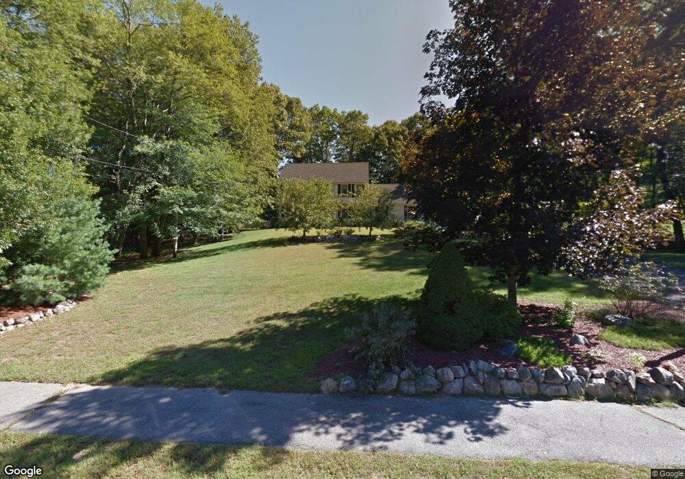
30 Longfellow Dr Franklin, MA 02038
Estimated Value: $822,000 - $1,111,000
4
Beds
3
Baths
2,424
Sq Ft
$377/Sq Ft
Est. Value
About This Home
This home is located at 30 Longfellow Dr, Franklin, MA 02038 and is currently estimated at $913,035, approximately $376 per square foot. 30 Longfellow Dr is a home located in Norfolk County with nearby schools including Helen Keller Elementary School, Annie Sullivan Middle School, and Franklin High School.
Ownership History
Date
Name
Owned For
Owner Type
Purchase Details
Closed on
Nov 10, 2023
Sold by
Rourke Michael J and Rourke Patricia E
Bought by
Rourke Ft and Rourke
Current Estimated Value
Purchase Details
Closed on
Oct 31, 2000
Sold by
Hastie J Scott J and Hastie Marie A
Bought by
Rourke Michael J
Purchase Details
Closed on
May 20, 1996
Sold by
Whitley Amy R and Whitley David D
Bought by
Scott Hasti J and Hastie Marie A
Create a Home Valuation Report for This Property
The Home Valuation Report is an in-depth analysis detailing your home's value as well as a comparison with similar homes in the area
Purchase History
| Date | Buyer | Sale Price | Title Company |
|---|---|---|---|
| Rourke Ft | -- | None Available | |
| Rourke Ft | -- | None Available | |
| Rourke Michael J | $387,000 | -- | |
| Scott Hasti J | $244,900 | -- | |
| Scott Hasti J | $244,900 | -- |
Source: Public Records
Mortgage History
| Date | Status | Borrower | Loan Amount |
|---|---|---|---|
| Previous Owner | Scott Hasti J | $291,000 | |
| Previous Owner | Scott Hasti J | $251,000 | |
| Previous Owner | Scott Hasti J | $20,000 |
Source: Public Records
Tax History
| Year | Tax Paid | Tax Assessment Tax Assessment Total Assessment is a certain percentage of the fair market value that is determined by local assessors to be the total taxable value of land and additions on the property. | Land | Improvement |
|---|---|---|---|---|
| 2025 | $8,255 | $710,400 | $331,100 | $379,300 |
| 2024 | $8,212 | $696,500 | $331,100 | $365,400 |
| 2023 | $7,928 | $630,200 | $282,200 | $348,000 |
| 2022 | $7,437 | $529,300 | $222,200 | $307,100 |
| 2021 | $7,406 | $505,500 | $249,500 | $256,000 |
| 2020 | $7,007 | $482,900 | $239,300 | $243,600 |
| 2019 | $6,928 | $472,600 | $229,000 | $243,600 |
| 2018 | $6,439 | $439,500 | $220,900 | $218,600 |
| 2017 | $6,169 | $423,100 | $204,500 | $218,600 |
| 2016 | $6,363 | $438,800 | $219,400 | $219,400 |
| 2015 | $6,349 | $427,800 | $208,400 | $219,400 |
| 2014 | $5,793 | $400,900 | $182,800 | $218,100 |
Source: Public Records
Map
Nearby Homes
- 30 Longobardi Dr Unit 30
- 3 Oak View Terrace Unit 3
- 62 Uncas Ave
- 90 E Central St Unit 103
- 90 E Central St Unit 106
- 90 E Central St Unit 304
- 90 E Central St Unit 202
- 90 E Central St Unit 105
- 90 E Central St Unit 301
- 64 Uncas Ave
- 76 Uncas Ave
- 66 Uncas Ave
- 68 Uncas Ave
- 80 Uncas Ave
- 75 Jordan Rd
- 82 Uncas Ave
- 82 Uncas Ave Unit 1
- 99 Summer St
- 88 Crescent St
- 17 Longhill Rd
- 28 Longfellow Dr
- 32 Longfellow Dr
- 231 Chestnut St
- 235 Chestnut St
- 26 Longfellow Dr
- 29 Longfellow Dr
- 34 Longfellow Dr
- 31 Longfellow Dr
- 4 Henry Ln
- 27 Longfellow Dr
- 219 Chestnut St
- 2 Henry Ln
- 211 Chestnut St
- 211 Chestnut St Unit 211
- 213 Chestnut St Unit 213
- 215 Chestnut St Unit 1
- 215 Chestnut St
- 215 Chestnut St Unit 215
- 229 Chestnut St
- 3 Longobardi Dr
Your Personal Tour Guide
Ask me questions while you tour the home.