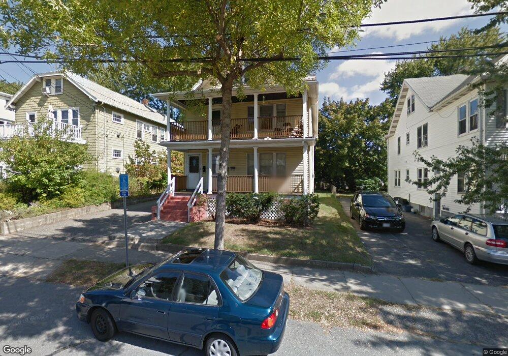
30 Waldo Rd Unit 32 Arlington, MA 02474
East Arlington NeighborhoodEstimated Value: $1,197,000 - $1,305,000
4
Beds
2
Baths
2,457
Sq Ft
$517/Sq Ft
Est. Value
About This Home
This home is located at 30 Waldo Rd Unit 32, Arlington, MA 02474 and is currently estimated at $1,270,012, approximately $516 per square foot. 30 Waldo Rd Unit 32 is a home located in Middlesex County with nearby schools including Hardy Elementary School, Thompson School, and Ottoson Middle School.
Ownership History
Date
Name
Owned For
Owner Type
Purchase Details
Closed on
Dec 31, 1991
Sold by
Traynor Joseph
Bought by
Zakaria Maria
Current Estimated Value
Purchase Details
Closed on
Sep 28, 1990
Sold by
Traynor Elaine M
Bought by
Traynor Joseph C
Home Financials for this Owner
Home Financials are based on the most recent Mortgage that was taken out on this home.
Original Mortgage
$157,000
Interest Rate
9.95%
Mortgage Type
Purchase Money Mortgage
Create a Home Valuation Report for This Property
The Home Valuation Report is an in-depth analysis detailing your home's value as well as a comparison with similar homes in the area
Home Values in the Area
Average Home Value in this Area
Purchase History
| Date | Buyer | Sale Price | Title Company |
|---|---|---|---|
| Zakaria Maria | $225,000 | -- | |
| Traynor Joseph C | $116,000 | -- |
Source: Public Records
Mortgage History
| Date | Status | Borrower | Loan Amount |
|---|---|---|---|
| Previous Owner | Traynor Joseph C | $157,000 |
Source: Public Records
Tax History Compared to Growth
Tax History
| Year | Tax Paid | Tax Assessment Tax Assessment Total Assessment is a certain percentage of the fair market value that is determined by local assessors to be the total taxable value of land and additions on the property. | Land | Improvement |
|---|---|---|---|---|
| 2025 | $11,642 | $1,081,000 | $592,800 | $488,200 |
| 2024 | $10,774 | $1,017,400 | $564,300 | $453,100 |
| 2023 | $10,764 | $960,200 | $473,100 | $487,100 |
| 2022 | $10,720 | $938,700 | $456,000 | $482,700 |
| 2021 | $10,395 | $916,700 | $456,000 | $460,700 |
| 2020 | $10,141 | $916,900 | $456,000 | $460,900 |
| 2019 | $9,492 | $843,000 | $484,500 | $358,500 |
| 2018 | $8,635 | $711,900 | $353,400 | $358,500 |
| 2017 | $8,089 | $644,000 | $307,800 | $336,200 |
| 2016 | $7,660 | $598,400 | $262,200 | $336,200 |
| 2015 | $7,532 | $555,900 | $256,500 | $299,400 |
Source: Public Records
Map
Nearby Homes
- 215 Massachusetts Ave Unit 19 (34)
- 57 Garrison Ave
- 230 Massachusetts Ave Unit 6
- 6 Hamilton Rd Unit 6
- 34 Belknap St
- 235 Powder House Blvd
- 11 Watson St Unit 1
- 11 Watson St Unit 2
- 16 High St Unit 2
- 202 Powder House Blvd Unit 2
- 327 Alewife Brook Pkwy Unit A
- 3 Seagrave Rd
- 21 High St
- 69 Clarendon Ave Unit A
- 23 Brookford St
- 23 Brookford St Unit 2
- 23 Brookford St Unit 1
- 69 Sterling St
- 23 Yale Rd
- 12 Arizona Terrace Unit 2
- 34 Waldo Rd Unit 36
- 34 Waldo Rd Unit 2
- 34 Waldo Rd Unit 34
- 34-36 Waldo Rd
- 26 Waldo Rd
- 26 Waldo Rd Unit 2
- 28 Waldo Rd
- 38 Waldo Rd Unit 40
- 78-80 Windsor St
- 35 Waldo Rd Unit 35
- 78 Windsor St Unit 80
- 22 Waldo Rd Unit 24
- 79 Trowbridge St Unit 81
- 79 Trowbridge St Unit 81
- 79 Trowbridge St Unit 1
- 79-81 Trowbridge St Unit 79
- 79-81 Trowbridge St Unit 2
- 79-81 Trowbridge St Unit 1
- 81 Trowbridge St Unit 81
- 44 Waldo Rd Unit 44