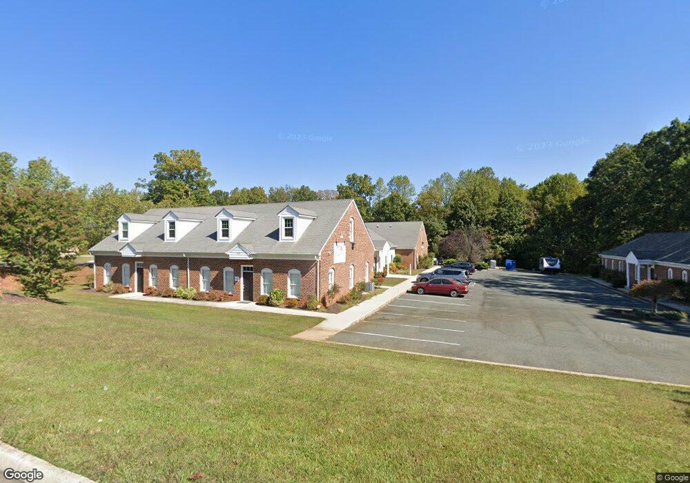
300 Enterprise Dr Unit B Forest, VA 24551
Estimated Value: $1,112,000 - $1,261,000
5
Beds
5
Baths
5,860
Sq Ft
$202/Sq Ft
Est. Value
About This Home
This home is located at 300 Enterprise Dr Unit B, Forest, VA 24551 and is currently estimated at $1,184,556, approximately $202 per square foot. 300 Enterprise Dr Unit B is a home located in Bedford County with nearby schools including Thomas Jefferson Elementary School, Forest Middle School, and Jefferson Forest High School.
Ownership History
Date
Name
Owned For
Owner Type
Purchase Details
Closed on
Apr 24, 2017
Sold by
Maddox Andrew D and Maddox Tabitha B
Bought by
Tebit Denis M and Tebit Emaculate V
Current Estimated Value
Home Financials for this Owner
Home Financials are based on the most recent Mortgage that was taken out on this home.
Original Mortgage
$790,000
Outstanding Balance
$657,758
Interest Rate
4.23%
Mortgage Type
Adjustable Rate Mortgage/ARM
Estimated Equity
$526,798
Purchase Details
Closed on
Mar 7, 2005
Sold by
Maddox & Son Construction Inc
Bought by
Maddox Andrew D and Maddox Tabitha B
Home Financials for this Owner
Home Financials are based on the most recent Mortgage that was taken out on this home.
Original Mortgage
$500,000
Interest Rate
4.87%
Mortgage Type
Adjustable Rate Mortgage/ARM
Create a Home Valuation Report for This Property
The Home Valuation Report is an in-depth analysis detailing your home's value as well as a comparison with similar homes in the area
Home Values in the Area
Average Home Value in this Area
Purchase History
| Date | Buyer | Sale Price | Title Company |
|---|---|---|---|
| Tebit Denis M | $790,000 | Attorney | |
| Maddox Andrew D | -- | None Available |
Source: Public Records
Mortgage History
| Date | Status | Borrower | Loan Amount |
|---|---|---|---|
| Open | Tebit Denis M | $790,000 | |
| Previous Owner | Maddox Andrew D | $500,000 |
Source: Public Records
Tax History Compared to Growth
Tax History
| Year | Tax Paid | Tax Assessment Tax Assessment Total Assessment is a certain percentage of the fair market value that is determined by local assessors to be the total taxable value of land and additions on the property. | Land | Improvement |
|---|---|---|---|---|
| 2025 | $4,169 | $1,016,900 | $135,000 | $881,900 |
| 2024 | $4,169 | $1,016,900 | $135,000 | $881,900 |
| 2023 | $4,169 | $508,450 | $0 | $0 |
| 2022 | $3,972 | $397,200 | $0 | $0 |
| 2021 | $3,972 | $794,400 | $110,000 | $684,400 |
| 2020 | $3,972 | $794,400 | $110,000 | $684,400 |
| 2019 | $3,972 | $794,400 | $110,000 | $684,400 |
| 2018 | $4,944 | $950,700 | $100,000 | $850,700 |
| 2017 | $4,944 | $950,700 | $100,000 | $850,700 |
| 2016 | $4,944 | $950,700 | $100,000 | $850,700 |
| 2015 | $4,944 | $950,700 | $100,000 | $850,700 |
| 2014 | $4,911 | $944,500 | $100,000 | $844,500 |
Source: Public Records
Map
Nearby Homes
- 17513 Forest Rd
- 1245 Jefferson Oaks Ct Unit 69
- 112 Forest Dale Dr
- 105 Simsbury Ln
- 114 Bexley Dr
- 102 N Woodfin Ct
- 206 Simsbury Ln
- 1055 Jefferson Oaks Ct Unit 3
- 114 Thornfield Dr
- 1170 Mont View Ln
- 408 Robin Dr
- 0 Forest Rd
- 202 Oak Knob Dr
- 725 Wyndhurst Dr
- 102 Springvale Dr
- 694 Wyndhurst Dr
- 1324 Cuddington Ln
- 300 Robin Dr
- 106 Omega Ct
- 202 Hounds Run
- 302 Enterprise Dr
- 206 Enterprise Dr
- 0 Brook Park Place
- 307 Brook Park Place
- 306 Enterprise Dr
- 301 Enterprise Dr
- 304 Brook Park Place
- 311 Brook Park Place
- 104 Homestead Dr
- 305 Enterprise Dr
- 2011 Enterprise Dr
- 100 Annjo Ct
- 103 Homestead Dr
- 106 Homestead Dr
- 102 Annjo Ct
- 317 Brook Park Place
- 2010 Enterprise Dr
- 309 Enterprise Dr
- 104 Annjo Ct
- 104 Annjo Ct