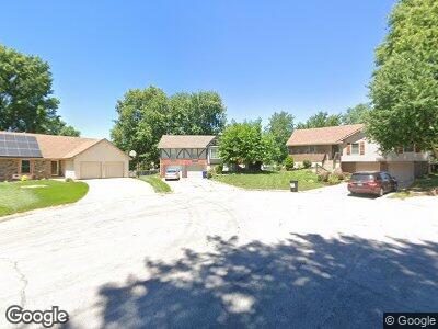
301 NE Lincoln Ct Lees Summit, MO 64064
Chapel Ridge NeighborhoodEstimated Value: $290,000 - $322,000
3
Beds
2
Baths
1,596
Sq Ft
$191/Sq Ft
Est. Value
About This Home
This home is located at 301 NE Lincoln Ct, Lees Summit, MO 64064 and is currently estimated at $304,656, approximately $190 per square foot. 301 NE Lincoln Ct is a home located in Jackson County with nearby schools including Chapel Lakes Elementary School, Delta Woods Middle School, and Blue Springs South High School.
Ownership History
Date
Name
Owned For
Owner Type
Purchase Details
Closed on
Dec 1, 2021
Sold by
Zion Larry R and Zion Marinell
Bought by
Dalton Matthew and Dalton Carmille
Current Estimated Value
Home Financials for this Owner
Home Financials are based on the most recent Mortgage that was taken out on this home.
Original Mortgage
$245,471
Outstanding Balance
$230,324
Interest Rate
3.1%
Purchase Details
Closed on
Feb 10, 2014
Sold by
Zion Larry R and Zion Marinell
Bought by
Zion Larry R and Zion Marinell
Purchase Details
Closed on
Jan 10, 2014
Sold by
Zion Larry R and Zion Marinell
Bought by
Brasel Deborah K and Parker Elisa E
Purchase Details
Closed on
Jun 24, 2010
Sold by
Zion Larry R and Zion Marinell
Bought by
Parker Elisa E
Purchase Details
Closed on
Mar 14, 1997
Sold by
Zion Larry R and Zion Marinell
Bought by
Brasel Deborah and Parkhurst Elisa
Create a Home Valuation Report for This Property
The Home Valuation Report is an in-depth analysis detailing your home's value as well as a comparison with similar homes in the area
Home Values in the Area
Average Home Value in this Area
Purchase History
| Date | Buyer | Sale Price | Title Company |
|---|---|---|---|
| Dalton Matthew | -- | None Available |
Source: Public Records
Mortgage History
| Date | Status | Borrower | Loan Amount |
|---|---|---|---|
| Open | Dalton Matthew | $245,471 | |
| Closed | Dalton Matthew | $245,471 | |
| Previous Owner | Zion Larry R | $88,531 |
Source: Public Records
Tax History Compared to Growth
Tax History
| Year | Tax Paid | Tax Assessment Tax Assessment Total Assessment is a certain percentage of the fair market value that is determined by local assessors to be the total taxable value of land and additions on the property. | Land | Improvement |
|---|---|---|---|---|
| 2024 | $3,387 | $45,036 | $5,480 | $39,556 |
| 2023 | $3,387 | $45,036 | $5,362 | $39,674 |
| 2022 | $2,678 | $31,540 | $4,185 | $27,355 |
| 2021 | $2,676 | $31,540 | $4,185 | $27,355 |
| 2020 | $2,581 | $30,091 | $4,185 | $25,906 |
| 2019 | $2,502 | $30,091 | $4,185 | $25,906 |
| 2018 | $2,245 | $26,189 | $3,642 | $22,547 |
| 2017 | $2,245 | $26,189 | $3,642 | $22,547 |
| 2016 | $2,075 | $24,282 | $3,002 | $21,280 |
| 2014 | $2,069 | $24,066 | $3,001 | $21,065 |
Source: Public Records
Map
Nearby Homes
- 3801 NE Colonial Dr
- 3611 NE Chapel Dr
- 306 NE Stanton Ln
- 416 NE Carriage St
- 325 NE Chapel Ct
- 3717 NE Stanton St
- 404 NE Colonial Ct
- 4004 NE Independence Ave
- 129 NE Wood Glen Ln
- 529 NE Sienna Place
- 4011 NE Woodridge Dr
- 4017 NE Woodridge Dr
- 264 NE Edgewater Dr
- 4709 NE Freehold Dr
- 4134 NE Hampstead Dr
- 202 NW Redwood Ct
- 416 NE Brockton Dr
- 208 NE Landings Cir
- 801 NE Lone Hill Dr
- 793 NE Algonquin St Unit A
- 301 NE Lincoln Ct
- 301 NE Lincoln St
- 303 NE Lincoln Ct
- 300 NE Lincoln Ct
- 3711 NE Colonial Dr
- 3709 NE Colonial Dr
- 302 NE Lincoln Ct
- 3713 NE Colonial Dr Unit 3
- 3713 NE Colonial Dr
- 305 NE Lincoln Ct
- 3707 NE Colonial Dr Unit 2
- 3707 NE Colonial Dr
- 3705 NE Colonial Dr
- 3715 NE Colonial Dr
- 305 NE Lincoln Ct
- 3717 NE Colonial Dr
- 3723 NE Colonial Dr Unit 2
- 3725 NE Colonial Dr
- 3721 NE Colonial Dr
- 3719 NE Colonial Dr