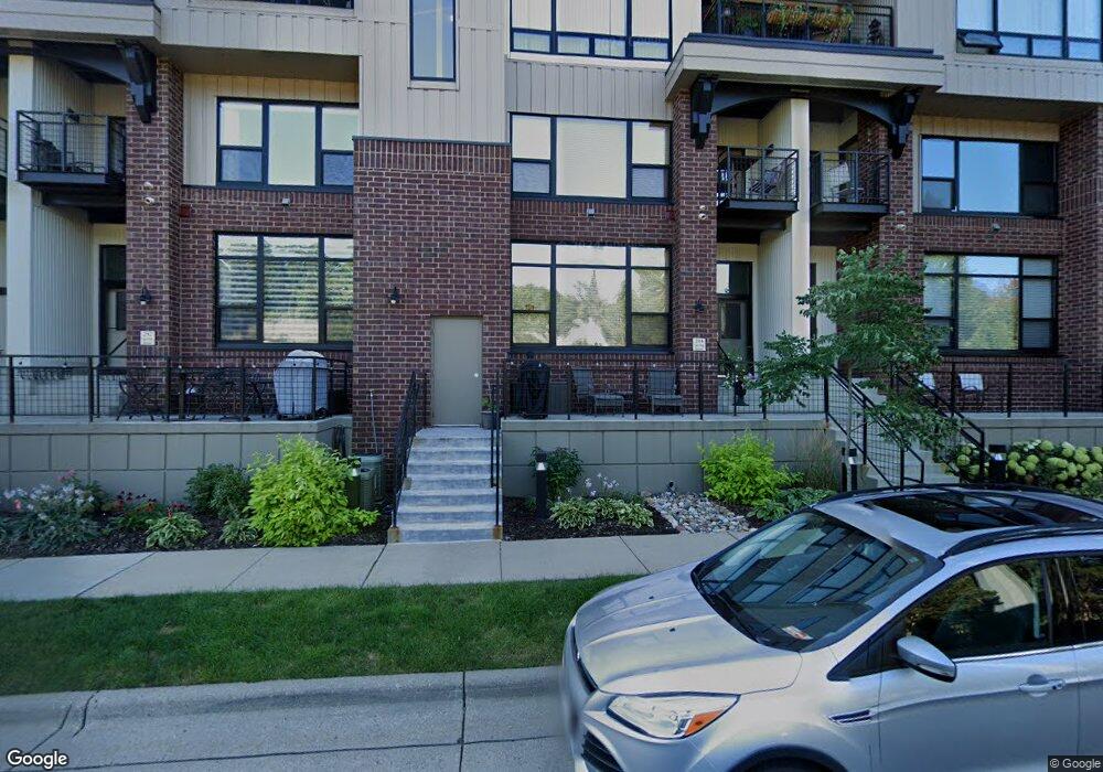
302 Spring St Saint Paul, MN 55102
West Seventh NeighborhoodEstimated Value: $531,615 - $689,000
2
Beds
3
Baths
2,432
Sq Ft
$253/Sq Ft
Est. Value
About This Home
This home is located at 302 Spring St, Saint Paul, MN 55102 and is currently estimated at $614,154, approximately $252 per square foot. 302 Spring St is a home located in Ramsey County with nearby schools including Maxfield Magnet Elementary School, Hidden River Middle School, and Central Senior High School.
Ownership History
Date
Name
Owned For
Owner Type
Purchase Details
Closed on
Nov 1, 2019
Sold by
Anshus Craig L and Kinda Pegedwenda
Bought by
Roszak Linda R
Current Estimated Value
Purchase Details
Closed on
Oct 26, 2017
Sold by
Zeigler Kenton and Zeigler Linda
Bought by
Anshus Craig L
Home Financials for this Owner
Home Financials are based on the most recent Mortgage that was taken out on this home.
Original Mortgage
$384,160
Interest Rate
3.83%
Purchase Details
Closed on
Dec 27, 2007
Sold by
The Rottlund Co
Bought by
Zeigler Kenton and Zeigler Linda
Purchase Details
Closed on
Jun 29, 2007
Sold by
Ryan Iowa City Llc
Bought by
The Rottlund Co Inc
Create a Home Valuation Report for This Property
The Home Valuation Report is an in-depth analysis detailing your home's value as well as a comparison with similar homes in the area
Home Values in the Area
Average Home Value in this Area
Purchase History
| Date | Buyer | Sale Price | Title Company |
|---|---|---|---|
| Roszak Linda R | $479,000 | Burnet Title | |
| Anshus Craig L | $480,200 | Burnet Title | |
| Zeigler Kenton | $412,000 | -- | |
| The Rottlund Co Inc | $1,670,684 | -- |
Source: Public Records
Mortgage History
| Date | Status | Borrower | Loan Amount |
|---|---|---|---|
| Previous Owner | Anshus Craig L | $384,160 |
Source: Public Records
Tax History
| Year | Tax Paid | Tax Assessment Tax Assessment Total Assessment is a certain percentage of the fair market value that is determined by local assessors to be the total taxable value of land and additions on the property. | Land | Improvement |
|---|---|---|---|---|
| 2025 | $7,792 | $506,200 | $1,000 | $505,200 |
| 2023 | $7,792 | $507,100 | $1,000 | $506,100 |
| 2022 | $7,444 | $450,300 | $1,000 | $449,300 |
| 2021 | $7,070 | $462,200 | $1,000 | $461,200 |
| 2020 | $7,616 | $455,400 | $1,000 | $454,400 |
| 2019 | $6,384 | $455,400 | $1,000 | $454,400 |
| 2018 | $6,176 | $376,300 | $1,000 | $375,300 |
| 2017 | $6,000 | $376,300 | $1,000 | $375,300 |
| 2016 | $6,064 | $0 | $0 | $0 |
| 2015 | $6,110 | $368,900 | $36,900 | $332,000 |
| 2014 | $6,152 | $0 | $0 | $0 |
Source: Public Records
Map
Nearby Homes
- 290 Spring St
- 190 Elm St
- 312 Spring St Unit 309
- 294 Spring St
- 256 Spring St Unit 413
- 336 Spring St
- 240 Spring St Unit 510
- 240 Spring St Unit 204
- 5 Irvine Park Unit 5B
- 162 McBoal St
- 360 Sherman St Unit 1607
- 89 Douglas St
- 334 Cherokee Ave Unit 103
- 359 Pleasant Ave
- 309 W Harrison Ave
- 350 Saint Peter St Unit 512
- 350 Saint Peter St Unit 701
- 350 Saint Peter St Unit 908
- 350 Saint Peter St Unit 405
- 350 Saint Peter St Unit 606
- 300 Spring St Unit 110
- 193 Sherman St
- 197 Sherman St
- 312 Spring St Unit 311
- 195 Sherman St
- 312 Spring St Unit 306
- 312 Spring St Unit 310
- 296 Spring St
- 312 Spring St Unit 301
- 312 Spring St Unit 315
- 312 Spring St Unit 313
- 312 Spring St Unit 302
- 312 Spring St Unit 409
- 185 Sherman St
- 312 Spring St Unit 414
- 312 Spring St Unit 314
- 312 Spring St Unit 406
- 312 Spring St Unit 410
- 312 Spring St Unit 312
- 312 Spring St Unit 305