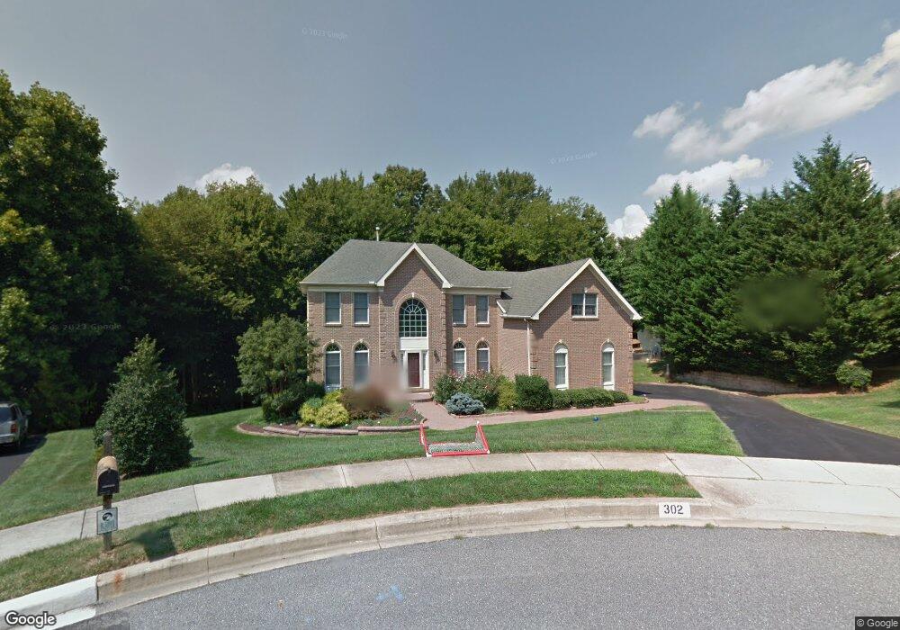
302 Walker Way Newark, DE 19711
Estimated Value: $723,000 - $822,000
4
Beds
3
Baths
3,012
Sq Ft
$254/Sq Ft
Est. Value
About This Home
This home is located at 302 Walker Way, Newark, DE 19711 and is currently estimated at $765,899, approximately $254 per square foot. 302 Walker Way is a home located in New Castle County with nearby schools including R. Elisabeth Maclary Elementary School, Shue-Medill Middle School, and Newark High School.
Ownership History
Date
Name
Owned For
Owner Type
Purchase Details
Closed on
Aug 1, 2002
Sold by
Sebastiani Joseph
Bought by
Sebastiani Joseph and Sebastiani Judith U
Current Estimated Value
Home Financials for this Owner
Home Financials are based on the most recent Mortgage that was taken out on this home.
Original Mortgage
$203,000
Interest Rate
6.39%
Create a Home Valuation Report for This Property
The Home Valuation Report is an in-depth analysis detailing your home's value as well as a comparison with similar homes in the area
Home Values in the Area
Average Home Value in this Area
Purchase History
| Date | Buyer | Sale Price | Title Company |
|---|---|---|---|
| Sebastiani Joseph | -- | -- |
Source: Public Records
Mortgage History
| Date | Status | Borrower | Loan Amount |
|---|---|---|---|
| Closed | Sebastiani Joseph | $203,000 |
Source: Public Records
Tax History Compared to Growth
Tax History
| Year | Tax Paid | Tax Assessment Tax Assessment Total Assessment is a certain percentage of the fair market value that is determined by local assessors to be the total taxable value of land and additions on the property. | Land | Improvement |
|---|---|---|---|---|
| 2024 | $1,489 | $141,100 | $18,400 | $122,700 |
| 2023 | $5,102 | $141,100 | $18,400 | $122,700 |
| 2022 | $5,048 | $141,100 | $18,400 | $122,700 |
| 2021 | $4,919 | $141,100 | $18,400 | $122,700 |
| 2020 | $4,777 | $141,100 | $18,400 | $122,700 |
| 2019 | $4,188 | $141,100 | $18,400 | $122,700 |
| 2018 | $4,090 | $141,100 | $18,400 | $122,700 |
| 2017 | $3,969 | $141,100 | $18,400 | $122,700 |
| 2016 | $3,958 | $141,100 | $18,400 | $122,700 |
| 2015 | $3,548 | $141,100 | $18,400 | $122,700 |
| 2014 | $3,547 | $141,100 | $18,400 | $122,700 |
Source: Public Records
Map
Nearby Homes
- 211 Cullen Way
- 221 Cullen Way
- 108 Lena Dr
- 230 Aronimink Dr
- 300 Capitol Trail
- 305 Poplar Ave
- 16 Hawthorne Ave
- 324 Delaplane Ave
- 29 Hawthorne Ave
- 402 Stafford Ave
- 311 Stamford Dr
- 104 Country Club Dr
- 4 Pinedale Rd
- 16 Pinedale Rd
- 506 Cambridge Dr
- 21 Dunbar Rd
- 132 Osage Ln
- 424 Brewster Dr
- 25 Brentwood Ln
- 47 Covered Bridge Ln