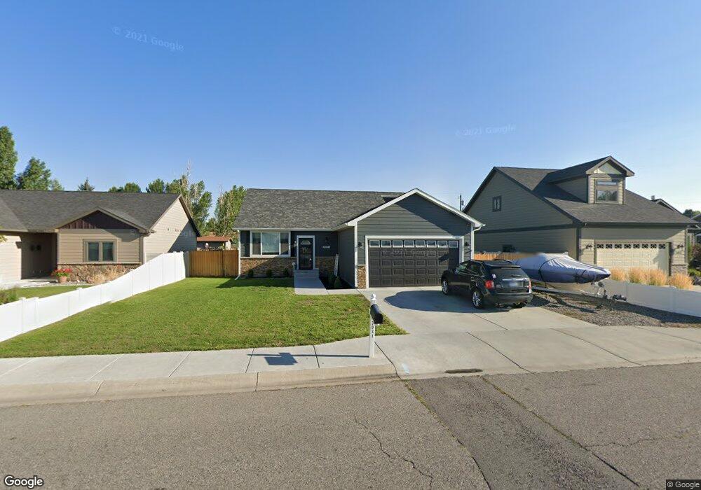
3031 Rosebud Dr Billings, MT 59102
West End NeighborhoodEstimated Value: $380,000 - $407,000
3
Beds
2
Baths
2,143
Sq Ft
$183/Sq Ft
Est. Value
About This Home
This home is located at 3031 Rosebud Dr, Billings, MT 59102 and is currently estimated at $391,692, approximately $182 per square foot. 3031 Rosebud Dr is a home with nearby schools including Big Sky Elementary School, Ben Steele Middle School, and Billings West High School.
Ownership History
Date
Name
Owned For
Owner Type
Purchase Details
Closed on
Jul 23, 2020
Sold by
Price Scott and Price Kim
Bought by
Buxbaum Breanne M
Current Estimated Value
Home Financials for this Owner
Home Financials are based on the most recent Mortgage that was taken out on this home.
Original Mortgage
$220,000
Outstanding Balance
$195,443
Interest Rate
3.2%
Mortgage Type
New Conventional
Estimated Equity
$196,249
Purchase Details
Closed on
Oct 15, 2018
Sold by
Lais Development Inc
Bought by
Price Scott and Price Kim
Purchase Details
Closed on
May 2, 2018
Sold by
Wheeler Ambe
Bought by
Lais Development Inc
Create a Home Valuation Report for This Property
The Home Valuation Report is an in-depth analysis detailing your home's value as well as a comparison with similar homes in the area
Home Values in the Area
Average Home Value in this Area
Purchase History
| Date | Buyer | Sale Price | Title Company |
|---|---|---|---|
| Buxbaum Breanne M | -- | First American Title Company | |
| Price Scott | -- | -- | |
| Lais Development Inc | -- | -- |
Source: Public Records
Mortgage History
| Date | Status | Borrower | Loan Amount |
|---|---|---|---|
| Open | Buxbaum Breanne M | $220,000 |
Source: Public Records
Tax History Compared to Growth
Tax History
| Year | Tax Paid | Tax Assessment Tax Assessment Total Assessment is a certain percentage of the fair market value that is determined by local assessors to be the total taxable value of land and additions on the property. | Land | Improvement |
|---|---|---|---|---|
| 2025 | $3,365 | $396,000 | $51,614 | $344,386 |
| 2024 | $3,365 | $351,600 | $48,556 | $303,044 |
| 2023 | $3,363 | $351,600 | $48,556 | $303,044 |
| 2022 | $2,783 | $253,700 | $45,238 | $208,462 |
| 2021 | $2,650 | $253,700 | $0 | $0 |
| 2020 | $2,827 | $260,100 | $0 | $0 |
| 2019 | $2,696 | $260,100 | $0 | $0 |
| 2018 | $2,687 | $254,700 | $0 | $0 |
| 2017 | $2,610 | $254,700 | $0 | $0 |
| 2016 | $1,982 | $190,293 | $0 | $0 |
| 2015 | $441 | $35,483 | $0 | $0 |
| 2014 | $510 | $23,094 | $0 | $0 |
Source: Public Records
Map
Nearby Homes
- 3254 Granger Ave E Unit F6
- 3254 Granger Ave E Unit K-1
- 7 W Meadows
- 3295 Granger Ave E Unit 6
- 4 W Meadow Dr
- 14 W Meadow Dr
- 28 Gatewood Dr
- 8 Brookpark Dr
- 46 Vista Dr
- 31 Wheatland Dr
- 16 Brookpark Dr
- 2916 Monad Rd
- 33 Wheatland Dr
- 25 Redrock Dr
- 3385 Granger Ave S Unit 4
- 3385 Granger Ave S Unit 24, 26, 27
- 3385 Granger Ave S Unit 27
- 3385 Granger Ave S Unit 26
- 3385 Granger Ave S Unit 24
- 30 Brookpark Dr
- 3021 Rosebud Dr
- 3039 Rosebud Dr
- 3015 Rosebud Dr
- 3038 Rosebud Dr
- 3020 Myrtle Dr
- 3030 Myrtle Dr
- 3014 Rosebud Dr
- 3036 Rosebud Dr
- 3014 Myrtle Dr
- 3005 Rosebud Dr
- 3038 Myrtle Dr
- 3006 Myrtle Dr
- 3006 Rosebud Dr
- 3046 Myrtle Dr
- 3019 Myrtle Dr
- 3029 Myrtle Dr
- 3025 Myrtle Dr
- 3013 Myrtle Dr
- 2955 Rosebud Dr
- 3007 Myrtle Dr