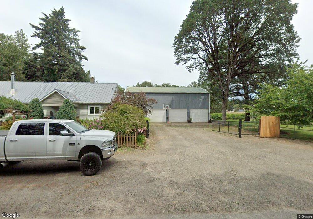
30319 Smith Loop Corvallis, OR 97333
Estimated Value: $634,000 - $751,485
2
Beds
2
Baths
2,728
Sq Ft
$253/Sq Ft
Est. Value
About This Home
This home is located at 30319 Smith Loop, Corvallis, OR 97333 and is currently estimated at $691,495, approximately $253 per square foot. 30319 Smith Loop is a home located in Benton County with nearby schools including Lincoln Elementary School, Linus Pauling Middle School, and Corvallis High School.
Ownership History
Date
Name
Owned For
Owner Type
Purchase Details
Closed on
Jan 13, 2016
Sold by
Smith Loren J
Bought by
Fields Melissa K and Fields Matt
Current Estimated Value
Purchase Details
Closed on
Nov 20, 2014
Sold by
Smith Nancy L
Bought by
Smith Nancy L and Nancy L Smith Living Trust
Purchase Details
Closed on
Jan 2, 2007
Sold by
Smith Loren J
Bought by
Smith Daniel L
Purchase Details
Closed on
Dec 27, 2006
Sold by
Smith Loren J
Bought by
Smith Daniel L
Purchase Details
Closed on
Jun 15, 2006
Sold by
Smith Loren J and Smith Nancy L
Bought by
Fields Matt and Fields Melissa K
Create a Home Valuation Report for This Property
The Home Valuation Report is an in-depth analysis detailing your home's value as well as a comparison with similar homes in the area
Purchase History
| Date | Buyer | Sale Price | Title Company |
|---|---|---|---|
| Fields Melissa K | -- | None Available | |
| Smith Nancy L | -- | None Available | |
| Smith Loren J | -- | None Available | |
| Smith Daniel L | $24,000 | None Available | |
| Smith Daniel L | $24,000 | None Available | |
| Fields Matt | $305,000 | None Available |
Source: Public Records
Tax History
| Year | Tax Paid | Tax Assessment Tax Assessment Total Assessment is a certain percentage of the fair market value that is determined by local assessors to be the total taxable value of land and additions on the property. | Land | Improvement |
|---|---|---|---|---|
| 2025 | $2,564 | $202,545 | -- | -- |
| 2024 | $2,564 | $196,763 | -- | -- |
| 2023 | $2,416 | $191,141 | $0 | $0 |
| 2022 | $2,347 | $185,699 | $0 | $0 |
| 2021 | $2,214 | $180,407 | $0 | $0 |
| 2020 | $2,192 | $175,270 | $0 | $0 |
| 2019 | $1,998 | $170,282 | $0 | $0 |
| 2018 | $2,071 | $165,439 | $0 | $0 |
| 2017 | $1,782 | $160,736 | $0 | $0 |
| 2016 | $1,737 | $156,171 | $0 | $0 |
| 2015 | $1,696 | $151,738 | $0 | $0 |
| 2014 | $1,672 | $147,435 | $0 | $0 |
| 2012 | -- | $139,201 | $0 | $0 |
Source: Public Records
Map
Nearby Homes
- 30274 Peoria Rd
- 29460 Peoria Rd
- 3651 SE Shoreline Dr
- 3676 SW 3rd St
- 3413 SE Shoreline Dr
- 30303 Bellfountain Rd
- 3060 SE Everglade St
- 300 SE Goodnight Av (#31) Ave Unit 31
- 300 SE Goodnight Ave Unit 82 Av
- 300 SE Goodnight Ave Unit 83 Av
- 300 SE Goodnight Ave Unit 74 Av
- 255 SE Jensen Ave
- 245 SE Jensen Ave
- 235 SE Jensen Ave
- 420 SW Wake Robin (-450) Ave
- TA 421203 SW Philomath Bl
- 27144 Irish Bend Loop
- 5285 & 5287 SW Watenpaugh Ave
- 2632 SW Brooklane Dr
- 33125 SE White Oak (#36) Rd Unit 36
Your Personal Tour Guide
Ask me questions while you tour the home.