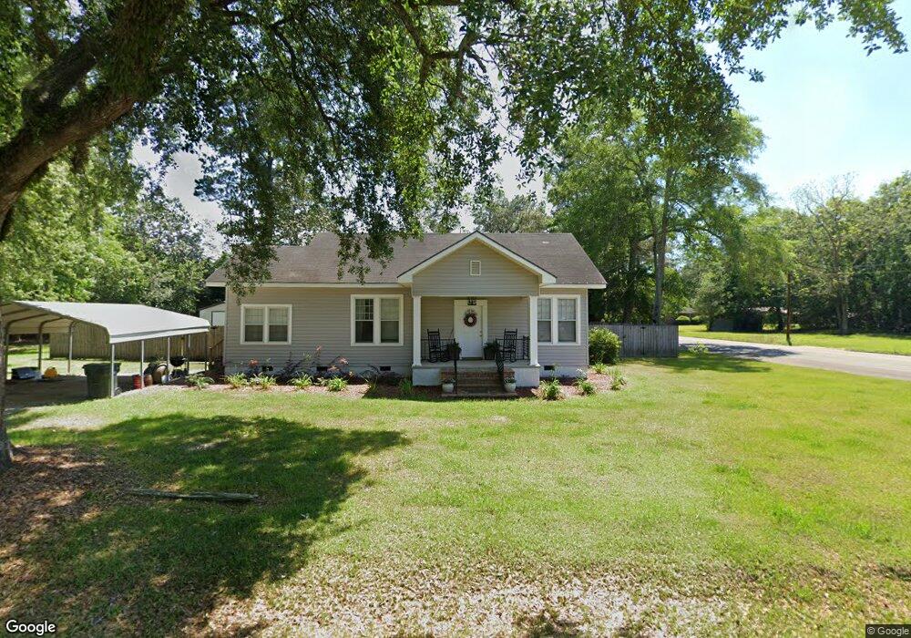
304 E Adams St Boston, GA 31626
Estimated Value: $120,485 - $189,000
Studio
1
Bath
1,348
Sq Ft
$118/Sq Ft
Est. Value
About This Home
This home is located at 304 E Adams St, Boston, GA 31626 and is currently estimated at $158,871, approximately $117 per square foot. 304 E Adams St is a home located in Thomas County with nearby schools including Hand in Hand Primary School, Garrison-Pilcher Elementary School, and Cross Creek Elementary School.
Ownership History
Date
Name
Owned For
Owner Type
Purchase Details
Closed on
May 5, 2025
Sold by
Maxwell Richard
Bought by
Maxwell Amanda Trust and Maxwell Richard Trust
Current Estimated Value
Purchase Details
Closed on
Jun 7, 2016
Sold by
Mathis Louise Harby
Bought by
Maxwell Richard A and Maxwell Amanda K
Home Financials for this Owner
Home Financials are based on the most recent Mortgage that was taken out on this home.
Original Mortgage
$90,000
Interest Rate
3.57%
Mortgage Type
New Conventional
Purchase Details
Closed on
Sep 30, 1977
Bought by
Mathis Louise Harby
Create a Home Valuation Report for This Property
The Home Valuation Report is an in-depth analysis detailing your home's value as well as a comparison with similar homes in the area
Purchase History
| Date | Buyer | Sale Price | Title Company |
|---|---|---|---|
| Maxwell Amanda Trust | -- | -- | |
| Maxwell Richard A | $85,000 | -- | |
| Mathis Louise Harby | -- | -- |
Source: Public Records
Mortgage History
| Date | Status | Borrower | Loan Amount |
|---|---|---|---|
| Previous Owner | Maxwell Richard A | $90,000 |
Source: Public Records
Tax History
| Year | Tax Paid | Tax Assessment Tax Assessment Total Assessment is a certain percentage of the fair market value that is determined by local assessors to be the total taxable value of land and additions on the property. | Land | Improvement |
|---|---|---|---|---|
| 2025 | $2,841 | $33,493 | $2,844 | $30,649 |
| 2024 | $1,036 | $32,094 | $2,844 | $29,250 |
| 2023 | $969 | $30,476 | $2,844 | $27,632 |
| 2022 | $618 | $25,735 | $2,133 | $23,602 |
| 2021 | $581 | $22,028 | $2,133 | $19,895 |
| 2020 | $592 | $21,927 | $2,133 | $19,794 |
| 2019 | $596 | $21,927 | $2,133 | $19,794 |
| 2018 | $597 | $21,786 | $2,133 | $19,653 |
| 2017 | $606 | $21,798 | $1,898 | $19,900 |
| 2016 | $555 | $21,607 | $1,898 | $19,709 |
| 2015 | $609 | $23,367 | $1,770 | $21,596 |
| 2014 | $599 | $22,858 | $1,770 | $21,087 |
| 2013 | -- | $23,769 | $1,770 | $21,999 |
Source: Public Records
Map
Nearby Homes
- 611 Bn S Main St
- 612-BN W Railroad Ave
- 536 N Leaphart St
- 682 Salem Rd
- 146 Old Highway 84 W
- 2815 Parker Rd
- 9900 Ozell Rd
- 431 Dry Lake Rd
- 2156 County Road 78
- 390 Crabapple Dr
- 1477 Fox Meadow Ln
- 7402 Coffee Rd
- 00 Cone Road & Beulah Church Rd
- 138
- 2951 Summerhill Rd
- 12431 US Highway 84 E
- 1038-BA Church St
- 7500 U S 19
- 800 Clifford St
- 7921 Five Forks Rd
- 305 E Adams St
- 211 S Green St
- 237 E Adams St
- 320 E Adams St
- 226 E Adams St
- 225 E Adams St
- 327 E Adams St
- 223 E Adams St
- 330 E Adams St
- 220 E Adams St
- 227 S Green St
- 315 E Jackson St
- 231 E Jackson St Unit BN
- 329 E Jackson St
- 223 E Jackson St Unit BN
- 206 E Adams St
- 339 E Adams St
- 225 S Stephens St
- 220 S Oak St
- 130 E Adams St
Your Personal Tour Guide
Ask me questions while you tour the home.