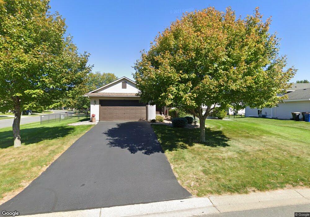
305 Thomas Ave Shakopee, MN 55379
Estimated Value: $402,000 - $420,000
4
Beds
2
Baths
1,350
Sq Ft
$305/Sq Ft
Est. Value
About This Home
This home is located at 305 Thomas Ave, Shakopee, MN 55379 and is currently estimated at $412,017, approximately $305 per square foot. 305 Thomas Ave is a home located in Scott County with nearby schools including Sweeney Elementary School, East Middle School, and Shakopee Senior High School.
Ownership History
Date
Name
Owned For
Owner Type
Purchase Details
Closed on
Mar 11, 2016
Sold by
Vosejpka David H
Bought by
Wiesner Colin and Wiesner Brianna
Current Estimated Value
Home Financials for this Owner
Home Financials are based on the most recent Mortgage that was taken out on this home.
Original Mortgage
$234,600
Outstanding Balance
$185,685
Interest Rate
3.65%
Mortgage Type
New Conventional
Estimated Equity
$226,332
Purchase Details
Closed on
Apr 29, 1998
Sold by
Gold Nugget Development Inc
Bought by
Novak-Fleck Inc
Create a Home Valuation Report for This Property
The Home Valuation Report is an in-depth analysis detailing your home's value as well as a comparison with similar homes in the area
Home Values in the Area
Average Home Value in this Area
Purchase History
| Date | Buyer | Sale Price | Title Company |
|---|---|---|---|
| Wiesner Colin | $276,000 | Stewart Title | |
| Novak-Fleck Inc | $40,900 | -- | |
| Vosejpka David H | $146,200 | -- |
Source: Public Records
Mortgage History
| Date | Status | Borrower | Loan Amount |
|---|---|---|---|
| Open | Wiesner Colin | $234,600 |
Source: Public Records
Tax History
| Year | Tax Paid | Tax Assessment Tax Assessment Total Assessment is a certain percentage of the fair market value that is determined by local assessors to be the total taxable value of land and additions on the property. | Land | Improvement |
|---|---|---|---|---|
| 2025 | $3,884 | $388,200 | $168,900 | $219,300 |
| 2024 | $3,954 | $378,900 | $164,600 | $214,300 |
| 2023 | $4,168 | $372,700 | $161,400 | $211,300 |
| 2022 | $4,170 | $385,500 | $161,400 | $224,100 |
| 2021 | $3,544 | $334,300 | $129,200 | $205,100 |
| 2020 | $3,776 | $313,000 | $110,600 | $202,400 |
| 2019 | $3,712 | $295,000 | $96,900 | $198,100 |
| 2018 | $3,416 | $0 | $0 | $0 |
| 2016 | $3,144 | $0 | $0 | $0 |
| 2014 | -- | $0 | $0 | $0 |
Source: Public Records
Map
Nearby Homes
- 521 Mcdevitt St
- 742 Atwood St S
- 224 Hickory Ln E
- 326 Braeburn Dr
- 1465 Mcintosh Cir
- 120 4th Ave E
- 1186 Quincy St
- 291 Appleblossom Ln
- 1187 Madison St S
- 1412 10th Ave W
- 902 7th Ave E
- 1562 Liberty Cir Unit 2403
- 216 Arabian Ave W
- 236 Ardennes Ave E
- 1195 Van Buren St S
- 1027 Eastview Cir
- 609 Providence Dr
- 1646 Liberty Cir
- 1126 Harrison St S
- 1603 3rd Ave W
- 315 Thomas Ave
- 1151 Scott St S
- 1164 Atwood St S
- 481 Hennes Ave
- 487 Thomas Ave
- 1141 Scott St S
- 1138 Scott St S
- 484 Thomas Ave
- 1154 Atwood St S
- 485 Hennes Ave
- 1128 Scott St S
- 1131 Scott St S
- 491 Thomas Ave
- 1157 Atwood St S
- 326 Hennes Ave
- 1144 Atwood St S
- 488 Thomas Ave
- 1153 Atwood St S
- 489 Hennes Ave
- 1135 Apgar St S
Your Personal Tour Guide
Ask me questions while you tour the home.