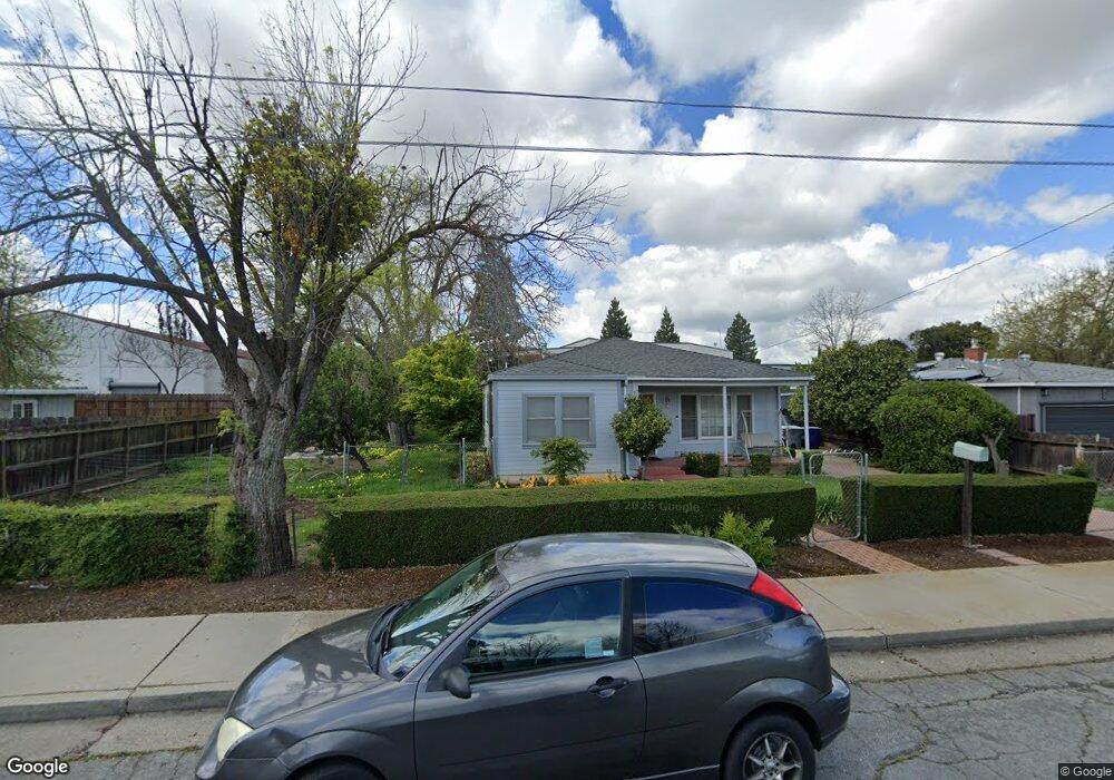
3063 Oleander Ave Merced, CA 95340
North Merced NeighborhoodEstimated Value: $248,000 - $331,000
2
Beds
1
Bath
1,006
Sq Ft
$294/Sq Ft
Est. Value
About This Home
This home is located at 3063 Oleander Ave, Merced, CA 95340 and is currently estimated at $295,261, approximately $293 per square foot. 3063 Oleander Ave is a home located in Merced County with nearby schools including Luther Burbank Elementary School, Herbert Hoover Middle School, and Merced High School.
Ownership History
Date
Name
Owned For
Owner Type
Purchase Details
Closed on
Jun 17, 1998
Sold by
Johnson Ethel M 1991 Revocable Trust and Carl A
Bought by
Meraz Linda M
Current Estimated Value
Home Financials for this Owner
Home Financials are based on the most recent Mortgage that was taken out on this home.
Original Mortgage
$69,776
Outstanding Balance
$13,910
Interest Rate
7.01%
Mortgage Type
FHA
Estimated Equity
$281,351
Create a Home Valuation Report for This Property
The Home Valuation Report is an in-depth analysis detailing your home's value as well as a comparison with similar homes in the area
Home Values in the Area
Average Home Value in this Area
Purchase History
| Date | Buyer | Sale Price | Title Company |
|---|---|---|---|
| Meraz Linda M | $70,000 | Chicago Title Co |
Source: Public Records
Mortgage History
| Date | Status | Borrower | Loan Amount |
|---|---|---|---|
| Open | Meraz Linda M | $69,776 |
Source: Public Records
Tax History
| Year | Tax Paid | Tax Assessment Tax Assessment Total Assessment is a certain percentage of the fair market value that is determined by local assessors to be the total taxable value of land and additions on the property. | Land | Improvement |
|---|---|---|---|---|
| 2025 | $1,090 | $109,716 | $47,020 | $62,696 |
| 2024 | $1,090 | $107,566 | $46,099 | $61,467 |
| 2023 | $1,073 | $105,458 | $45,196 | $60,262 |
| 2022 | $1,056 | $103,391 | $44,310 | $59,081 |
| 2021 | $1,052 | $101,365 | $43,442 | $57,923 |
| 2020 | $1,058 | $100,327 | $42,997 | $57,330 |
| 2019 | $1,040 | $98,360 | $42,154 | $56,206 |
| 2018 | $947 | $96,432 | $41,328 | $55,104 |
| 2017 | $981 | $94,542 | $40,518 | $54,024 |
| 2016 | $964 | $92,689 | $39,724 | $52,965 |
| 2015 | $948 | $91,298 | $39,128 | $52,170 |
| 2014 | $926 | $89,511 | $38,362 | $51,149 |
Source: Public Records
Map
Nearby Homes
- 3009 Colony Park Dr
- 822 Seneca St
- 3033 Colony Park Dr
- 842 E Alexander Ave
- 439 E Olive Ave
- 3045 Silver Elm Ct
- 891 Hansen Ave
- 280 E Olive Ave
- 3061 El Capitan Ave
- 2972 Tahoe Dr
- 3191 El Capitan Ave
- 3216 El Capitan Ave
- 635 Brookdale Dr
- 688 Elise Ct
- 1300 Kensington Dr
- 3279 Cherokee Ave
- 466 Columbia Ave
- 1011 Wyoming Dr
- 415 Columbia Ave
- 3308 Shamrock Place
- 3069 Oleander Ave
- 3073 Oleander Ave
- 3047 Oleander Ave
- 3077 Oleander Ave
- 3064 Oleander Ave
- 3060 Oleander Ave
- 3070 Oleander Ave
- 3054 Oleander Ave
- 3074 Oleander Ave
- 3048 Oleander Ave
- 3035 Oleander Ave
- 3078 Oleander Ave
- 726 E Olive Ave
- 3091 Oleander Ave
- 3042 Oleander Ave
- 3063 Sycamore Ave
- 3057 Sycamore Ave
- 3069 Sycamore Ave
- 820 E Olive Ave
- 3053 Sycamore Ave