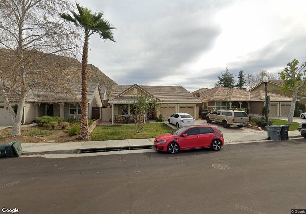
3069 Hawthorne Rd Perris, CA 92571
North Perris NeighborhoodEstimated Value: $507,000 - $542,000
3
Beds
2
Baths
1,400
Sq Ft
$370/Sq Ft
Est. Value
About This Home
This home is located at 3069 Hawthorne Rd, Perris, CA 92571 and is currently estimated at $517,320, approximately $369 per square foot. 3069 Hawthorne Rd is a home located in Riverside County with nearby schools including Sierra Vista Elementary School, Lakeside Middle School, and Rancho Verde High School.
Ownership History
Date
Name
Owned For
Owner Type
Purchase Details
Closed on
Sep 17, 2020
Sold by
Laraperez Carlos Alberto and Perez Carlos Alerto
Bought by
Laraperez Carlos Alberto
Current Estimated Value
Home Financials for this Owner
Home Financials are based on the most recent Mortgage that was taken out on this home.
Original Mortgage
$106,239
Outstanding Balance
$75,814
Interest Rate
2.9%
Mortgage Type
New Conventional
Estimated Equity
$441,506
Purchase Details
Closed on
Nov 27, 2010
Sold by
Kb Home Coastal Inc
Bought by
Perez Carlos Alberto Lara
Home Financials for this Owner
Home Financials are based on the most recent Mortgage that was taken out on this home.
Original Mortgage
$129,724
Interest Rate
3.87%
Mortgage Type
FHA
Create a Home Valuation Report for This Property
The Home Valuation Report is an in-depth analysis detailing your home's value as well as a comparison with similar homes in the area
Home Values in the Area
Average Home Value in this Area
Purchase History
| Date | Buyer | Sale Price | Title Company |
|---|---|---|---|
| Laraperez Carlos Alberto | -- | Wfg National Title Company | |
| Laraperez Carlos Alberto | -- | Wfg National Title Company | |
| Perez Carlos Alberto Lara | $155,000 | First American Title Hsd |
Source: Public Records
Mortgage History
| Date | Status | Borrower | Loan Amount |
|---|---|---|---|
| Open | Laraperez Carlos Alberto | $106,239 | |
| Previous Owner | Perez Carlos Alberto Lara | $129,724 |
Source: Public Records
Tax History
| Year | Tax Paid | Tax Assessment Tax Assessment Total Assessment is a certain percentage of the fair market value that is determined by local assessors to be the total taxable value of land and additions on the property. | Land | Improvement |
|---|---|---|---|---|
| 2025 | $4,947 | $198,565 | $51,239 | $147,326 |
| 2023 | $4,947 | $190,856 | $49,250 | $141,606 |
| 2022 | $4,758 | $187,115 | $48,285 | $138,830 |
| 2021 | $4,511 | $183,447 | $47,339 | $136,108 |
| 2020 | $4,481 | $181,567 | $46,854 | $134,713 |
| 2019 | $4,358 | $178,008 | $45,936 | $132,072 |
| 2018 | $4,308 | $174,519 | $45,036 | $129,483 |
| 2017 | $4,243 | $171,098 | $44,153 | $126,945 |
| 2016 | $4,238 | $167,744 | $43,288 | $124,456 |
| 2015 | $4,273 | $165,227 | $42,639 | $122,588 |
| 2014 | $4,223 | $161,992 | $41,804 | $120,188 |
Source: Public Records
Map
Nearby Homes
- 27366 Dunite Dr
- 27354 Dunite Dr
- 27379 Dunite Dr
- Plan 2378 Modeled at Rockridge
- Plan 2533 at Rockridge
- Plan 1800 at Rockridge
- Plan 2763 Modeled at Rockridge
- Plan 2026 Modeled at Rockridge
- 27330 Dunite Dr
- 27365 Dunite Dr
- 27318 Dunite Dr
- 27353 Dunite Dr
- 1910 Mount Verdugo Ln
- 27334 Fossil Cove
- 27341 Dunite Dr
- 27329 Dunite Dr
- 27322 Fossil Cove
- 27279 Fossil Cove
- 27321 Fossil Cove
- 3577 Whieldon Dr
- 3073 Hawthorne Rd
- 3065 Hawthorne Rd
- 3077 Hawthorne Rd
- 3061 Hawthorne Rd
- 3068 Mallow Ct
- 3064 Mallow Ct
- 3072 Mallow Ct
- 3060 Mallow Ct
- 3076 Mallow Ct
- 3081 Hawthorne Rd
- 3057 Hawthorne Rd
- 3070 Hawthorne Rd
- 3062 Hawthorne Rd
- 3056 Mallow Ct
- 3080 Mallow Ct
- 3074 Hawthorne Rd
- 3058 Hawthorne Rd
- 3085 Hawthorne Rd
- 3053 Hawthorne Rd
- 3078 Hawthorne Rd
Your Personal Tour Guide
Ask me questions while you tour the home.