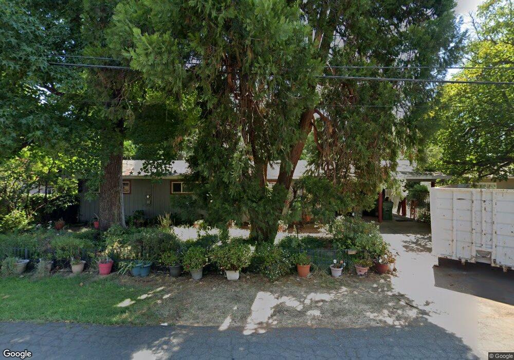
3081 Henderson Rd Redding, CA 96002
Bechelli NeighborhoodEstimated Value: $288,000 - $382,111
3
Beds
2
Baths
1,744
Sq Ft
$197/Sq Ft
Est. Value
About This Home
This home is located at 3081 Henderson Rd, Redding, CA 96002 and is currently estimated at $343,528, approximately $196 per square foot. 3081 Henderson Rd is a home located in Shasta County with nearby schools including Rother Elementary School, Parsons Junior High School, and Enterprise High School.
Ownership History
Date
Name
Owned For
Owner Type
Purchase Details
Closed on
Aug 18, 2014
Sold by
Mcvean Susan Y and Mcvean Susan
Bought by
Mcvean Susan Y
Current Estimated Value
Home Financials for this Owner
Home Financials are based on the most recent Mortgage that was taken out on this home.
Original Mortgage
$185,000
Interest Rate
4.12%
Mortgage Type
New Conventional
Create a Home Valuation Report for This Property
The Home Valuation Report is an in-depth analysis detailing your home's value as well as a comparison with similar homes in the area
Home Values in the Area
Average Home Value in this Area
Purchase History
| Date | Buyer | Sale Price | Title Company |
|---|---|---|---|
| Mcvean Susan Y | -- | Placer Title Company |
Source: Public Records
Mortgage History
| Date | Status | Borrower | Loan Amount |
|---|---|---|---|
| Closed | Mcvean Susan Y | $185,000 |
Source: Public Records
Tax History
| Year | Tax Paid | Tax Assessment Tax Assessment Total Assessment is a certain percentage of the fair market value that is determined by local assessors to be the total taxable value of land and additions on the property. | Land | Improvement |
|---|---|---|---|---|
| 2025 | $2,090 | $198,168 | $50,374 | $147,794 |
| 2024 | $2,059 | $194,284 | $49,387 | $144,897 |
| 2023 | $2,059 | $190,475 | $48,419 | $142,056 |
| 2022 | $2,000 | $186,741 | $47,470 | $139,271 |
| 2021 | $1,930 | $183,081 | $46,540 | $136,541 |
| 2020 | $1,921 | $181,204 | $46,063 | $135,141 |
| 2019 | $1,904 | $177,652 | $45,160 | $132,492 |
| 2018 | $1,880 | $174,170 | $44,275 | $129,895 |
| 2017 | $1,912 | $170,756 | $43,407 | $127,349 |
| 2016 | $1,787 | $167,408 | $42,556 | $124,852 |
| 2015 | $1,771 | $164,894 | $41,917 | $122,977 |
| 2014 | $1,757 | $161,665 | $41,096 | $120,569 |
Source: Public Records
Map
Nearby Homes
- 2590 Henderson Rd
- 3425 Riverview Dr
- 550 Parsons Dr
- 351 Weldon St
- 1108 4th St
- 1106 2nd St
- 1115 2nd St
- 2630 Wyndham Ln
- 1209 C St
- 0000 Wyndham Pointe Subdivision
- 3829 Thea Dr
- 3817 Thea Dr
- 3428 Adams Ln
- 918 Parsons Dr
- 3660-3671 Technology Way
- 0 Churn Creek Rd Unit 25-496
- 0 Churn Creek Rd Unit 26-609
- 0 Churn Creek Rd Unit 25-5491
- 3708 Traverse St
- 745 Parkview Ave
- 3063 Henderson Rd
- 3045 Henderson Rd
- 3055 Henderson Rd
- 3043 Henderson Rd
- 3050 Henderson Rd
- 3030 Henderson Rd
- 3060 Irene St
- 3040 Henderson Rd
- 158 Wilshire Dr
- 3062 Henderson Rd Unit 1
- 3062 Henderson Rd
- 3040 Irene St
- 3040 Irene Way
- 2940 Henderson Rd
- 3020 Irene St
- 3130 Henderson Rd
- 2950 Irene St
- 200 Wilshire Dr
- 110 Wilshire Dr
- 3013 Henderson Rd
Your Personal Tour Guide
Ask me questions while you tour the home.