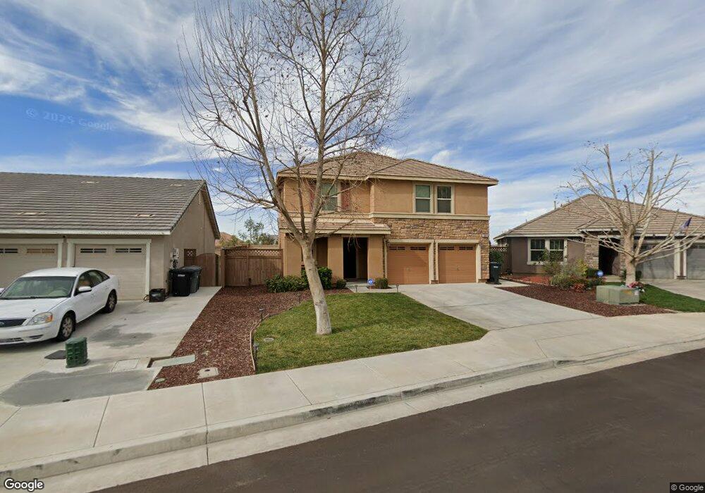
3082 Hawthorne Rd Perris, CA 92571
North Perris NeighborhoodEstimated Value: $524,805 - $573,000
4
Beds
3
Baths
1,861
Sq Ft
$300/Sq Ft
Est. Value
About This Home
This home is located at 3082 Hawthorne Rd, Perris, CA 92571 and is currently estimated at $557,451, approximately $299 per square foot. 3082 Hawthorne Rd is a home located in Riverside County with nearby schools including Sierra Vista Elementary School, Lakeside Middle School, and Rancho Verde High School.
Ownership History
Date
Name
Owned For
Owner Type
Purchase Details
Closed on
Aug 19, 2010
Sold by
Kb Home Coastal Inc
Bought by
Hill Kimberly S and Hill David
Current Estimated Value
Home Financials for this Owner
Home Financials are based on the most recent Mortgage that was taken out on this home.
Original Mortgage
$187,465
Outstanding Balance
$123,807
Interest Rate
4.52%
Mortgage Type
FHA
Estimated Equity
$433,644
Create a Home Valuation Report for This Property
The Home Valuation Report is an in-depth analysis detailing your home's value as well as a comparison with similar homes in the area
Home Values in the Area
Average Home Value in this Area
Purchase History
| Date | Buyer | Sale Price | Title Company |
|---|---|---|---|
| Hill Kimberly S | $190,000 | First Amer Title Ins Co Nhs |
Source: Public Records
Mortgage History
| Date | Status | Borrower | Loan Amount |
|---|---|---|---|
| Open | Hill Kimberly S | $187,465 |
Source: Public Records
Tax History Compared to Growth
Tax History
| Year | Tax Paid | Tax Assessment Tax Assessment Total Assessment is a certain percentage of the fair market value that is determined by local assessors to be the total taxable value of land and additions on the property. | Land | Improvement |
|---|---|---|---|---|
| 2025 | $5,517 | $243,392 | $51,239 | $192,153 |
| 2023 | $5,517 | $233,943 | $49,250 | $184,693 |
| 2022 | $5,314 | $229,357 | $48,285 | $181,072 |
| 2021 | $5,057 | $224,861 | $47,339 | $177,522 |
| 2020 | $5,023 | $222,556 | $46,854 | $175,702 |
| 2019 | $4,868 | $218,193 | $45,936 | $172,257 |
| 2018 | $4,812 | $213,916 | $45,036 | $168,880 |
| 2017 | $4,737 | $209,722 | $44,153 | $165,569 |
| 2016 | $4,727 | $205,611 | $43,288 | $162,323 |
| 2015 | $4,757 | $202,525 | $42,639 | $159,886 |
| 2014 | $4,702 | $198,559 | $41,804 | $156,755 |
Source: Public Records
Map
Nearby Homes
- 3294 Treehouse Dr
- 3012 Zara Cir
- 1979 Mount Verdugo Ln
- 3083 Avalon Pkwy
- 1886 Mount Verdugo Ln
- 27354 Dunite Dr
- 1931 Brockstone Dr
- 27342 Dunite Dr
- 27330 Dunite Dr
- 27379 Dunite Dr
- Plan 1800 at Rockridge
- Plan 2763 Modeled at Rockridge
- Plan 2026 Modeled at Rockridge
- Plan 2533 at Rockridge
- Plan 2378 Modeled at Rockridge
- 27318 Dunite Dr
- 27365 Dunite Dr
- 27353 Dunite Dr
- 27341 Dunite Dr
- 27334 Fossil Cove
- 3078 Hawthorne Rd
- 3086 Hawthorne Rd
- 3074 Hawthorne Rd
- 2002 Anise Dr
- 3070 Hawthorne Rd
- 3085 Hawthorne Rd
- 2010 Anise Dr
- 3083 Avishan Dr
- 3081 Hawthorne Rd
- 3087 Avishan Dr
- 3079 Avishan Dr
- 3077 Hawthorne Rd
- 2018 Anise Dr
- 3075 Avishan Dr
- 3073 Hawthorne Rd
- 2026 Anise Dr
- 3071 Avishan Dr
- 1980 Montanra Ln
- 3069 Hawthorne Rd
- 3084 Mallow Ct