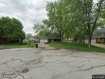
30W370 Briar Ln Naperville, IL 60563
Scots Plains NeighborhoodEstimated Value: $431,000 - $518,000
4
Beds
3
Baths
2,129
Sq Ft
$221/Sq Ft
Est. Value
About This Home
This home is located at 30W370 Briar Ln, Naperville, IL 60563 and is currently estimated at $471,388, approximately $221 per square foot. 30W370 Briar Ln is a home located in DuPage County with nearby schools including Longwood Elementary School, Thayer J. Hill Middle School, and Metea Valley High School.
Ownership History
Date
Name
Owned For
Owner Type
Purchase Details
Closed on
Jul 19, 2002
Sold by
Michelson Courtney E and Michelson Ruth G
Bought by
Fattes Thomas M and Fattes Wanda K
Current Estimated Value
Home Financials for this Owner
Home Financials are based on the most recent Mortgage that was taken out on this home.
Original Mortgage
$197,200
Interest Rate
6.8%
Create a Home Valuation Report for This Property
The Home Valuation Report is an in-depth analysis detailing your home's value as well as a comparison with similar homes in the area
Home Values in the Area
Average Home Value in this Area
Purchase History
| Date | Buyer | Sale Price | Title Company |
|---|---|---|---|
| Fattes Thomas M | $246,500 | -- |
Source: Public Records
Mortgage History
| Date | Status | Borrower | Loan Amount |
|---|---|---|---|
| Open | Fattes Thomas M | $180,000 | |
| Closed | Fattes Thomas M | $176,100 | |
| Closed | Fattes Thomas M | $50,000 | |
| Closed | Fattes Thomas M | $198,000 | |
| Closed | Fattes Thomas M | $197,200 |
Source: Public Records
Tax History Compared to Growth
Tax History
| Year | Tax Paid | Tax Assessment Tax Assessment Total Assessment is a certain percentage of the fair market value that is determined by local assessors to be the total taxable value of land and additions on the property. | Land | Improvement |
|---|---|---|---|---|
| 2023 | $7,542 | $132,250 | $41,670 | $90,580 |
| 2022 | $7,198 | $122,070 | $38,170 | $83,900 |
| 2021 | $6,943 | $117,720 | $36,810 | $80,910 |
| 2020 | $6,933 | $117,720 | $36,810 | $80,910 |
| 2019 | $6,658 | $111,960 | $35,010 | $76,950 |
| 2018 | $6,070 | $100,550 | $30,870 | $69,680 |
| 2017 | $5,912 | $97,140 | $29,820 | $67,320 |
| 2016 | $5,799 | $93,230 | $28,620 | $64,610 |
| 2015 | $5,735 | $88,520 | $27,170 | $61,350 |
| 2014 | $6,029 | $90,260 | $27,500 | $62,760 |
| 2013 | $6,030 | $90,890 | $27,690 | $63,200 |
Source: Public Records
Map
Nearby Homes
- 1017 Mandalay Ct
- 1004 Mandalay Ct
- 2084 Maplewood Cir
- 2080 Maplewood Cir
- 2043 Yellow Daisy Ct
- 918 Genesee Dr
- 937 Genesee Dr
- 2574 Golf Ridge Cir
- 2409 Golf Ridge Cir
- 2404 Golf Ridge Cir
- 2530 Oneida Ln Unit 2530
- 2543 Oneida Ln
- 1007 Sheridan Cir Unit 211101
- 1004 Sheridan Cir Unit 211808
- 1045 Sheridan Cir Unit 211404
- 1640 Hilton Head Dr
- 2825 Collins Ct
- 2712 Sheridan Ct Unit 270403
- 1817 Paxton Dr
- 879 Pas Ct Unit 101
- 30W370 Briar Ln
- 30w Briar Ln
- 30W358 Briar Ln
- 5S462 Gordon Terrace
- 30W371 Bruce Ln
- 30W357 Bruce Ln
- 30W383 Bruce Ln
- 30w Bruce Ln
- 5S472 Gordon Terrace
- 30W346 Briar Ln
- 30W345 Bruce Ln
- 5S481 Gordon Terrace
- 5S484 Gordon Terrace
- 30 Bruce Ln
- 30W336 Briar Ln
- 30W335 Bruce Ln
- 30W341 Briar Ln
- 5S504 Gordon Terrace
- 5S505 Gordon Terrace
- 30W326 Briar Ln