
Seller's Agent in 2025
Anthony Paoletti
Keller Williams Realty North Central
(978) 430-8172
29 in this area
79 Total Sales
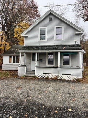
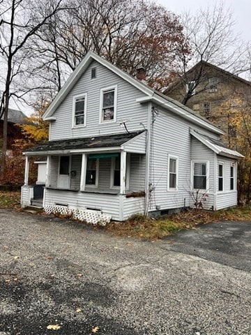
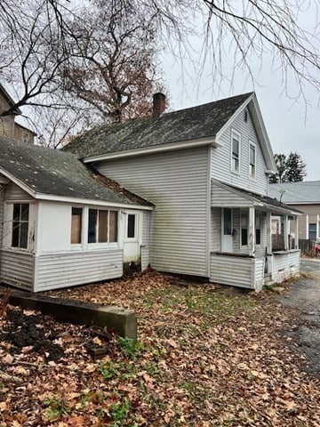
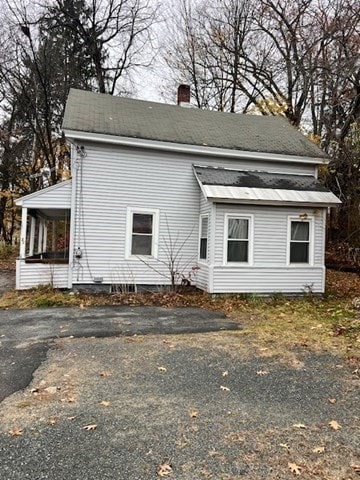
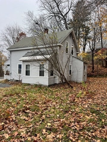
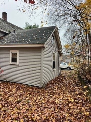
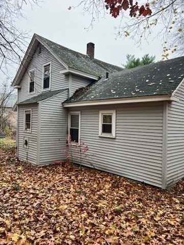
This home offers great potential for those ready to make it shine again! The first floor features a good-sized kitchen, dining room, and a convenient first-floor bedroom. The bathroom could use some updating, but the layout offers a solid foundation. Upstairs are two additional bedrooms, including a spacious primary, plus a versatile bonus room ideal for an office or playroom. The adjacent lot was acquired years ago, providing plenty of parking and outdoor space. Offer deadline is Sunday Nov 16th 5pm.
Last Agent to Sell the Property
Keller Williams Realty North Central Listed on: 11/12/2025
| Date | Type | Sale Price | Title Company |
|---|---|---|---|
| Quit Claim Deed | $156,000 | -- | |
| Deed | $29,900 | -- | |
| Deed | $17,500 | -- | |
| Foreclosure Deed | $19,685 | -- |
| Date | Status | Loan Amount | Loan Type |
|---|---|---|---|
| Open | $224,000 | Purchase Money Mortgage | |
| Previous Owner | $15,000 | Purchase Money Mortgage | |
| Previous Owner | $40,500 | No Value Available | |
| Previous Owner | $10,000 | No Value Available |
| Date | Event | Price | List to Sale | Price per Sq Ft |
|---|---|---|---|---|
| 12/19/2025 12/19/25 | Sold | $156,000 | +4.0% | $129 / Sq Ft |
| 11/17/2025 11/17/25 | Pending | -- | -- | -- |
| 11/12/2025 11/12/25 | For Sale | $150,000 | -- | $124 / Sq Ft |
| Year | Tax Paid | Tax Assessment Tax Assessment Total Assessment is a certain percentage of the fair market value that is determined by local assessors to be the total taxable value of land and additions on the property. | Land | Improvement |
|---|---|---|---|---|
| 2025 | $2,767 | $217,700 | $30,700 | $187,000 |
| 2024 | $2,535 | $197,600 | $30,700 | $166,900 |
| 2023 | $2,464 | $175,500 | $22,300 | $153,200 |
| 2022 | $2,221 | $138,400 | $21,200 | $117,200 |
| 2021 | $2,070 | $117,200 | $19,300 | $97,900 |
| 2020 | $1,934 | $112,600 | $17,500 | $95,100 |
| 2019 | $1,832 | $105,000 | $16,500 | $88,500 |
| 2018 | $1,785 | $91,200 | $15,000 | $76,200 |
| 2017 | $1,785 | $87,500 | $15,000 | $72,500 |
| 2016 | $1,642 | $82,800 | $15,000 | $67,800 |
Seller's Agent in 2025
Anthony Paoletti
Keller Williams Realty North Central
(978) 430-8172
29 in this area
79 Total Sales
Buyer's Agent in 2025
Ruth Truesdell
Real Broker MA, LLC
(413) 824-7316
20 in this area
45 Total Sales
Source: MLS Property Information Network (MLS PIN)
MLS Number: 73454157
APN: ATHO M:00029 B:00100 L:00000
Disclaimer: Certain information contained herein is derived from information provided by parties other than Homes.com. All information provided is deemed reliable, but is not guaranteed to be accurate and should be independently verified.
![]() The property listing data and information, or the Images, set forth herein were provided to MLS Property Information Network, Inc. from third party sources, including sellers, lessors and public records, and were compiled by MLS Property Information Network, Inc. The property listing data and information, and the Images, are for the personal, non-commercial use of consumers having a good faith interest in purchasing or leasing listed properties of the type displayed to them and may not be used for any purpose other than to identify prospective properties which such consumers may have a good faith interest in purchasing or leasing. MLS Property Information Network, Inc. and its subscribers disclaim any and all representations and warranties as to the accuracy of the property listing data and information, or as to the accuracy of any of the Images, set forth herein.
The property listing data and information, or the Images, set forth herein were provided to MLS Property Information Network, Inc. from third party sources, including sellers, lessors and public records, and were compiled by MLS Property Information Network, Inc. The property listing data and information, and the Images, are for the personal, non-commercial use of consumers having a good faith interest in purchasing or leasing listed properties of the type displayed to them and may not be used for any purpose other than to identify prospective properties which such consumers may have a good faith interest in purchasing or leasing. MLS Property Information Network, Inc. and its subscribers disclaim any and all representations and warranties as to the accuracy of the property listing data and information, or as to the accuracy of any of the Images, set forth herein.
Ask me questions while you tour the home.